Barraute, Quebec

Last updated
Barraute
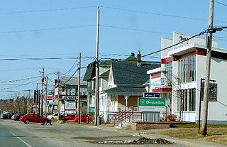
EgliseBarraute.JPG
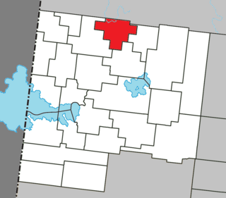
Barraute Quebec location diagram.png
Location within Abitibi RCM.
Canada Western Quebec location map.png
Red pog.svg
Barraute
Location in western Quebec.
Coordinates: 48°26′N77°38′W / 48.433°N 77.633°W / 48.433; -77.633 Coordinates: 48°26′N77°38′W / 48.433°N 77.633°W / 48.433; -77.633 [1]
CountryCanada
Province Quebec
Region Abitibi-Témiscamingue
RCM Abitibi
Settled1910s
ConstitutedJanuary 5, 1994
Government
[2]
  MayorYvan Roy
   Federal riding Abitibi—Témiscamingue
   Prov. riding Abitibi-Ouest
Area
  Total504.10 km2 (194.63 sq mi)
  Land497.97 km2 (192.27 sq mi)
Population
 (2011) [3]
  Total1,980
  Density4.0/km2 (10/sq mi)
  Pop 2006-2011
Decrease2.svg 4.0%
  Dwellings
986
Time zone UTC−05:00 (EST)
  Summer (DST) UTC−04:00 (EDT)
Postal code(s)
Area code(s) 819
HighwaysQc386.svg Route 386
Qc397.svg Route 397

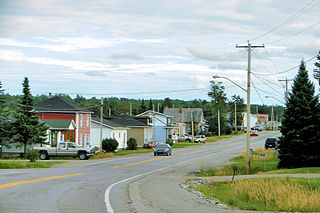
Barraute is a municipality in the Canadian province of Quebec, located in the Abitibi Regional County Municipality.

Provinces and territories of Canada Top-level subdivisions of Canada

The provinces and territories of Canada are sub-national governments within the geographical areas of Canada under the authority of the Canadian Constitution. In the 1867 Canadian Confederation, three provinces of British North America—New Brunswick, Nova Scotia, and the Province of Canada —were united to form a federated colony, becoming a sovereign nation in the next century. Over its history, Canada's international borders have changed several times, and the country has grown from the original four provinces to the current ten provinces and three territories. Together, the provinces and territories make up the world's second-largest country by area.
Quebec Province of Canada

Quebec is one of the thirteen provinces and territories of Canada. It is bordered to the west by the province of Ontario and the bodies of water James Bay and Hudson Bay; to the north by Hudson Strait and Ungava Bay; to the east by the Gulf of Saint Lawrence and the province of Newfoundland and Labrador; and to the south by the province of New Brunswick and the US states of Maine, New Hampshire, Vermont, and New York. It also shares maritime borders with Nunavut, Prince Edward Island, and Nova Scotia. Quebec is Canada's largest province by area and its second-largest administrative division; only the territory of Nunavut is larger. It is historically and politically considered to be part of Central Canada.

Abitibi Regional County Municipality Regional county municipality in Quebec, Canada

Abitibi Regional County Municipality is a regional county municipality in the Abitibi-Témiscamingue region of Quebec. The seat is Amos.

Contents

It is home to the Mont-Vidéo Ski Resort. [4]

History

Colonization began after the completion of the National Transcontinental Railway through the Abitibi region. In 1916, the family of Uldéric Hardy arrived, followed by a further 20 in 1917 and, by 1918, the place had a total of some 30 families. The new settlement was initially called Natagan, taken from the Natagan River, a First Nations name that means "winding waters." In 1917, the Natagan River Post Office opened, renamed to Barraute in 1919. [1]

The National Transcontinental Railway (NTR) was a historic railway between Winnipeg and Moncton in Canada. Much of the line is now operated by the Canadian National Railway.

In Canada, the First Nations are the predominant indigenous peoples in Canada south of the Arctic Circle. Those in the Arctic area are distinct and known as Inuit. The Métis, another distinct ethnicity, developed after European contact and relations primarily between First Nations people and Europeans. There are 634 recognized First Nations governments or bands spread across Canada, roughly half of which are in the provinces of Ontario and British Columbia.

In 1918, the United Township Municipality of Fiedmont-et-Barraute was formed, incorporating the geographic townships of Fiedmont and Barraute (proclaimed in 1916). Pierre-Jean Bachoie, called Barraute (1723-1760), was an officer of the Régiment de Béarn in the army of General Montcalm and member of the Order of Saint Louis. Fiedmont likewise was an officer of the army of Montcalm. [1]

Régiment de Béarn

The Régiment de Béarn was a French Army regiment active in the 18th century. It is principally known for its role in the Seven Years' War, when it served in the North American theatre.

Louis-Joseph de Montcalm French general

Louis-Joseph de Montcalm-Grozon, marquis de Montcalm de Saint-Veran was a French soldier best known as the commander of the forces in North America during the Seven Years' War.

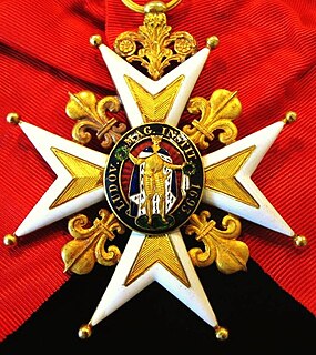
Order of Saint Louis French military order

The Royal and Military Order of Saint Louis is a dynastic order of chivalry founded 5 April 1693 by King Louis XIV, named after Saint Louis. It was intended as a reward for exceptional officers, notable as the first decoration that could be granted to non-nobles. By the authorities of the French Republic, it is considered a predecessor of the Legion of Honour, with which it shares the red ribbon.

In 1948, a portion of the municipal territory separated and was incorporated as the Village Municipality of Barraute. In 1950, zinc and silver mines began operating, that in addition to its favourable location along the railroad and Laflamme River (a tributary of the Bell River), contributed to the local prosperity. In 1951, the United Township Municipality of Fiedmont-et-Barraute changed status to just municipality. But the closure of the zinc and silver mines in 1957, as well as the closure in 1965 of Canada's only lithium mine in neighbouring La Corne, dealt a blow to the economy of Barraute. [1]

Bell River (Quebec) river in Northern Quebec, tributary of Nottaway river, in Canada

The Bell River is a tributary of the south shore of Lake Matagami, which flows into the Nottaway River, a tributary of Rupert Bay. The Bell River flows into the Abitibi-Témiscamingue and Eeyou Istchee Baie-James regions in the administrative region of Nord-du-Québec, in Quebec, in Canada.

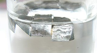
Lithium Chemical element with atomic number 3

Lithium is a chemical element with the symbol Li and atomic number 3. It is a soft, silvery-white alkali metal. Under standard conditions, it is the lightest metal and the lightest solid element. Like all alkali metals, lithium is highly reactive and flammable, and must be stored in mineral oil. When cut, it exhibits a metallic luster, but moist air corrodes it quickly to a dull silvery gray, then black tarnish. It never occurs freely in nature, but only in compounds, such as pegmatitic minerals, which were once the main source of lithium. Due to its solubility as an ion, it is present in ocean water and is commonly obtained from brines. Lithium metal is isolated electrolytically from a mixture of lithium chloride and potassium chloride.

La Corne Municipality in Quebec, Canada

La Corne is a municipality in the Canadian province of Quebec in Abitibi Regional County Municipality.

In 1978, the Town of Barville (incorporated in 1953) was merged into the Municipality of Fiedmont-et-Barraute and, in 1994, the Municipalities of Fiedmont-et-Barraute and Barraute were regrouped into the new Municipality of Barraute. [1]

Economy

In 2012, Quebec Lithium Corp. reopened Quebec Lithium Mine, which had operated as an underground mine from 1955 to 1965. They are planning to carve an open pit mine over pegmatite dikes. (The pegmatite is about 1% lithium carbonate.) The mine is about 60 km (37 mi) north of Val-d'Or, 38 km (24 mi) southeast of Amos, and 15 km (9.3 mi) west of Barraute. Access to the mine is via paved road from Val-d'Or. [5]

Quebec Lithium Mine was a lithium mine in Quebec, Canada. The deposit was discovered in 1942 by Georges H. Dumont.

Pegmatite Very coarse grained plutonic rock

A pegmatite is an igneous rock, formed underground, with interlocking crystals usually larger than 2.5 cm in size (1 in). Most pegmatites are found in sheets of rock near large masses of igneous rocks called batholiths.

Lithium carbonate chemical compound

Lithium carbonate is an inorganic compound, the lithium salt of carbonate with the formula Li
2
CO
3
. This white salt is widely used in the processing of metal oxides and treatment of mood disorder.

Demographics

Population trend: [6]

Private dwellings occupied by usual residents: 876 (total dwellings: 986)

Mother tongue: [7]

Municipal council

See also

Related Research Articles

Val-dOr City in Quebec, Canada

Val-d'Or is a city in Quebec, Canada with a population of 32,491 inhabitants according to the Canada 2016 Census. The city is located in the Abitibi-Témiscamingue region near La Vérendrye Wildlife Reserve.

Amos, Quebec Town in Quebec, Canada

Amos is a town in northwestern Quebec, Canada, on the Harricana River. It is the seat of Abitibi Regional County Municipality.

Mont-Laurier City in Quebec, Canada

Mont-Laurier is a town and incorporated municipality in northwest Quebec, Canada, located on the banks of the Rivière du Lièvre, a tributary of the Ottawa River. Known as the "Capital of the Haute-Laurentides", the motto of the town is Laurus elationis praemium, which translates to "Lift the laurels of reward". The demonym for its inhabitants is Lauriermontois.

Malartic, Quebec City in Quebec, Canada

Malartic is a town on the Malartic River in northwestern Quebec, Canada, in the La Vallée-de-l'Or Regional County Municipality. It is located about 80 kilometres (50 mi) east of the centre of Rouyn-Noranda along Quebec Route 117 and the Canadian National Railway.

La Motte, Quebec Municipality in Quebec, Canada

La Motte is a municipality in the Canadian province of Quebec, located in the Abitibi Regional County Municipality and the administrative region of Abitibi-Témiscamingue.

Preissac Municipality in Quebec, Canada

Preissac is a municipality in the Canadian province of Quebec, located in the Abitibi Regional County Municipality. The village of Preissac itself is located at the north end of Lake Preissac.

Rochebaucourt Municipality in Quebec, Canada

Rochebaucourt is a municipality in the Canadian province of Quebec, located in the Abitibi Regional County Municipality.

Duparquet City in Quebec, Canada

Duparquet is a ville in northwestern Quebec, Canada in the MRC d'Abitibi-Ouest. It covers 157.4 km2 (60.8 sq mi) and had a population of 657 as of the Canada 2011 Census.

Macamic, Quebec City in Quebec, Canada

Macamic is a ville in northwestern Quebec, Canada, in the Abitibi-Ouest Regional County Municipality. It covers 202.34 km² and had a population of 2,734 in the Canada 2011 Census.

La Reine, Quebec Municipality in Quebec, Canada

La Reine is a municipality in northwestern Quebec, Canada, on the La Reine River in the Abitibi-Ouest Regional County Municipality. It had a population of 340 in the Canada 2011 Census.

Normétal Municipality in Quebec, Canada

Normétal is a municipality in northwestern Quebec, Canada, in the Abitibi-Ouest Regional County Municipality. It had a population of 856 in the Canada 2011 Census.

Palmarolle Municipality in Quebec, Canada

Palmarolle is a municipality in northwestern Quebec, Canada, in the Abitibi-Ouest Regional County Municipality. It covers 118.36 km² and had a population of 1,465 as of the Canada 2011 Census. It is considered to have the best agricultural land of the entire Abitibi region.

Roquemaure, Quebec Municipality in Quebec, Canada

Roquemaure is a municipality in northwestern Quebec, Canada in the MRC d'Abitibi-Ouest. It covers 121.67 km² and had a population of 414 as of the Canada 2011 Census.

Val-Saint-Gilles Municipality in Quebec, Canada

Val-Saint-Gilles is a municipality in northwestern Quebec, Canada, in the Abitibi-Ouest Regional County Municipality about 24 kilometres (15 mi) north of La Sarre. It covers 110.54 km² and with a population of 154 in the Canada 2006 Census, it is the least populous incorporated municipality in the regional county.

Nédélec Township municipality in Quebec, Canada

Nédélec is a township municipality in western Quebec, Canada, in the Témiscamingue Regional County Municipality.

Lac-Chicobi Unorganized territory in Quebec, Canada

Lac-Chicobi is an unorganized territory in the Canadian province of Quebec, located within the Abitibi Regional County Municipality. The area consists of two non-contiguous portions on either side of the incorporated municipality of Berry.

Lac-Despinassy Unorganized territory in Quebec, Canada

Lac-Despinassy is an unorganized territory in the Canadian province of Quebec, located within the Abitibi Regional County Municipality. The area is east of the municipality of Saint-Dominique-du-Rosaire, north of La Morandière, Rochebaucourt and the parish municipality of Senneterre, and west of the city of Senneterre.

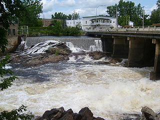
Des Aulnes River (Laflamme River tributary) tributary of the Laflamme River, flowing in Barraute, Abitibi, Quebec, Canada

The Des Aulnes River is a tributary of the west bank of the Laflamme river, flowing in the municipality of Barraute, in the regional county municipality (MRC) of Abitibi, in the administrative region of Abitibi-Témiscamingue, Quebec, Canada. His course is entirely in Barraute Township.

References

  1. 1 2 3 4 5 "Barraute (Municipalité)" (in French). Commission de toponymie du Québec. Retrieved 2011-01-11.
  2. 1 2 "Barraute". Répertoire des municipalités (in French). Ministère des Affaires municipales, des Régions et de l'Occupation du territoire. Archived from the original on 2012-06-04. Retrieved 2011-01-11.
  3. 1 2 "Barraute census profile". 2011 Census data . Statistics Canada. Retrieved 2011-01-11.
  4. "Mont-Vidéo ski maps". skimap.org. Retrieved 2013-03-07.
  5. "Quebec Lithium". Canada Lithium Corp. Archived from the original on 2013-03-10. Retrieved 2013-03-07.
  6. Statistics Canada: 1996, 2001, 2006, 2011 census
  7. "Barraute community profile". 2006 Census data . Statistics Canada. Retrieved 2011-01-11.