La Corne

Last updated

La Corne
La Corne QC.JPG
La Corne Quebec location diagram.png
Location within Abitibi RCM
Canada Western Quebec location map.png
Red pog.svg
La Corne
Location in western Quebec
Coordinates: 48°21′N78°00′W / 48.350°N 78.000°W / 48.350; -78.000 [1]
CountryCanada
Province Quebec
Region Abitibi-Témiscamingue
RCM Abitibi
Settledc. 1935
ConstitutedAugust 2, 1975
Government
[2]
  MayorÉric Comeau
   Federal riding Abitibi—Témiscamingue
   Prov. riding Abitibi-Ouest
Area
  Total332.26 km2 (128.29 sq mi)
  Land308.13 km2 (118.97 sq mi)
Population
 (2021) [3]
  Total778
  Density2.5/km2 (6/sq mi)
  Pop (2016-21)
Increase2.svg 8.2%
  Dwellings
382
Time zone UTC−05:00 (EST)
  Summer (DST) UTC−04:00 (EDT)
Postal code(s)
Area code 819
HighwaysQc111.svg R-111
Website www.lacorne.ca OOjs UI icon edit-ltr-progressive.svg

La Corne is a municipality in the Canadian province of Quebec in Abitibi Regional County Municipality.

Contents

The place is named in honour of Louis de La Corne (1703–1761), a French naval officer who was wounded in the Battle of Sainte-Foy in 1760. Until 1978, the place name was incorrectly spelled as Lacorne. [1]

From 1955 to 1965, La Corne was home to Canada's only lithium mine. The underground mine had a 150 m (490 ft) deep shaft and lateral workings on three levels, and provided lithium to the glass and ceramics industries. With the advent of lithium batteries for electric cars and a myriad of consumer electronic products, the mine is currently being studied for reopening in late 2012 as an open-pit mine. [4] [ needs update ]

History

The municipality of La Corne was founded in 1975 under the name Lacorne. The name was changed to the current La Corne in 1978. [5]

Demographics

Historical census populations – La Corne
YearPop.±%
1976 608    
1981 631+3.8%
1986 642+1.7%
1991 616−4.0%
1996 621+0.8%
YearPop.±%
2001 629+1.3%
2006 682+8.4%
2011 700+2.6%
2016 719+2.7%
2021 778+8.2%
Source: Statistics Canada

Private dwellings occupied by usual residents (2021): 322 (total dwellings: 382) [3]

Mother tongue (2021): [3]

Government

Municipal council (as of 2023): [2]

List of former mayors: [5]

Related Research Articles

<span class="mw-page-title-main">Val-d'Or</span> City in Quebec, Canada

Val-d'Or is a city in Quebec, Canada with a population of 32,752 inhabitants according to the 2021 Canadian census. The city is located in the Abitibi-Témiscamingue region near La Vérendrye Wildlife Reserve.

<span class="mw-page-title-main">Sainte-Anne-des-Plaines</span> City in Quebec, Canada

Sainte-Anne-des-Plaines is a city in southwestern Quebec, Canada, 40 km northwest of the city of Montreal in the Thérèse-De Blainville Regional County Municipality, in the region of Laurentides. Its population was 14,990 during the census of 2014.

<span class="mw-page-title-main">Amos, Quebec</span> Town in Quebec, Canada

Amos is a town in northwestern Quebec, Canada, on the Harricana River. It is the seat of Abitibi Regional County Municipality.

<span class="mw-page-title-main">Barraute</span> Municipality in Quebec, Canada

Barraute is a municipality in the Canadian province of Quebec, located in the Abitibi Regional County Municipality.

<span class="mw-page-title-main">Preissac</span> Municipality in Quebec, Canada

Preissac is a municipality in the Canadian province of Quebec, located in the Abitibi Regional County Municipality. The village of Preissac itself is located at the north end of Lake Preissac.

<span class="mw-page-title-main">Landrienne</span> Township municipality in Quebec, Canada

Landrienne is a township municipality in the Canadian province of Quebec, located in the Abitibi Regional County Municipality. It is part of the census agglomeration of Amos.

<span class="mw-page-title-main">Saint-Marc-de-Figuery</span> Parish municipality in Quebec, Canada

Saint-Marc-de-Figuery is a parish municipality in the Canadian province of Quebec, located in the Abitibi Regional County Municipality. It is part of the census agglomeration of Amos.

<span class="mw-page-title-main">Authier, Quebec</span> Municipality in Quebec, Canada

Authier is a municipality in northwestern Quebec, Canada, in the Abitibi-Ouest Regional County Municipality. It had a population of 290 in the 2021 Canadian census.

<span class="mw-page-title-main">Normétal</span> Municipality in Quebec, Canada

Normétal is a municipality in northwestern Quebec, Canada, in the Abitibi-Ouest Regional County Municipality. It had a population of 778 in the 2021 Canadian census.

<span class="mw-page-title-main">Sainte-Hélène-de-Mancebourg</span> Parish municipality in Quebec, Canada

Sainte-Hélène-de-Mancebourg is a parish municipality in northwestern Quebec, Canada in the Abitibi-Ouest Regional County Municipality. It covers 68.15 km2 and had a population of 410 as of the 2021 Canadian census.

<span class="mw-page-title-main">Moffet, Quebec</span> Municipality in Quebec, Canada

Moffet is a municipality in northwestern Quebec, Canada, in the Témiscamingue Regional County Municipality. The municipality had a population of 206 as of the 2021 Canadian census.

<span class="mw-page-title-main">Belcourt, Quebec</span> Municipality in Quebec, Canada

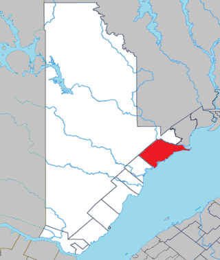
Belcourt is a municipality in northwestern Quebec, Canada, in the La Vallée-de-l'Or Regional County Municipality.

<span class="mw-page-title-main">Sainte-Thérèse-de-la-Gatineau</span> Municipality in Quebec, Canada

Sainte-Thérèse-de-la-Gatineau is a municipality in the Outaouais region of Quebec, Canada. Located between the Gatineau River and Thirty-One Mile Lake, it is the smallest municipality in terms of population in the La Vallée-de-la-Gatineau Regional County Municipality.

<span class="mw-page-title-main">Duhamel, Quebec</span> Municipality in Quebec, Canada

Duhamel is a town and municipality in the Outaouais region of Quebec, Canada. It is the largest municipality in surface area in the Papineau Regional County Municipality.

<span class="mw-page-title-main">Colombier, Quebec</span> Municipality in Quebec, Canada

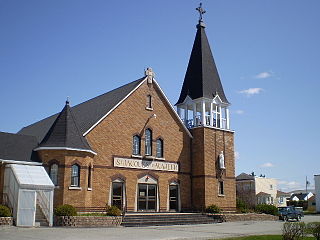
Colombier is a municipality in the Canadian province of Quebec, located in the Côte-Nord region and the regional county municipality of La Haute-Côte-Nord. It is located along Route 138, about 60 kilometres (37 mi) south-west of Baie-Comeau.

<span class="mw-page-title-main">Mont-Saint-Michel, Quebec</span> Municipality in Quebec, Canada

Mont-Saint-Michel is a municipality in the Laurentides region of Quebec, Canada, part of the Antoine-Labelle Regional County Municipality.

<span class="mw-page-title-main">Saint-Félix-de-Valois, Quebec</span> Municipality in Quebec, Canada

Saint-Félix-de-Valois is a municipality in the Lanaudière region of Quebec, Canada, part of the Matawinie Regional County Municipality.

<span class="mw-page-title-main">Chute-aux-Outardes</span> Village municipality in Quebec, Canada

Chute-aux-Outardes is a village municipality in Quebec, Canada, at the mouth of the Outardes River. It is about 20 kilometres (12 mi) south-west of Baie-Comeau along Route 138.

<span class="mw-page-title-main">Mont-Saint-Pierre, Quebec</span> Village municipality in Quebec, Canada

Mont-Saint-Pierre is a village municipality in Quebec, Canada, located in the regional county municipality of La Haute-Gaspésie in the administrative region of Gaspésie–Îles-de-la-Madeleine.

<span class="mw-page-title-main">Franquelin, Quebec</span> Municipality in Quebec, Canada

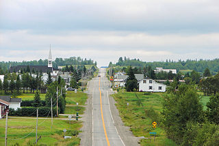
Franquelin is a municipality in Quebec, Canada, in the administrative region of Côte-Nord in RCM Manicouagan. Its population is 285 people over 430 square kilometres. Franquelin was founded at the foot of Massifs rocks of the Laurentians where impressive cliffs plunge to the Gulf of Saint Lawrence.

References

  1. 1 2 "Banque de noms de lieux du Québec: Reference number 72436". toponymie.gouv.qc.ca (in French). Commission de toponymie du Québec.
  2. 1 2 3 "La Corne". Répertoire des municipalités (in French). Ministère des Affaires municipales et de l'Habitation. Retrieved 2023-07-24.
  3. 1 2 3 4 "La Corne community profile". 2021 Census data . Statistics Canada. Retrieved 2023-06-09.
  4. "Quebec Lithium Project". Canada Lithium Corp. Archived from the original on 2013-03-10. Retrieved 2011-01-11.
  5. 1 2 "Répertoire des entités géopolitiques: La Corne (municipalité) 2.8.1975 - ..." www.mairesduquebec.com. Institut généalogique Drouin. Retrieved 24 July 2023.
  6. 1 2 "Éric Comeau redevient maire de La Corne". Radio-Canada.ca (in Canadian French). Retrieved 2023-07-11.