Launay | |
---|---|
Coordinates: 48°39′N78°32′W / 48.650°N 78.533°W [1] | |
Country | Canada |
Province | Quebec |
Region | Abitibi-Témiscamingue |
RCM | Abitibi |
Settled | c. 1917 |
Constituted | May 18, 1921 |
Named for | Jean-Baptiste Leporquier de Launay [1] |
Government | |
• Mayor | Claudette Laroche |
• Federal riding | Abitibi—Témiscamingue |
• Prov. riding | Abitibi-Ouest |
Area | |
• Total | 259.22 km2 (100.09 sq mi) |
• Land | 257.80 km2 (99.54 sq mi) |
Population (2021) [3] | |
• Total | 211 |
• Density | 0.8/km2 (2/sq mi) |
• Pop (2016-21) | 3.2% |
• Dwellings | 99 |
Time zone | UTC−5 (EST) |
• Summer (DST) | UTC−4 (EDT) |
Postal code(s) | |
Area code | 819 |
Highways | R-111 |
Website | www |
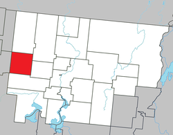
Launay is a township municipality in the Canadian province of Quebec, located in the Abitibi Regional County Municipality.
The municipality is named after Jean-Baptiste Leporquier de Launay, a military commander and captain of the Guyenne Regiment from the mid-18th century. [1]
Its economy is dependent on agriculture and forestry. [1]
The town's origin began with the construction of the railway station along the National Transcontinental Railway in 1913. In 1916, the geographic township was established, and settlement began the following year. On May 18, 1921, the Township Municipality of Launay was created out of unincorporated territory. Its first school was built in 1922, and its post office opened the following year (which closed in 1956). [1] [4] [5]
In 1947, Launay was connected to the electrical grid, and in 1961, to the telephone system. In 1971, the Canadian National railway company closed Launay Station, which was demolished in 1988. That same year, the municipal sewer network was installed. [4]
In the 2021 Census of Population conducted by Statistics Canada, Launay had a population of 211 living in 97 of its 99 total private dwellings, a change of -3.2% from its 2016 population of 218. With a land area of 257.8 km2 (99.5 sq mi), it had a population density of 0.8/km2 (2.1/sq mi) in 2021. [3]
2021 | 2016 | 2011 | |
---|---|---|---|
Population | 211 (-3.2% from 2016) | 218 (-4.8% from 2011) | 229 (+1.3% from 2006) |
Land area | 257.8 km2 (99.5 sq mi) | 258.51 km2 (99.81 sq mi) | 258.24 km2 (99.71 sq mi) |
Population density | 0.8/km2 (2.1/sq mi) | 0.8/km2 (2.1/sq mi) | 0.9/km2 (2.3/sq mi) |
Median age | 49.2 (M: 54, F: 44.4) | 50 (M: 53, F: 47) | 47.1 (M: 47.2, F: 46.8) |
Private dwellings | 99 (total) 97 (occupied) | 118 (total) 100 (occupied) | 97 (total) 96 (occupied) |
Median household income | $.n/a | $.n/a | $.n/a |
Mother tongue (2021): [3]
|
|
| |||||||||||||||||||||||||||||||||||||||||||||||||||||||||||||||
Source: Statistics Canada |
Municipal council (as of 2023): [2]
List of former mayors: [5]
Year | Liberal | Conservative | Bloc Québécois | New Democratic | Green | ||||||
---|---|---|---|---|---|---|---|---|---|---|---|
2021 | 17% | 19 | 7% | 8 | 58% | 64 | 5% | 6 | 5% | 5 | |
2019 | 22% | 25 | 16% | 18 | 51% | 59 | 8% | 9 | 3% | 4 | |
2015 | 30% | 28 | 5% | 5 | 18% | 17 | 43% | 40 | 1% | 1 | |
2011 | 2% | 2 | 13% | 14 | 36% | 40 | 50% | 56 | 0% | 0 | |
2008 | 18% | 16 | 19% | 17 | 46% | 41 | 13% | 12 | 4% | 4 | |
2006 | 12% | 13 | 31% | 35 | 52% | 59 | 4% | 4 | 2% | 2 | |
2004 | 24% | 26 | 10% | 11 | 59% | 64 | 4% | 4 | 3% | 3 | |
Year | CAQ | Liberal | QC solidaire | Parti Québécois | |||||
---|---|---|---|---|---|---|---|---|---|
2022 | 51% | 53 | 6 | 6 | 13% | 13 | 25% | 26 | |
2018 | 20% | 29 | 14% | 20 | 23% | 34 | 39% | 56 | |
2014 | 9% | 12 | 30% | 37 | 13% | 16 | 45% | 55 | |
2012 | 16% | 18 | 16% | 18 | 5% | 6 | 61% | 69 | |
Federally, Launay is part of the federal riding of Abitibi—Témiscamingue. In the 2021 Canadian federal election, the incumbent Sébastien Lemire of the Bloc Québécois was re-elected to represent the population Launay in the House of Commons of Canada.
Provincially it is part of the riding of Abitibi-Ouest. In the 2022 Quebec general election the incumbent MNA Suzanne Blais, of the Coalition Avenir Québec, was re-elected to represent the population of Launay in the National Assembly of Quebec.
La Vallée-de-l'Or is a regional county municipality in the Abitibi-Témiscamingue region in Northwestern Quebec, Canada. The seat is in Val-d'Or. It is named for its gold deposits in the Harricana River and Bell River valleys.
Amos is a town in northwestern Quebec, Canada, on the Harricana River. It is the seat of Abitibi Regional County Municipality.
Hemmingford is a village municipality located in Les Jardins-de-Napierville Regional County Municipality of southern Quebec. The population as of 2021 was 829.
Champneuf is a municipality in the Canadian province of Quebec, located in the Abitibi Regional County Municipality. It is the least populated incorporated place in the Abitibi-Témiscamingue region.
Rochebaucourt is a former municipality in the Canadian province of Quebec, located in the Abitibi Regional County Municipality. In 2023, it was merged with La Morandière to from the new Municipality of La Morandière-Rochebaucourt.
Trécesson is a township municipality in the Canadian province of Quebec, located in the Abitibi Regional County Municipality.
Saint-Marc-de-Figuery is a parish municipality in the Canadian province of Quebec, located in the Abitibi Regional County Municipality. It is part of the census agglomeration of Amos.
Macamic is a ville in northwestern Quebec, Canada, in the Abitibi-Ouest Regional County Municipality. It covers 202 km² and had a population of 2,744 in the 2021 Canadian census. It is located on the shores of the namesake Lake Macamic.
Chazel is a municipality in northwestern Quebec, Canada, in the Abitibi-Ouest Regional County Municipality. It had a population of 254 in the 2021 Canadian census.
Dupuy is a municipality in northwestern Quebec, Canada, in the Abitibi-Ouest Regional County Municipality. It covers 123.48 km2 and had a population of 940 as of the 2021 Canadian census.
Rapide-Danseur is a municipality in northwestern Quebec, Canada, in the Abitibi-Ouest Regional County Municipality. It covers 173.73 km2 and had a population of 380 as of the 2021 Canadian census.
Clermont is a township municipality in northwestern Quebec, Canada, in Abitibi-Ouest Regional County Municipality. It had a population of 484 in the 2021 Canadian census. The population centre itself is sometimes referred to as Saint-Vital-de-Clermont.
Sainte-Hélène-de-Mancebourg is a parish municipality in northwestern Quebec, Canada in the Abitibi-Ouest Regional County Municipality. It covers 68.15 km2 and had a population of 410 as of the 2021 Canadian census.
Sheenboro is a village and municipality in the Outaouais region, part of the Pontiac Regional County Municipality, Quebec, Canada. It was formerly known as Sheen-Esher-Aberdeen-et-Malakoff. Its territory stretches along the north shore of the Ottawa River from Chichester to Rapides-des-Joachims.
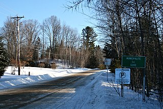
Gore is a township municipality in the Canadian province of Quebec, located within the Argenteuil Regional County Municipality. Its main community is Lakefield.
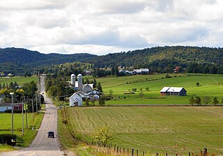
Harrington is a township municipality in the Laurentides region of Quebec, Canada, part of the Argenteuil Regional County Municipality. It is located in the Laurentian Mountains, about 40 kilometres (25 mi) north-west of Lachute.
Wentworth is a township municipality in the Laurentides region of Quebec, Canada, part of the Argenteuil Regional County Municipality, north-west of Lachute.
Otter Lake is a municipality in the Outaouais region, northwest of Gatineau, part of the Pontiac Regional County Municipality, Quebec, Canada.
Alleyn-et-Cawood is a municipality in the Outaouais region, northwest of Gatineau, part of the Pontiac Regional County Municipality, Quebec, Canada. Its main population centre is Danford Lake, located along Route 301.
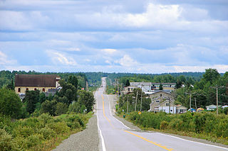
La Morandière-Rochebaucourt is a municipality in the Canadian province of Quebec, located in the Abitibi Regional County Municipality.