
Paya Lebar is a planning area located in the East Region of Singapore, bordered by Hougang to the west, Sengkang to the northwest, Tampines to the east, Bedok to the south and Pasir Ris to the north.

Serangoon is a planning area and residential town located in the North-East Region of Singapore.

Paya Lebar MRT station is a Mass Rapid Transit (MRT) interchange station on the East West line (EWL) and Circle line (CCL) in Geylang, Singapore. Despite the name, this station is not located in Paya Lebar but rather along Paya Lebar Road, near the junction with Sims Avenue. It is located among the developments of the Paya Lebar Central commercial hub and near the Geylang Serai district.
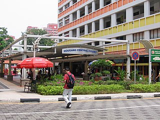
Hougang is a planning area and mature residential town located in the North-East Region of Singapore. It is the largest housing estate in Singapore based on land area, and is home to 247,528 residents as of 2018. Hougang planning area is bordered by Sengkang to the north, Geylang to the south, Bedok to the southeast, Toa Payoh to the southwest, Serangoon to the west and Paya Lebar to the east.

Bedok is a planning area and residential town located in the geographical region of Tanah Merah along the south-eastern coast of the East Region of Singapore. Bedok is bounded by five other planning areas: Paya Lebar to the north, Hougang to the northwest, Tampines to the northeast and east, Geylang to the west and Marine Parade to the southwest. It also shares a maritime boundary with the Singapore Strait to the south and southeast.
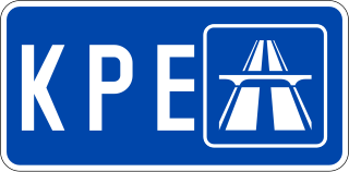
The Kallang–Paya Lebar Expressway (KPE) is the third newest of Singapore's network of expressways. The southern (Kallang) section of the expressway opened first, on 26 October 2007, with the remaining section opened on 20 September 2008.

The Pan Island Expressway is the oldest and longest expressway in Singapore. It is also Singapore's longest road. The expressway runs from the East Coast Parkway near Changi Airport in the east to Tuas in the west and has a total length of 42.8 kilometres.
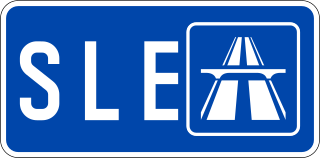
The Seletar Expressway is a highway in Singapore that traverses the northern end of the island and joins the Central Expressway (CTE) and the Tampines Expressway (TPE) in Seletar to the Bukit Timah Expressway (BKE) in Kranji.
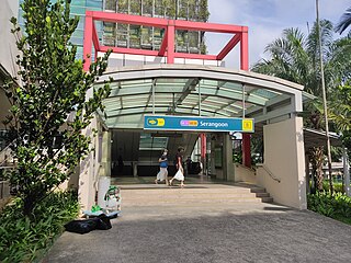
Serangoon MRT station is an underground Mass Rapid Transit (MRT) interchange station on the North East (NEL) and Circle (CCL) lines. Situated in Serangoon, Singapore along Upper Serangoon Road and Serangoon Central, the station is integrated with the Nex shopping complex and the Serangoon Bus Interchange. The station is near the Serangoon Neighbourhood Police Centre and Braddell Heights Community Hub and serves various residential estates in the area.
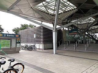
Bartley MRT station is an underground Mass Rapid Transit (MRT) station on the Stage 3 of the Circle line, located on the boundary of Serangoon and Toa Payoh planning areas, Singapore.

The Aljunied Group Representation Constituency is a five-member group representation constituency (GRC) in the north-eastern and eastern region of Singapore. It consists of a large part of Hougang, Paya Lebar, Serangoon Gardens, the southern half of Serangoon North as well as a portion of Bedok and a very small section of Tampines managed by the Aljuined-Hougang Town Council. The GRC consists of five divisions: Eunos, Bedok Reservoir-Punggol, Kaki Bukit, Serangoon and Paya Lebar. The current members of parliament are Gerald Giam, Pritam Singh, Muhamad Faisal Manap and Sylvia Lim from the Worker's Party (WP) after the resignation of Leon Perera.

The Outer Ring Road System, or more commonly known as ORRS, is a network of major arterial roads in Singapore that forms a ring road through the towns along the city fringe. The ORRS is a semi-expressway, just like the West Coast Highway. Since 1994, roads along the ORRS have been upgraded in stages to provide a smoother route to travel across the island. Roads and interchanges along the ORRS are constantly being upgraded to cater to the ever increasing traffic demand. It starts as Portsdown Avenue in Queenstown and ends as Tampines Avenue 10 in Tampines. The series of roads passes through the areas of Queenstown, Bukit Timah, Central Catchment Nature Reserve, Bishan, Toa Payoh, Geylang and Tampines.

Kovan is a neighbourhood located within the town of Hougang, in Singapore. The neighbourhood today largely consists of private housing properties, where majority of the residents live in terrace homes, semi-detached houses and bungalows.

The North East Community Development Council is one of five Community Development Councils (CDCs) set up across the Republic of Singapore to aid in local administration of governmental policies and schemes. They are funded in part by the government although they are free to engage in fund-raising activities.
Occasionally, some parts of Singapore are inundated by floods, usually in the form of flash floods that came about due to intense rainfall over a short period of time. Floods in Singapore are much less severe than floods in other countries, often only lasting a few hours before dissipating on its own.

Kaki Bukit is an industrial area located in Bedok in the East Region of Singapore. It is home to many high tech industrial companies and warehouses. There used to be a prison complex called Kaki Bukit Centre, which was converted to a prison school in 2000. It has since moved to Tanah Merah and the Acacia Welfare Home now stands in its place. On the south of Kaki Bukit is Jalan Tenaga and Jalan Damai neighbourhoods of Bedok Reservoir Road. Redevelopments are in the pipeline for Kaki Bukit beyond 2030 when Paya Lebar Airbase, located just north of the estate, relocates to Changi. Not only would land be freed up for use but building height restrictions, that are currently in place for safety reasons because the estate is directly aligned with the airbase runway, would also be lifted. Kaki Bukit is classified by Urban Redevelopment Authority (URA) as a subzone under the planning area of Bedok, its boundaries differ from the constituency boundaries used by the Singapore Parliament.
Rural East Constituency was a constituency represented in the Legislative Council of Singapore from 1948 until 1951. It elected one Legislative Council member.