Ang Mo Kio is a planning area and residential town situated in the North-East of Singapore. Located approximately 11 km (6.8 mi) north of the Downtown Core district, Ang Mo Kio is the 3rd most populated planning area in the North-East Region and ranks 8th in terms of population in the country overall. The planning area is located at the south-western corner of the North-East Region, bordered by the planning areas of Yishun to the north, Sengkang to the north-east, Serangoon to the east, Bishan to the south and the Central Water Catchment to the west.

Sembawang is a planning area and residential town located in the North Region of Singapore. Sembawang planning area is bordered by Simpang to the east, Mandai to the south, Yishun to the southeast, Woodlands to the west and the Straits of Johor to the north.
Woodlands is a planning area and residential town located in the North of Singapore. As of 2019, the town has a population of 254,733. It is the densest planning area and is the regional centre for the North Region of the country.

Kallang is a planning area and residential zone located in the Central Region of Singapore.

Yishun, formerly known as Nee Soon, is a residential town located in the northeastern corner of the North Region of Singapore, bordering Simpang and Sembawang to the north, Mandai to the west, the Central Water Catchment to its southwest, Ang Mo Kio to its south, as well as Seletar and Sengkang to its east and southeast respectively.

Serangoon is a planning area and residential town located in the North-East Region of Singapore.

Thomson is a relatively narrow area stretching from Novena in the Central Region of Singapore up north till Sembawang. The area is mainly located within the central catchment area where some of Singapore's reservoirs are located, including MacRitchie Reservoir, Upper Peirce Reservoir and Lower Peirce Reservoir.

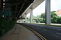
The Central Expressway (CTE) in Singapore is the major highway connecting the city centre of Singapore with the northern residential parts of the island, including Toa Payoh, Bishan and Ang Mo Kio and further onwards to the Seletar Expressway and the Tampines Expressway.
Jalan Kayu is a road situated in Sengkang, Singapore. It is located in the northwestern part of Fernvale, near the Seletar–Sengkang boundary.
The Seletar Expressway is a highway in Singapore that traverses the northern end of the island and joins the Central Expressway (CTE) and the Tampines Expressway (TPE) in Seletar to the Bukit Timah Expressway (BKE) in Kranji.

Toa Payoh MRT station is an underground Mass Rapid Transit (MRT) station on the North South line (NSL) in Toa Payoh, Singapore. Located in the town centre of Toa Payoh, it is integrated with the Toa Payoh Bus Interchange and the HDB Hub, headquarters of the Housing and Development Board. The station is underneath the intersection of three roads: Lorong 1 Toa Payoh, Lorong 2 Toa Payoh and Lorong 6 Toa Payoh.
The North Region of Singapore is one of the five regions in the city-state. The region is the second largest region in terms of land area, and has a population of 582,330. Woodlands is the regional centre and also the most populous town with 255,130 residents living in the area. Comprising 13,500 hectares of land area, it includes eight planning areas.

Novena MRT station is an underground Mass Rapid Transit (MRT) station on the North South Line. Located along Thomson Road in Novena, Singapore, the station is located near landmarks such as Tan Tock Seng Hospital, Mount Elizabeth Novena Hospital and United Square. Planned as part of Phase One of the MRT system, under the working name Thomson, the station's name was changed to Novena in November 1982, after the Novena Church. Construction of the station commenced in January 1984, and the station opened in December 1987.
Mandai Road is a major road located in Mandai, in the northern area of Singapore. The road starts from Woodlands Road and ends at the junction of Sembawang Road and Upper Thomson Road. The road was built in 1855 in a jungle and appeared in the Franklin and Jackson Plan of Singapore (1828) as a river indicated as "R. Mandi". It has been said the name of the road comes from a tree known as the "Mandai tree".

Mandai is a planning area located in the North Region of Singapore, famously known for being the access point of the Singapore Zoo and Night Safari.
The North–South Corridor (NSC), originally conceptualised as the North-South Expressway, is an under-construction expressway that will be the 11th of Singapore's network of expressways when completed. The North South Corridor will serve increasing traffic along the north-south corridor that is currently served by the Central Expressway (CTE). The 21 kilometres (13 mi) expressway will cost about S$7–8 billion when fully completed in 2026 as North-South Corridor and will connect the East Coast Parkway (ECP) with the northern parts of Singapore.
Mandai Depot is an integrated train and bus depot located in Mandai, Singapore. The train depot serves as the maintenance and control centre of the Thomson-East Coast line while the bus depot is used for the Sembawang-Yishun Bus Package.
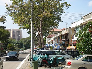
Chong Pang is a housing estate located in the subzone of Yishun West along the Sembawang–Yishun boundary in the town of Yishun, Singapore. It was named after the former Chong Pang village. It has precincts of Neighbourhood 1, part of Neighbourhood 7 and private residential areas along Sembawang Road.