
Katsuta is a district located in Okayama Prefecture, Japan.
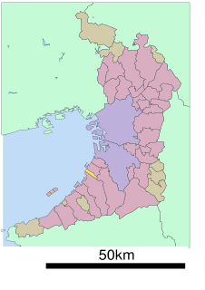
Senboku is a district located in Osaka Prefecture, Japan.
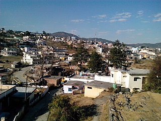
Champawat is a town and a Nagar Palika Parishad in Champawat district in the state of Uttarakhand, India. It is the administrative headquarters of Champawat district. The town was the former capital of the Kumaon Kingdom.

Clive is a village in central Alberta, Canada. It is located 15 minutes east of Lacombe and 30 minutes from Red Deer.

Chhabra is a city and a municipality in Baran district in the state of Rajasthan, India, near to the border with Madhya Pradesh. Chhabra is a historic walled city with a fort and got its name from the six gates in the walls.

Vyšná Myšľa is a village and municipality in Košice-okolie District in the Kosice Region of eastern Slovakia.

Nové Sady, until 1948 Ašakert ) is a village and municipality in the Nitra District in western central Slovakia, in the Nitra Region.

Sultanpur is a town and a nagar panchayat in Udham Singh Nagar district in the Indian state of Uttarakhand.

Ayer Bemban is a small village in the north of Kulai District, Johor, Malaysia.
Daulatpur is a town and market place in Rajapur Municipality in Bardiya District in the Bheri Zone of south-western Nepal. The former village development committee (VDC) was merged with Daulatpur, Naya Gaun, Badalpur, Bhimapur and Rajapur VDCs to form the new municipality on 18 May 2014. At the time of the 1991 Nepal census it had a population of 5,888 and had 681 houses in the town.
Sarmi is a village development committee in Dolpa District in the Karnali Zone of north-western Nepal. At the time of the 1991 Nepal census it had a population of 1,396 people in 279 households.

Wsola is a village in the administrative district of Gmina Jedlińsk, within Radom County, Masovian Voivodeship, in east-central Poland. It lies approximately 4 kilometres (2 mi) south of Jedlińsk, 10 km (6 mi) north of Radom, and 82 km (51 mi) south of Warsaw.
Hardauna is a village development committee in Kapilvastu District in the Lumbini Zone of southern Nepal. At the time of the 1991 Nepal census it had a population of 3393 people living in 576 individual households.
Takeli is a village and jamoat in north-western Tajikistan. It is located in Mastchoh District in Sughd province. The jamoat has a total population of 13,956.
Janakpatti is a village in Varanasi district, Uttar Pradesh, India. The village has population of about 450 and is located close to the Varanasi–Jaunpur border.
Ežeriekai is a village in Varėna district municipality, in Alytus County, in southeastern Lithuania. According to the 2001 census, the village has a population of 18 people.

Kondurg is a Village and Mandal headquarters in Mahbubnagar district, Telangana.
Howmeh Rural District is a rural district (dehestan) in the Central District of Bandar Lengeh County, Hormozgan Province, Iran. At the 2006 census, its population was 9,624, in 1,888 families. The rural district has 21 villages.

Khulna is a village and a gram panchayat in Sandeshkhali II CD Block in Basirhat subdivision of North 24 Parganas district in the Indian state of West Bengal.
Sadpur is a village in Chanditala I community development block of Srirampore subdivision in Hooghly district in the Indian state of West Bengal.
