Related Research Articles

Bath is the largest city in the county of Somerset, England, known for and named after its Roman-built baths. In 2019, the population was 101,106. Bath is in the valley of the River Avon, 97 miles (156 km) west of London and 11 miles (18 km) southeast of Bristol. The city became a World Heritage Site in 1987, and was later added to the transnational World Heritage Site known as the "Great Spa Towns of Europe" in 2021.

Somerset is a county in South West England which borders Gloucestershire and Bristol to the north, Wiltshire to the east, Dorset to the south-east and Devon to the south-west. It is bounded to the north and west by the Severn Estuary and the Bristol Channel, its coastline facing southeastern Wales. Its traditional border with Gloucestershire is the River Avon. Somerset is formed of six districts, of which two are unitary authorities and its county town is Taunton.

South Gloucestershire is a unitary authority area in the ceremonial county of Gloucestershire, South West England. South Gloucestershire was created in 1996 from the northern section of the county of Avon, which was abolished at that time.

Bath and North East Somerset (B&NES) is a unitary authority district in England. Bath and North East Somerset Council was created on 1 April 1996 following the abolition of the county of Avon. It is part of the ceremonial county of Somerset.
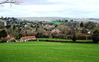
Chew Stoke is a small village and civil parish in the affluent Chew Valley, in Somerset, England, about 8 miles (13 km) south of Bristol and 10 miles north of Wells. It is at the northern edge of the Mendip Hills, a region designated by the United Kingdom as an Area of Outstanding Natural Beauty, and is within the Bristol/Bath green belt. The parish includes the hamlet of Breach Hill, which is approximately 2 miles (3.2 km) southwest of Chew Stoke itself.
Monkton Combe is a village and civil parish in north Somerset, England, 3 miles (4.8 km) south of Bath. The parish, which includes the hamlet of Tucking Mill, had a population of 554 in 2013. It was formerly known as Combe, owing to its geography, while it was also known as Monckton Combe and Combe Monckton until last century.

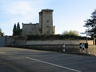
Bathwick is an electoral ward in the City of Bath, England, on the opposite bank of the River Avon to the historic city centre.

Bathford is a village and civil parish 3 miles (4.8 km) east of Bath, England. The parish, which includes Warleigh, has a population of 1,759 and extends over 1,800 acres (7.3 km2).

North East Somerset is a constituency represented in the House of Commons of the UK Parliament, since its 2010 creation, by Jacob Rees-Mogg, a Conservative currently serving as Minister for Brexit Opportunities & Government Efficiency
Batheaston is a village and civil parish 2 miles (3.2 km) east of the English city of Bath and on the north bank of the River Avon. The parish has a population of 2,735. The northern area of the parish on the road to St Catherine is an area known as Northend.
Camerton is a village and civil parish in Somerset, 6 miles (9.7 km) south west of Bath, lying on the Cam Brook. The parish has a population of 655.

Freshford is a village and civil parish in the Avon valley 6 miles (10 km) south-east of Bath, in the county of Somerset, England. The parish has a population of 551. It is in the Cotswolds Area of Outstanding Natural Beauty (AONB), within the Green Belt and is in a conservation area.
Greater Bristol is a term used for the conurbation which contains and surrounds the city of Bristol in the South West of England. There is no official "Greater Bristol" authority, but the term is sometimes used by local, regional and national authorities, and others as a synonym for either the "Bristol Urban Area" or a wider area of the former County of Avon, and by some, TfGB, to refer to the Province of Bristol as defined by C. B. Fawcett (1919) or Derek Senior (1969). The Bristol post town covers a wider area than the city of Bristol.
Kelston is a small village and civil parish in Somerset, 4 miles (6.4 km) north west of Bath, and 8 miles (12.9 km) east of Bristol, on the A431 road. It is situated just north of the River Avon, close to the Kelston and Saltford locks. The parish has a population of 248.

Limpley Stoke is a village and civil parish in Wiltshire, England. It lies in the Avon valley between Bath and Freshford, and is both above and below the A36 road.

Southstoke is a small village and civil parish in north east Somerset, England. In 2004 the parish council requested that the name be formally changed to South Stoke, as "this is historically the more established spelling and better reflects the origin and meaning of the Parish name."

Charlcombe is a civil parish and small village just north of Bath in the Bath and North East Somerset unitary authority, Somerset, England. The parish had a population of 422 in 2011, and includes the villages of Woolley and Langridge and the hamlet of Lansdown.
St Catherine is a small, but very spread out, rural village within the civil parish of Batheaston in Bath and North East Somerset and Marshfield Parish, South Gloucestershire, England, United Kingdom.

North Stoke is a village within the civil parish of Kelston in the Bath and North East Somerset (BANES) unitary authority within the historic county of Somerset, England, and close to the border with South Gloucestershire. The parish has a population of 72.

Lyncombe is a district and electoral ward in Bath, Somerset, and a former parish in the Diocese of Bath and Wells. In the mid-19th century the parish was formed when the parish of Widcombe and Lyncombe was split in two, but it was abolished in the late 1960s. The village of Lyncombe existed since at least the Saxon period prior to becoming part of the City of Bath.
References
- ↑ Davenport, Peter (2002). Medieval Bath Uncovered. Stroud: Tempus. pp. 97–98. ISBN 0-7524-1965-X.
- ↑ Reverend John Collinson (1791). The History and Antiquities of the County of Somerset, Collected from Authentick Records, and an Actual Survey Made by the Late Mr Edmund Rack Adorned with a Map of the County and Engravings of Roman and other Reliques, Town-seals, Baths, Churches and Gentleman's Seats. Vol. 1. p. 97. ISBN 978-1-171-40217-6.
- ↑ "Somerset Hundreds". GENUKI. Retrieved 9 September 2011.