
Launceston is a city in the north of Tasmania, Australia, at the confluence of the North Esk and South Esk rivers where they become the Tamar River (kanamaluka). Launceston has a population of 110,472 in the significant urban area (2020). Launceston is the second most populous city in Tasmania after the state capital, Hobart, As of 2020, Launceston is the 17th largest city in Australia. Launceston is fourth-largest inland city and the ninth-largest non-capital city in Australia. Launceston is the most liveable regional city, and was one of the most popular regional cities to move to in Australia from 2020 to 2021. Launceston won the Australian town of the year in 2022.
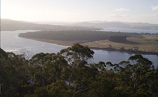
The Tamar River, officially kanamaluka / River Tamar, is a 70-kilometre (43-mile) estuary located in northern Tasmania, Australia. Despite being called a river, the waterway is a brackish and tidal estuary over its entire length.

The Batman Bridge is a modern road bridge that carries the Batman Highway across the Tamar River, between Whirlpool Reach, Hillwood at its eastern end and Sidmouth / Deviot midpoint at its western end, in north Tasmania, Australia. The bridge connects the Batman Highway with the West Tamar Highway and the East Tamar Highway. The bridge overlooks the Deviot Sailing Club and is named in honour of John Batman, a Launceston businessman and co-founder of Melbourne.

George Town is a large town in north-east Tasmania, on the eastern bank of the mouth of the Tamar River. The Australian Bureau of Statistics records the George Town Municipal Area had a population of 6,764 as of 30 June 2016.

Beaconsfield is a former gold mining town near the Tamar River, in the north-east of Tasmania, Australia. It lies 40 kilometres north of Launceston on the West Tamar Highway. It is a rural and residential locality in the local government areas (LGA) of West Tamar and Latrobe in the Launceston and North-west and west LGA regions of Tasmania. The 2016 census has a population of 1298 for the state suburb of Beaconsfield.
Newnham is a residential locality in the local government area (LGA) of Launceston in the Launceston LGA region of Tasmania. The locality is about 7 kilometres (4.3 mi) north of the town of Launceston. The 2016 census recorded a population of 6453 for the state suburb of Newnham. It is a suburb of Launceston. Newnham is located on the East Tamar Highway, on the eastern side of the Tamar River.
The 30-ton sloop Rebecca was launched in 1834, built by Captain George Plummer at his boatyard on the banks of the Tamar River at Rosevears, Van Diemen's Land (Tasmania).

The West Tamar Highway is a highway in Tasmania, Australia. It covers the western edge of the Tamar River, from Launceston to the beach town of Greens Beach.
The East Tamar Highway is a highway in Tasmania, Australia. It covers the eastern edge of the Tamar River, from Launceston to the lighthouse at Low Head.

Riverside is a rural and urban locality in the local government areas of Meander Valley and West Tamar in the Launceston region of Tasmania. The locality is about 39 kilometres (24 mi) south-east of the town of Beaconsfield. The 2016 census has a population of 6472 for the state suburb of Riverside. It is a residential suburb 5 kilometres (2.5 mi) north-west of the central business district of Launceston, Tasmania's second largest city. The West Tamar Highway runs through the suburb, adjoining Riverside to the West Tamar, which includes small towns: Beaconsfield, and Beauty Point. Riverside is part of the West Tamar Council local government area. The suburb is now Launceston's largest by population, narrowly ahead of Kings Meadows. The main shopping centre opened in the 1960s and includes: a Woolworths supermarket, a Banjos bakery, a pharmacist and several retail shops.
Dilston is a rural and residential locality in the local government area (LGA) of Launceston in Tasmania. The locality is about 17 kilometres (11 mi) north-west of the town of Launceston. The 2016 census has a population of 531 for the state suburb of Dilston.
Hillwood is a small town approximately 25.5 kilometres (15.8 mi) north of Launceston. Hillwood is known for its Hillwood Berry Farm, Millers Orchard, Egg Island and various amenities including a sports oval which is used by the Hillwood Sharks Football Club in the NTFA. The 2016 census determined a population of 578 for the state suburb of Hillwood.

In Tasmania, Highway 1 is a 336-kilometre (209 mi) long route that connects Hobart to the state's north coast, and to Launceston via a 3.8-kilometre (2.4 mi) long spur. Highway 1 also exists on the mainland of Australia, linking the state capitals via a circular route around the coastline. All roads within the Highway 1 system are allocated a road route numbered 1, M1, A1, or B1, depending on the state route numbering system. In Tasmania the highway is designated as National Highway 1, though all other routes in the state are alphanumeric.
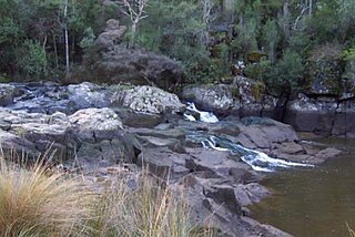
The Supply River is a perennial river located in the northern region of Tasmania, Australia.
Sidmouth is a locality and small rural community in the local government area of West Tamar, in the Western Tamar Valley region of Tasmania. It is located about 35 kilometres (22 mi) north-west of the town of Launceston. The Tamar River forms the north-eastern boundary. The 2016 census determined a population of 394 for the state suburb of Sidmouth.
Bridgenorth is a locality and small rural community in the local government area of West Tamar, in the Western Tamar Valley region of Tasmania. It is located about 22 kilometres (14 mi) north-west of the town of Launceston. A small part of the locality, about 4.5%, is in the Meander Valley Council area. The 2016 census determined a population of 373 for the state suburb of Bridgenorth.
Rosevears is a locality and small rural community in the local government area of West Tamar, in the Western Tamar Valley region of Tasmania. It is located about 22 kilometres (14 mi) north-west of the town of Launceston. The Tamar River forms the eastern and north-eastern boundaries. The 2016 census determined a population of 352 for the state suburb of Rosevears.
Gravelly Beach is a locality and small rural community in the local government area of West Tamar, in the Western Tamar Valley region of Tasmania. It is located about 28 kilometres (17 mi) north-west of the town of Launceston. The Tamar River forms the eastern boundary. The 2016 census determined a population of 567 for the state suburb of Gravelly Beach.
