Launceston is a city in the north of Tasmania, Australia, at the confluence of the North Esk and South Esk rivers where they become the Tamar River (kanamaluka). As of 2021, the Launceston urban area has a population of 90,953. Launceston is the second most populous city in Tasmania after the state capital, Hobart. Launceston is the fifth-largest inland city and the ninth-largest non-capital city in Australia. Launceston is regarded as the most livable regional city, and was one of the most popular regional cities to move to in Australia from 2020 to 2021. Launceston was named Australian Town of the Year in 2022.

The Batman Bridge is a modern road bridge that carries the Batman Highway across the Tamar River, between Whirlpool Reach, Hillwood at its eastern end and Sidmouth / Deviot midpoint at its western end, in north Tasmania, Australia. The bridge connects the Batman Highway with the West Tamar Highway and the East Tamar Highway. The bridge overlooks the Deviot Sailing Club and is named in honour of John Batman, a Launceston businessman and co-founder of Melbourne.
The Bass Highway is a highway in Tasmania, Australia. It connects the three cities across the north of the state – Burnie, Devonport and Launceston. The road was named due to its proximity to the Bass Strait. It is a part of the National Highway, designated as National Highway 1, together with the Midland and Brooker highways in Tasmania.

The Brooker Highway is a highway in the Australian state of Tasmania. As one of Hobart's three major radials, the highway connects traffic from the city centre with the northern suburbs and is the major road connection to the cities and towns of northern Tasmania. With an annual average daily traffic of 48,000, the highway is one of the busiest in Tasmania. The Brooker Highway has recently been declared part of the National Highway.
The Arthur Highway (A9) is a Tasmanian highway which runs from Sorell in the near south to Port Arthur in the far south-east.

Western Distributor is a 4.3-kilometre-long (2.7 mi) grade-separated motorway that is primarily elevated for the majority of its route on the western fringe of the Sydney central business district. It links the southern end of Bradfield Highway at the Sydney Harbour Bridge to Victoria Road in Rozelle, at its western terminus near White Bay. It is a constituent part of the A4 route.

Trevallyn is a residential locality in the local government areas (LGAs) of Launceston (25%) and West Tamar (75%) in the Launceston LGA region of Tasmania. The locality is about 3 kilometres (1.9 mi) west of the city of Launceston. The 2016 census recorded a population of 4562 for the state suburb of Trevallyn. It is a suburb of Launceston.
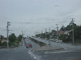
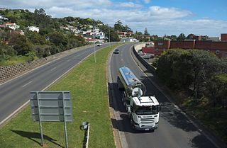
The East Tamar Highway is a highway in Tasmania, Australia. It covers the eastern edge of the Tamar River, from Launceston to the lighthouse at Low Head.

Riverside is a rural and urban locality in the local government areas of Meander Valley and West Tamar in the Launceston region of Tasmania, Australia. The locality is about 39 kilometres (24 mi) south-east of the town of Beaconsfield. The 2016 census has a population of 6472 for the state suburb of Riverside. It is a residential suburb 5 kilometres (2.5 mi) north-west of the central business district of Launceston, Tasmania's second largest city. The West Tamar Highway runs through the suburb, adjoining Riverside to the West Tamar, which includes small towns such as Beaconsfield, and Beauty Point. Riverside is part of the West Tamar Council local government area. The suburb is now Launceston's largest by population, narrowly ahead of Kings Meadows. The main shopping centre opened in the 1960s and includes: a Woolworths supermarket, a bakery, a pharmacist and some local businesses.

West Launceston is a residential locality in the local government area (LGA) of Launceston in the Launceston LGA region of Tasmania. The locality is about 3 kilometres (1.9 mi) south-west of the town of Launceston. The 2016 census recorded a population of 4212 for the state suburb of West Launceston. The suburb is part of the Launceston CBD and is also near Cataract Gorge.

In South Australia, Highway 1 is a 1,715-kilometre (1,066 mi) long route that follows the coastline of the state, from the Victorian border near Mount Gambier to the Western Australian border near Eucla. Highway 1 continues around the rest of Australia, joining all mainland state capitals, and connecting major centres in Tasmania. All roads within the Highway 1 system are allocated a road route numbered M1, A1, B1 or R1, depending on the state route numbering system. In South Australia, most of the highway is designated as route A1, with multi-lane, dual-carriage-way sections generally designated route M1, and the alignment around the Adelaide CBD designated route R1. South-east of Tailem Bend, it is designated route B1.

In Tasmania, Highway 1 is a 336-kilometre (209 mi) long route that connects Hobart to the state's north coast, and to Launceston via a 3.8-kilometre (2.4 mi) long spur. Highway 1 also exists on the mainland of Australia, linking the state capitals via a circular route around the coastline. All roads within the Highway 1 system are allocated a road route numbered 1, M1, A1, or B1, depending on the state route numbering system. In Tasmania the highway is designated as National Highway 1, though all other routes in the state are alphanumeric.
Mount Direction is a locality and small rural community in the local government areas of Launceston and George Town, in the Launceston and North-east regions of Tasmania. It is located about 27 kilometres (17 mi) north-west of the town of Launceston. The Tamar River forms a small section of the south-western boundary. The 2016 census determined a population of 246 for the state suburb of Mount Direction.
Sidmouth is a locality and small rural community in the local government area of West Tamar, in the Western Tamar Valley region of Tasmania. It is located about 35 kilometres (22 mi) north-west of the town of Launceston. The Tamar River forms the north-eastern boundary. The 2016 census determined a population of 394 for the state suburb of Sidmouth.
Greens Beach is a locality and small rural community in the local government area of West Tamar, in the Western Tamar Valley region of Tasmania. It is located about 61 kilometres (38 mi) north-west of the town of Launceston. Bass Strait forms the northern boundary. The 2016 census determined a population of 209 for the state suburb of Greens Beach.
Rosevears is a locality and small rural community in the local government area of West Tamar, in the Western Tamar Valley region of Tasmania. It is located about 22 kilometres (14 mi) north-west of the town of Launceston. The Tamar River forms the eastern and north-eastern boundaries. The 2016 census determined a population of 352 for the state suburb of Rosevears.
Gravelly Beach is a locality and small rural community in the local government area of West Tamar, in the Western Tamar Valley region of Tasmania. It is located about 28 kilometres (17 mi) north-west of the town of Launceston. The Tamar River forms the eastern boundary. The 2016 census determined a population of 567 for the state suburb of Gravelly Beach.
Holwell is a locality and small rural community in the local government areas of West Tamar and Latrobe, in the Launceston and North-west and west regions of Tasmania. It is located about 43 kilometres (27 mi) north-west of the town of Launceston. A small part of the locality is in the Latrobe Council area. The 2016 census determined a population of 65 for the state suburb of Holwell.