Bayham

Last updated

Bayham
Municipality of Bayham
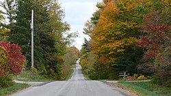
Fall in Ontario - panoramio.jpg
Motto: 
Opportunity is Yours
Canada Southern Ontario location map 2.png
Red pog.svg
Bayham
Location in southern Ontario
Coordinates: 42°44′N80°47′W / 42.733°N 80.783°W / 42.733; -80.783
CountryFlag of Canada (Pantone).svg  Canada
ProvinceFlag of Ontario.svg  Ontario
County Elgin
Settled1800s
IncorporatedJanuary 1, 1850
Government
  MayorEdward Ketchabaw
  Federal riding Elgin—Middlesex—London
  Prov. riding Elgin—Middlesex—London
Area
[1]
  Land244.97 km2 (94.58 sq mi)
Population
 (2016) [1]
  Total7,396
  Density30.2/km2 (78/sq mi)
Time zone UTC-5 (EST)
  Summer (DST) UTC-4 (EDT)
Postal Code
N0J
Area codes 519 and 226
Website www.bayham.on.ca

Bayham (2011 Population: 6,989) is a municipality in the southeast corner of Elgin County, Ontario, Canada. It is south of the town of Tillsonburg and Oxford County.

Contents

History

Bayham was named in 1810 for Viscount Bayham Charles Pratt, a friend of land grant recipient Colonel Talbot. The township was incorporated on January 1, 1850. The villages of Port Burwell and Vienna were incorporated as separate municipalities and separated from the township in 1949 and 1853 respectively.

In 1998, Bayham was re-amalgamated with Port Burwell and Vienna and Eden to form an expanded Municipality of Bayham.

Communities

The municipality comprises the communities of Corinth, Eden, Froggetts Corners, North Hall, Port Burwell, Richmond, Springer's Hill, Straffordville, Vienna and Wadger.

Demographics

Historical population
YearPop.±%
1996 6,234    
2001 6,375+2.3%
2006 6,727+5.5%
2011 6,989+3.9%
2016 7,396+5.8%
[2] [3] [1]

In the 2021 Census of Population conducted by Statistics Canada, Bayham had a population of 7,096 living in 2,264 of its 2,435 total private dwellings, a change of -4.1% from its 2016 population of 7,396. With a land area of 244.6 km2 (94.4 sq mi), it had a population density of 29.0/km2 (75.1/sq mi) in 2021. [4]

Canada census – Bayham community profile
2021 2016 2011
Population7,096 (-4.1% from 2016)7,396 (+5.8% from 2011)6,989 (+3.9% from 2006)
Land area244.60 km2 (94.44 sq mi)244.97 km2 (94.58 sq mi)245.00 km2 (94.60 sq mi)
Population density29/km2 (75/sq mi)30.2/km2 (78/sq mi)28.5/km2 (74/sq mi)
Median age34.4 (M: 32.8, F: 35.6)34.3 (M: 34.0, F: 34.6)35.0 (M: 34.6, F: 35.4)
Private dwellings2,435 (total)  2,264 (occupied)2,557 (total) 2,481 (total) 
Median household income$83,000$65,254
References: 2021 [5] 2016 [6] 2011 [7] earlier [8] [9]

See also

Related Research Articles

<span class="mw-page-title-main">North Grenville</span> Municipality in Ontario, Canada

North Grenville is a township in eastern Ontario, Canada, in the United Counties of Leeds and Grenville on the Rideau River. It is located just south of Ottawa in Canada's National Capital Region.

<span class="mw-page-title-main">Muskoka Lakes</span> Township in Ontario, Canada

The Township of Muskoka Lakes is a municipality of the District Municipality of Muskoka, Ontario, Canada. It has a year-round population of 7,652.

<span class="mw-page-title-main">Lanark Highlands</span> Township in Ontario, Canada

Lanark Highlands is a township in eastern Ontario, Canada in Lanark County. The township administrative offices are located in the village of Lanark.

<span class="mw-page-title-main">Tay Valley, Ontario</span> Township in Ontario, Canada

Tay Valley is a township in eastern Ontario, Canada, on the Tay River in the southwest corner of Lanark County, adjacent to the United Counties of Leeds and Grenville and Frontenac County. The township administrative offices are located in Glen Tay.

<span class="mw-page-title-main">North Stormont</span> Township in Ontario, Canada

North Stormont is a lower tier township in eastern Ontario, Canada in the United Counties of Stormont, Dundas and Glengarry.

<span class="mw-page-title-main">Seguin, Ontario</span> Township in Ontario, Canada

Seguin is a township in central Ontario, Canada, in the District of Parry Sound.

<span class="mw-page-title-main">Elgin County</span> County in Ontario, Canada

Elgin County is a county of the Canadian province of Ontario with a 2016 population of 50,069. Its population centres are St. Thomas, Aylmer, Port Stanley, Belmont, Dutton and West Lorne. The county seat is St. Thomas, which is separated from the county but within its geographic boundary.

<span class="mw-page-title-main">Admaston/Bromley</span> Township in Ontario, Canada

Admaston/Bromley is an incorporated township in Renfrew County, Eastern Ontario, Canada. It was formed on January 1, 2000, when Admaston and Bromley Townships were amalgamated. It takes part of its name from Admaston, Staffordshire, a small English hamlet.

<span class="mw-page-title-main">Brockton, Ontario</span> Municipality in Ontario, Canada

Brockton is a municipality in the Canadian province of Ontario, located in Bruce County. As of 2016, the population was 9,461.

<span class="mw-page-title-main">Tay, Ontario</span> Township in Ontario, Canada

Tay is a township in Central Ontario, Canada, located in Simcoe County in the southern Georgian Bay region. The township was named in 1822 after a pet dog of Lady Sarah Maitland (1792–1873), wife of Sir Peregrine Maitland, Lieutenant Governor of Upper Canada. Two other adjoining townships were also named for her pet dogs, Tiny and Flos.

<span class="mw-page-title-main">Central Elgin</span> Municipality in Ontario, Canada

Central Elgin is a township located in Southwestern Ontario, Canada in Elgin County on Lake Erie. It is part of the London census metropolitan area.

<span class="mw-page-title-main">Dutton/Dunwich</span> Municipality in Ontario, Canada

Dutton/Dunwich is a municipality located in western Elgin County in Southwestern Ontario, Canada.

<span class="mw-page-title-main">Shuniah</span> Municipality in Ontario, Canada

Shuniah is a municipal township bordering the city of Thunder Bay, Ontario, Canada on the east. Shuniah was incorporated by an act of the Ontario legislature in 1873, and at that time included much of present-day Thunder Bay and its predecessor and surrounding municipalities. It gradually shrunk in size until by 1936 it included only three wards, the geographic townships of McIntyre, McGregor, and McTavish. That year it had the Ontario Legislative Assembly remove a number of islands in Lake Superior that had formed the Island Ward since 1873. In 1970 McIntyre Township was amalgamated into the city of Thunder Bay. Shuniah, named after the Ojibwa word "zhooniyaa" for "money" or "silver", was settled largely due to silver mining potential identified in the mid-19th century.

<span class="mw-page-title-main">Central Manitoulin</span> Township in Ontario, Canada

Central Manitoulin is a township in the Canadian province of Ontario. It is located on Manitoulin Island and in Manitoulin District.

<span class="mw-page-title-main">Cramahe, Ontario</span> Township in Ontario, Canada

Cramahe is a rural township located in Northumberland County in southern Ontario, Canada. It is situated just off Ontario Highway 401 approximately 140 km East of Toronto. It was named for Hector Theophilus de Cramahé, who was Lieutenant-Governor of the Province of Quebec. The township's seat and largest town is Colborne.

<span class="mw-page-title-main">Ryerson, Ontario</span> Township in Ontario, Canada

Ryerson is an incorporated township in the Almaguin Highlands region of Parry Sound District in northeastern Ontario, Canada. It had a population of 745 in the 2021 Canadian census. It was named after Egerton Ryerson, the Chief Superintendent of Education for Ontario from 1844 to 1876.

<span class="mw-page-title-main">Southwest Middlesex, Ontario</span> Municipality in Ontario, Canada

Southwest Middlesex is a municipality in Middlesex County, Ontario, Canada.

Malahide is a municipal township in Elgin County in southwestern Ontario, Canada.

<span class="mw-page-title-main">Neebing</span> Municipality in Ontario, Canada

Neebing is a municipality in the Canadian province of Ontario, located in the Thunder Bay District immediately south of the city of Thunder Bay. It is part of Thunder Bay's Census Metropolitan Area.

<span class="mw-page-title-main">O'Connor, Ontario</span> Township in Ontario, Canada

O'Connor is a township in the Canadian province of Ontario, located 32 kilometres (20 mi) west of the city of Thunder Bay. The municipality was formed on January 1, 1907. The township serves as a bedroom community of Thunder Bay, with some agriculture, and is part of Thunder Bay's Census Metropolitan Area.

References

  1. 1 2 3 "Census Profile, 2016 Census: Bayham, Municipality". Statistics Canada. 8 February 2017. Retrieved June 12, 2019.
  2. Statistics Canada: 1996, 2001, 2006 census
  3. "Bayham census profile". 2011 Census of Population . Statistics Canada. 8 February 2012. Retrieved 2012-08-09.
  4. "Population and dwelling counts: Canada, provinces and territories, census divisions and census subdivisions (municipalities), Ontario". Statistics Canada. February 9, 2022. Retrieved March 31, 2022.
  5. "2021 Community Profiles". 2021 Canadian Census . Statistics Canada. February 4, 2022. Retrieved 2023-10-19.
  6. "2016 Community Profiles". 2016 Canadian Census . Statistics Canada. August 12, 2021. Retrieved 2019-06-12.
  7. "2011 Community Profiles". 2011 Canadian Census . Statistics Canada. March 21, 2019. Retrieved 2012-08-09.
  8. "2006 Community Profiles". 2006 Canadian Census . Statistics Canada. August 20, 2019.
  9. "2001 Community Profiles". 2001 Canadian Census . Statistics Canada. July 18, 2021.