Beaudesert Shire Tramway

Last updated

Beaudesert Shire Tramway
StateLibQld 1 111364 Train on the Beaudesert tramway halted at Rathdowney Station, 1912.jpg
Beaudesert Shire Tramway mixed train at Rathdowney station in 1912
Overview
StatusClosed
Owner Beaudesert Shire
Locale Beaudesert Shire
Service
Type Industrial tramway
Operator(s) Beaudesert Shire
History
Opened10 October 1903;118 years ago (1903-10-10)
Closed30 September 1944;77 years ago (1944-09-30)
Technical
Track length39.36 mi (63.34 km)
Track gauge 1,067 mm (3 ft 6 in)
Route map
BSicon exCONTg.svg
Arrow Blue Up 001.svg Beaudesert line
BSicon d.svg
BSicon exdKBHFe-L.svg
BSicon uexdKBHFa-R.svg
0 mi
0 km
Beaudesert
BSicon uexHST.svg
5 mi
8 km
Josephville
BSicon uexHST.svg
10 mi
16 km
Laravale
BSicon uexBHF.svg
12 mi
19 km
Tabooba Junction
BSicon uexKRW+l.svg
BSicon uexKRWgr.svg
BSicon uexSTR.svg
BSicon uexHST.svg
17 mi
27 km
Christmas Creek
BSicon uexSTR.svg
BSicon uexHST.svg
20 mi
32 km
Hillview
BSicon uexSTR.svg
BSicon uexKBHFe.svg
22 mi
35 km
Lamington
BSicon WASSER+l.svg
BSicon uexhKRZWae.svg
BSicon dWASSERq.svg
BSicon d.svg
BSicon uexHST.svg
17 mi
27 km
Innisplain
BSicon uexHST.svg
21 mi
34 km
Dulbolla
BSicon CONTgq.svg
BSicon uxmKRZu.svg
BSicon CONTfq.svg
Arrow Blue Left 001.svg Interstate line Arrow Blue Right 001.svg
BSicon WASSERl.svg
BSicon uexhKRZWae.svg
BSicon dWASSERq.svg
BSicon d.svg
BSicon uexKBHFe.svg
22 mi
35 km
Rathdowney

The Beaudesert Shire Tramway was a narrow gauge tramway which operated from Beaudesert to Lamington and Rathdowney in the Scenic Rim Region, Queensland, Australia, It was one of 15 light railways built and operated by Divisional Boards and Shire Councils in Queensland. [1] The line carried passengers and cargo. It operated from 1903 to 1944. It was initially profitable and seen as a great success for the local shire council. The tramway is credited with opening up the agricultural lands of the upper Logan River. [2]

Contents

History

The Tabragalba Divisional Board, predecessor of the Beaudesert Shire, proposed the construction of the Tramway in 1899. [3] Approval was granted on 23 October 1901 and the Beaudesert Tramway Committee was formed on 3 March 1902.

The Tramway opened from Beaudesert to Innisplain and Lilybank (later renamed Christmas Creek [4] ) on 10 October 1903 with Sir Herbert Chermside, Governor of Queensland, officiating at the opening ceremony at Tabooba Junction. [5] In August 1907, it was decided to extend the line to Rathdowney from Innisplain. At the same shire meeting an extension from Christmas Creek was also agreed upon. [6] In 1910, a loan for the extensions was granted. [7]

The Christmas Creek to Lamington extension opened in October 1910 and the Innreplain to Rathdowney extension in March 1911. [1] The total cost of construction was £92,770. [8] In 1918, residents of Urbenville in northern New South Wales unsuccessfully agitated for an extension from Rathdowney to the west of Mount Lindesay. [9]

Services ran between Beaudesert and Rathdowney three times per week. [10] The main traffic was timber, dairy produce and livestock [8] which were trans-shipped to the Queensland Railways Beaudesert line. Early traffic was promising. For example, in the 1905-1906 financial year the Tramway carried 6,712 passengers, 75,375 imperial gallons (90,522 US gal; 342,660 L) of cream, 2,854 pigs, 743 long tons (755 t; 832 short tons) of general merchandise, 260 long tons (264 t; 291 short tons) of other agricultural produce and 9,669 long tons (9,824 t; 10,829 short tons) of timber. [11] During the 1920s the movement of timber was gradually decreasing. [12] The tramway was used to transport postal mail to Rathdowney. [13]

Extension of the New South Wales North Coast railway line from Kyogle to Brisbane commenced in 1926 and generated additional traffic on the tramway carrying construction materials. This led to considerable delays with services unable to run to the timetable. [14] Rathdowney and nearby towns were served by the 4 ft 8+12 in (1,435 mm) standard gauge interstate line from 1930. Traffic volume on the line experienced significant decreases starting from this time. [15] Following the "encroachment" of the standard gauge line and increasing competition from road transport, the Shire approached the Government of Queensland to take over the Tramway but the Minister for Railways declined. [16]

With declining traffic, the Tramway ceased operations on 30 Sep 1944. The rails and rolling stock were sold, [17] and the Beaudesert Tramway Committee was abolished on 31 December 1945. [18]

Route

See map: Beaudesert Tramway 1935

Locomotives

ImageClassNumber/Name Wheel arrangement BuilderBuilders numberBuiltNotes
StateLibQld 1 111364 Train on the Beaudesert tramway halted at Rathdowney Station, 1912.jpg B12 35 2-6-0 Ipswich Railway Workshops31878Purchased from Queensland Railways in 1902.
Used for construction of the line.
Beaudesert Shire Tramway Foden 1944.jpg Foden 4-2-0 Rail tractor based on a Foden steam lorry
B13 52 4-6-0 Dubs19071884Purchased from Queensland Railways in 1921.
Beaudesert Shire Tramway 185.jpg B13 185 4-6-0 Dubs17511883Purchased from Queensland Railways in 1939.

Rolling stock

The Tramway owned locomotives, passenger carriages capable of carrying 70 people and goods vans, with timber wagons and other rolling stock hired from Queensland Railways. [8]

Remains

Much of the Tramway reservation is now on private property, although substantial portions are visible from public roads such as the Mount Lindesay Highway. The Tramway station at Rathdowney still exists. Tramway Road at Christmas Creek is built on the former tramway reservation.

See also

Related Research Articles

Tweed Heads, New South Wales Town in New South Wales, Australia

Tweed Heads is a town in New South Wales. It is located on the Tweed River in north-eastern New South Wales, Australia, in Tweed Shire, next to the border with Queensland and adjacent to its "twin town" of Coolangatta, which is a suburb of the Gold Coast. It is often referred to as a town where people can change time zones – even celebrate New Year twice within an hour – simply by crossing the street, due to its proximity to the Queensland border, and the fact that New South Wales observes daylight saving whereas Queensland does not.

Rathdowney, Queensland Town in Queensland, Australia

Rathdowney is a rural town and locality in the Scenic Rim Region, Queensland, Australia. In the 2016 census, Rathdowney had a population of 308 people.

Beaudesert, Queensland Town in Queensland, Australia

Beaudesert is a rural town and locality in the Scenic Rim Region, Queensland, Australia. In the 2016 census, Beaudesert had a population of 6,395 people.

Logan River

The Logan River is a perennial river located in the Scenic Rim, Logan and Gold Coast local government areas of the South East region of Queensland, Australia. The 184-kilometre (114 mi)-long river is one of the dominant waterways in South East Queensland that drains the southern ranges of the Scenic Rim and empties into Moreton Bay after navigating the City of Logan, a major suburban centre located south of Brisbane. The catchment is dominated by urban and agricultural land use. Near the river mouth are mangrove forests and a number of aquaculture farms.

South Coast railway line, Queensland

The South Coast railway line was a railway from Brisbane, the capital city of Queensland, Australia. The route via the South Coast to Tweed Heads on the border of Queensland and New South Wales. The line operated from 1889 to 1964. The Gold Coast railway line re-opened in 1996 along a modified alignment in the north and a new route south but does not extend as far south yet as the South Coast line.
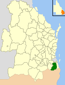
Beaudesert Shire Local government area in Queensland, Australia

The Shire of Beaudesert was a local government area located in South East Queensland, Australia, stretching from the New South Wales border, along the Gold Coast hinterland to the urban fringes of the cities of Brisbane and Ipswich. The Shire covered an area of 2,854.3 square kilometres (1,102.1 sq mi), and existed from 1879 until its abolition on 15 March 2008, following which it was split between Logan City and the new Scenic Rim Region.

The Shire of Tingalpa was a local government area in the south-eastern suburbs of Brisbane, Queensland, Australia. The shire, administered from Mount Cotton, covered an area of 120 square miles (311 km2), and existed as a local government entity from 1879 until 1949.
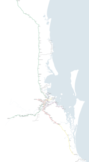
Rail network in South East Queensland

Queensland Rail operates ten suburban lines and three interurban lines. Centring in the Brisbane City, it extends as far as Gympie in the north, Varsity Lakes in the south, Rosewood in the west, and Cleveland in the east to Moreton Bay.

Shire of Coomera

The Shire of Coomera was a local government area in South East Queensland, Australia. The shire, administered from Coomera, existed as a local government entity from 1879 until 1949.

The Shire of Tamborine was a local government area in South East Queensland, Australia, centred on the village of Tamborine. It existed from 1890 to 1949.

Lower Beechmont is a locality in the City of Gold Coast, Queensland, Australia. It is situated in the Gold Coast hinterland. In the 2016 census, Lower Beechmont had a population of 1,046 people.

Barney View, Queensland Suburb of Scenic Rim Region, Queensland, Australia

Barney View is a rural locality in the Scenic Rim Region, Queensland, Australia. In the 2016 census, Barney View had a population of 64 people.

Christmas Creek, Queensland Suburb of Scenic Rim Region, Queensland, Australia

Christmas Creek is a rural locality in the Scenic Rim Region, Queensland, Australia. In the 2016 census Christmas Creek had a population of 53 people.
Tabooba, Queensland Suburb of Scenic Rim Region, Queensland, Australia

Tabooba is a rural locality in the Scenic Rim Region, Queensland, Australia. In the 2016 census, Tabooba had a population of 72 people.
Palen Creek, Queensland Suburb of Scenic Rim Region, Queensland, Australia

Palen Creek is a rural locality in the Scenic Rim Region, Queensland, Australia. It borders New South Wales. In the 2016 census, Palen Creek had a population of 280 people.
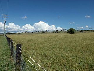
Innisplain, Queensland Suburb of Scenic Rim Region, Queensland, Australia

Innisplain is a rural locality in the Scenic Rim Region, Queensland, Australia. In the 2016 census, Innisplain had a population of 85 people.

Running Creek, Queensland Suburb of Scenic Rim Region, Queensland, Australia

Running Creek is a rural locality in the Scenic Rim Region, Queensland, Australia. In the 2016 census Running Creek had a population of 147 people. It borders New South Wales.

Lamington, Queensland Suburb of Scenic Rim Region, Queensland, Australia

Lamington is a rural locality in the Scenic Rim Region, Queensland, Australia. In the 2016 census Lamington had a population of 86 people.

Ipswich–Boonah–Rathdowney Road is a continuous 87.8 kilometres (54.6 mi) road route in the Ipswich and Scenic Rim regions of Queensland, Australia. It has two official names, Ipswich–Boonah Road and Boonah–Rathdowney Road. The entire route is signed as State Route 93, and much of it is also part of Tourist Drive 16.

Beaudesert–Beenleigh Road is a continuous 35.5 kilometres (22.1 mi) road route in the Scenic Rim and Logan City regions of Queensland, Australia. Part of the road is signed as State Route 90 and the rest as State Route 92. Beaudesert–Beenleigh Road is a state-controlled road, part district and part regional.

References

  1. 1 2 Keith McDonald and Ray Ellis (1980). Beaudesert Shire Tramway. Light Railway Research Society of Australia. ISBN   0909340110.
  2. "Beaudesert Shire Tramway". The Brisbane Courier . No. 16, 698. Queensland, Australia. 19 July 1911. p. 5. Retrieved 28 March 2016 via National Library of Australia.
  3. Tabragalba Divisional Board Minutes, 7 November 1899; QSA:SRS4983/1/5
  4. "BEAUDESERT TRAMWAY". The Brisbane Courier . No. 16, 565. Queensland, Australia. 13 February 1911. p. 9. Retrieved 24 August 2020 via National Library of Australia.
  5. "Beaudesert-Lara Tramway: Official Opening". The Brisbane Courier. 12 October 1903. p. 4.
  6. "Beaudesert Tramway Extensions". The Brisbane Courier . Vol. LXIV, no. 15, 479. Queensland, Australia. 22 August 1907. p. 5. Retrieved 28 March 2016 via National Library of Australia.
  7. "The Upper Logan". The Brisbane Courier . No. 16, 945. Queensland, Australia. 4 May 1912. p. 12. Retrieved 28 March 2016 via National Library of Australia.
  8. 1 2 3 "The Beaudesert Tramway". The Brisbane Courier. 14 January 1924. p. 15.
  9. "Suggested Beaudesert Tramway Extension". Daily Examiner . Vol. 6, no. 884. New South Wales, Australia. 18 June 1918. p. 4. Retrieved 28 March 2016 via National Library of Australia.
  10. "For the Man on the Land". The Brisbane Courier . No. 22, 296. Queensland, Australia. 13 July 1929. p. 11. Retrieved 28 March 2016 via National Library of Australia.
  11. "Beaudesert Tramway: Report for 1906". The Brisbane Courier. 12 September 1906. p. 5.
  12. "Beaudesert Tramway". The Brisbane Courier . No. 21, 545. Queensland, Australia. 14 February 1927. p. 11. Retrieved 28 March 2016 via National Library of Australia.
  13. "Beaudesert Tramway". The Beaudesert Times . Vol. XVIII, no. 983. Queensland, Australia. 18 March 1927. p. 2. Retrieved 28 March 2016 via National Library of Australia.
  14. "Beaudesert Tramway". The Daily Telegraph . No. 16, 784. Queensland, Australia. 17 September 1926. p. 4 (City Edition). Retrieved 28 March 2016 via National Library of Australia.
  15. "Beaudesert Tramway". The Beaudesert Times . Vol. XXII, no. 1156. Queensland, Australia. 18 July 1930. p. 5. Retrieved 28 March 2016 via National Library of Australia.
  16. "Beaudesert Tramway Hit Hard By Kyogle Line: Deputation to Minister". The Brisbane Courier. 31 July 1931. p. 4.
  17. "Beaudesert Sells Its Tramway". The Courier-Mail. 1 November 1944. p. 4.
  18. Queensland State Archives Agency ID10855, Beaudesert Tramway Committee

Commons-logo.svg Media related to Beaudesert Shire Tramway at Wikimedia Commons

Coordinates: 28°10′28″S152°54′13″E / 28.17444°S 152.90361°E / -28.17444; 152.90361