Related Research Articles

Stanton is an unincorporated community in southern Franklin County, Missouri, United States. It lies on Interstate 44 at the junction with Missouri Supplemental Route W, which provides access to Meramec Caverns, located approximately two miles southeast along the Meramec River.

Couch is a small, unincorporated community in Oregon County, Missouri, United States. It is located six miles south of Alton on Missouri Route A. The ZIP Code for Couch is 65690.

Vichy is an unincorporated community in southern Maries County, Missouri, United States. It is located on U.S. Route 63, approximately ten miles north of Rolla. The community was founded in 1880 and is named after Vichy, France. A post office called Vichy has been in operation since 1880. The Rolla National Airport, a former U.S. Army airfield owned and operated by the City of Rolla, with two 5,500 ft (1,700 m) asphalt runways, is located nearby. The ZIP Code for Vichy is 65580.

Valles Mines is an unincorporated community in southern Jefferson County, Missouri, United States. It is located approximately seven miles south of De Soto. It is located on Missouri Route V less than one mile west of U.S. Route 67. Joachim Creek flows past the north side of the community. The ZIP Code for Valles Mines is 63087.
Lonedell is an unincorporated community in southeastern Franklin County, Missouri, United States. It is at the intersection of Route 30 and routes N and FF and approximately eight miles east of St. Clair. The Little Meramac River flows just south of the community.
Williamsburg is an unincorporated community in eastern Callaway County, Missouri, United States. It is located on Missouri Supplemental Route D just north of Interstate 70, approximately thirteen miles northeast of Fulton. The Whetstone Creek Conservation Area along Whetstone Creek lies about one mile to the north. The ZIP Code for Williamsburg is 63388.

Maywood is an unincorporated community in southern Lewis County, Missouri, United States. It is located on Missouri Route V just north of the Lewis-Marion county line, approximately eleven miles northwest of Palmyra and ten miles west of Quincy, Illinois. The community is part of the Quincy, IL–MO Micropolitan Statistical Area. The ZIP Code for Maywood is 63454.

Loose Creek is an unincorporated community in Osage County, Missouri, United States. It is located north of U.S. Route 50, approximately eight miles east of Missouri's capital of Jefferson City. The ZIP Code for Loose Creek is 65054.

Thompson is an unincorporated community in Audrain County, Missouri, United States. It is located six miles west of Mexico on Route 22. The ZIP Code for Thompson is 65285.
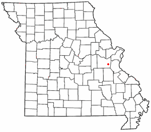
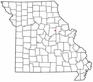
Noser Mill is an unincorporated community in Franklin County, Missouri, United States. The community is located on the Bourbeuse River, adjacent to Route 185 south of Beaufort.
Oak Hill is an unincorporated community in northwest Crawford County, in the U.S. state of Missouri. The community is located on the east bank of Brush Creek, one-quarter mile south of the Crawford-Gasconade county line and is on Missouri Route CC, one mile east of Missouri Route 19.
Beemont is an unincorporated community in western Franklin County, in the U.S. state of Missouri. The community is located on Missouri Route ZZ on the west side of Boeuf Creek one half mile east of the Franklin-Gasconade county line.
Campbellton is an unincorporated community in northern Franklin County, in the U.S. state of Missouri. The community lies on Missouri Route 185 between Lyon to the southwest and Dundee to the northeast. Campbellton School is approximately 1.5 miles northeast on Route 185. Boeuf Creek drains the area to the north and the small stream, Slaughter Branch, flows past the village to the south.
Champion City is an unincorporated community in southwest Franklin County in the U.S. state of Missouri.
Clover Bottom is an unincorporated community in Franklin County, in the U.S. state of Missouri. The community is at the intersection of routes YY and AJ approximately 3.5 miles west of Krakow.
Dissen is an unincorporated community in western Franklin County, in the U.S. state of Missouri. The community is located on the north side of Boeuf Creek along Missouri Route Y and four miles southwest of New Haven.
Dundee is an unincorporated community in northern Franklin County, in the U.S. state of Missouri. The community is above the Missouri River floodplain on Missouri Route 100 approximately six miles northwest of Washington and five miles east of New Haven.
Kiel is an unincorporated community in northwest Franklin County, in the U.S. state of Missouri.
Krakow is an unincorporated community in Franklin County, in the U.S. state of Missouri. The community is situated on Missouri Route A, between Union to the south and Washington to the north.
Port Hudson is an unincorporated community in western Franklin County, in the U.S. state of Missouri. The community is on Missouri Route C and approximately two miles north of Leslie and US Route 50.
References
- ↑ U.S. Geological Survey Geographic Names Information System: Beaufort, Missouri
- ↑ Missouri Atlas & Gazetteer, Delorme, 1st ed., 1998, p.39 ISBN 0899332242
- 1 2 "Franklin County Place Names, 1928–1945 (archived)". The State Historical Society of Missouri. Archived from the original on 24 June 2016. Retrieved 29 September 2016.
{{cite web}}: CS1 maint: bot: original URL status unknown (link) - ↑ "Post Offices". Jim Forte Postal History. Archived from the original on 6 October 2014. Retrieved 29 September 2016.
- ↑ "Beaufort ZIP Code". zipdatamaps.com. 2022. Retrieved November 11, 2022.
Municipalities and communities of Franklin County, Missouri, United States | ||
|---|---|---|
| Cities |  | |
| Villages | ||
| Townships | ||
| CDPs | ||
| Other communities |
| |
| Ghost towns | ||
| Footnotes | ‡This populated place also has portions in an adjacent county or counties | |
38°25′15″N91°11′21″W / 38.42083°N 91.18917°W
| | This Franklin County, Missouri state location article is a stub. You can help Wikipedia by expanding it. |