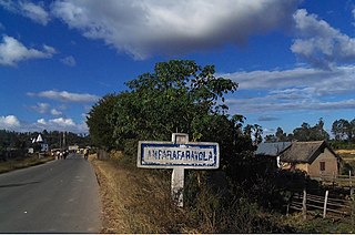
Amparafaravola is a rural municipality in Madagascar. It belongs to the district of Amparafaravola, which is a part of Alaotra-Mangoro Region. The population of the municipality was 33,299 in 2018 that are distributed in 21 Fokontany (villages) that are: Marotaolana, Antanambao, Ambohimandroso, Ambohipeno, Maritampona, Ampasimbola, Ambalamirahona, Analamiranga, Amparafaravola, Ambodihasina, Besarety, Ambalafarisoa, Ampilahoana, Antsakoana, Morarano-Nord, Ambodimanga, Ambondrona, Andilana Sud, Sahamamy, Ambondroala and Ambohivorikely. It is situated at 65 km from Ambatondrazaka.
Ambohimarina is a town and commune in northern Madagascar. It belongs to the district of Ambanja, which is a part of Diana Region. The population of the commune was estimated to be approximately 7,000 as of the 2001 census.
Befotaka is a rural municipality in Madagascar. It belongs to the district of Analalava, which is a part of Sofia Region. The population of the commune was estimated to be approximately 17,000 in 2001 commune census.
Ambaliha is a town and commune in Madagascar. It belongs to the district of Analalava, which is a part of Sofia Region. The population of the commune was estimated to be approximately 12,000 in 2001 commune census.
Anjalazala is a town and commune in Madagascar. It belongs to the district of Antsohihy, which is a part of Sofia Region. The population of the commune was estimated to be approximately 4,000 in 2001 commune census.

Andilamena is a rural commune in Madagascar. It belongs to the district of Andilamena, which is a part of Alaotra-Mangoro Region. The population of the commune was 37,229 in 2018.
Marovato is a town and commune in Madagascar. It belongs to the district of Andilamena, which is a part of Alaotra-Mangoro Region. The population of the commune was estimated to be approximately 4,000 in 2001 commune census.
Soalazaina is a town and commune in Madagascar. It belongs to the district of Ambatondrazaka, which is a part of Alaotra-Mangoro Region. The population of the commune was estimated to be approximately 8,000 according to the 2001 commune census.
Vavatenina is a municipality in Madagascar. It belongs to the district of Vavatenina, which is a part of Analanjirofo Region. The population of the commune was 35,750 in 2018.
Amboavory is a town and commune in Madagascar. It belongs to the district of Amparafaravola, which is a part of Alaotra-Mangoro Region. It is situated on the northern banks of Lake Alaotra. The population of the commune was 15,465 in 2018.
Ambohijanahary is a rural municipality in Madagascar. It belongs to the district of Amparafaravola, which is a part of the Alaotra-Mangoro Region, and lies on the RN3a, approximately 320km from Antananarivo. The population of the commune was estimated to be 28,000 in the 2001 commune census.
Ambohitrarivo is a town and commune in Madagascar. It belongs to the district of Amparafaravola, which is a part of Alaotra-Mangoro Region. The population of the commune was estimated to be approximately 23,000 in 2001 commune census.
Andrebakely Est is a town and commune in Madagascar. It belongs to the district of Amparafaravola, which is a part of Alaotra-Mangoro Region. The population of the commune was estimated to be approximately 12,000 in 2001 commune census.
Beanana is a town and commune in Madagascar. It belongs to the district of Amparafaravola, which is a part of Alaotra-Mangoro Region. The population of the commune was estimated to be approximately 10,000 in 2001 commune census.
Morarano Chrome is a town and commune in Madagascar. It belongs to the district of Amparafaravola, which is a part of the Alaotra-Mangoro Region. The population of the commune was estimated to be approximately 42,127.
Ranomainty is a town and commune in Madagascar. It belongs to the district of Amparafaravola, which is a part of Alaotra-Mangoro Region. The population of the commune was estimated to be approximately 8,000 in 2001 commune census.
Vohitsara is a town and commune in Madagascar. It belongs to the district of Amparafaravola, which is a part of the Alaotra-Mangoro Region. The population of the commune was estimated to be approximately 5,000 in the 2001 commune census.
Bevoay is a town and commune in Madagascar. It belongs to the district of Taolanaro, which is a part of Anosy Region. The population of the commune was estimated to be approximately 15,000 in 2001 commune census.
Amporoforo is a town and commune in Madagascar. It belongs to the district of Farafangana, which is a part of Atsimo-Atsinanana Region. The population of the commune was estimated to be approximately 11,000 in 2001 commune census.
Anparafaravola District is a district in the Alaotra-Mangoro region in Madagascar. Its capital is Amparafaravola.

