The Toamasina Province is a former province of Madagascar with an area of 71,911 km². It had a population of 2,855,600 (2004). Its capital was Toamasina, the most important seaport of the country. The province was also known as Tamatave Province.

Analamanga is a region in central Madagascar, containing the capital Antananarivo and its surrounding metropolitan area. The region has an area of 17,488 square kilometres, and had a population of 4,325.226 in 2018.

Ambatondrazaka is a city in Madagascar

Moramanga is a city in Madagascar. It is located in the region Alaotra-Mangoro and the Moramanga District. It has a population of 57084 inhabitants (2018).

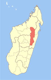
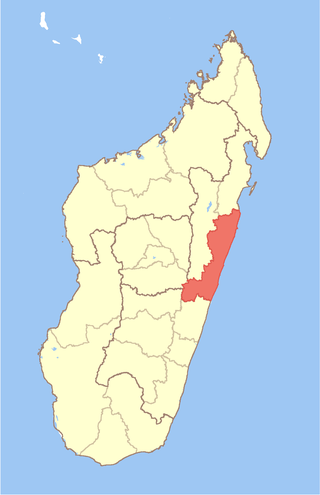
Analanjirofo is a region in northeastern Madagascar. Until 2009 it was a part of Toamasina Province. It borders Sava Region to the north, Sofia Region to the west, Alaotra-Mangoro Region to the southwest and Atsinanana Region to the south.
Betsiboka is a region of Madagascar. It borders Boeny Region in north, Sofia in northeast, Alaotra-Mangoro in east, Analamanga and Bongolava in south and Melaky in west. The capital of the region is Maevatanana. Until 2009 Betsiboka belonged to Mahajanga Province. The population was 394,561 in 2018 within the area of 30,025 km2 (11,593 sq mi). Betsiboka is one of the least densely populated regions in Madagascar.
Atsinanana is a coastal region in eastern Madagascar. It borders Analanjirofo region in the north, Alaotra-Mangoro in the west, Vakinankaratra and Amoron'i Mania in the southwest, and Vatovavy in the south. The region contains over 285km of coastline, which includes many beaches and cultural heritage sites.
Manakambahiny Ouest or Manakambahiny Andrefana is a rural municipality in Madagascar. It belongs to the district of Ambatondrazaka, which is a part of Alaotra-Mangoro Region. The population of the commune was estimated to be approximately 22,000 in 2001 commune census.
Andilanatoby is a rural municipality in Madagascar. It is situated at 55 km south-east of Ambatondrazaka and also belongs to the district with the same name: Ambatondrazaka, which is a part of Alaotra-Mangoro Region. The population of the commune was estimated to be approximately 22,000 in 2001 commune census.

Didy is a rural commune in Madagascar. It belongs to the district of Ambatondrazaka, which is a part of Alaotra-Mangoro Region. The population of the commune was estimated to be 33,039 in 2018.
Imerimandroso is a town and commune in Madagascar. It belongs to the district of Ambatondrazaka, which is a part of Alaotra-Mangoro Region. The population of the commune was estimated to be approximately 11,000 in 2001 commune census.
Amboasary is a rural commune in Madagascar. It belongs to the district of Moramanga, which is a part of Alaotra-Mangoro Region. The population of the commune was 13,601 in 2018.

Andasibe is a rural municipality in Madagascar. It belongs to the district of Moramanga, which is a part of Alaotra-Mangoro Region. The population of the commune was estimated to be approximately 13493 in 2006.

Beforona is a town and commune in Madagascar. It belongs to the district of Moramanga, which is a part of Alaotra-Mangoro Region. The population of the commune was estimated to be approximately 20,380 in 2018.
Morarano Gare is a rural municipality in Madagascar. It belongs to the district of Moramanga, which is a part of Alaotra-Mangoro Region. The population of the commune was 17,545 in 2018.
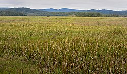
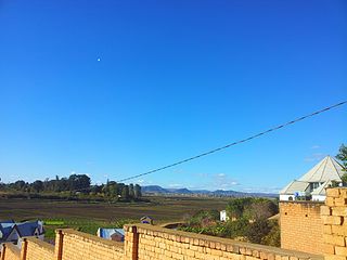
Amboavory is a town and commune in Madagascar. It belongs to the district of Amparafaravola, which is a part of Alaotra-Mangoro Region. It is situated on the northern banks of Lake Alaotra. The population of the commune was 15,465 in 2018.
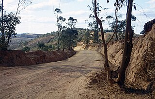
Ambohijanahary is a rural municipality in Madagascar. It belongs to the district of Amparafaravola, which is a part of the Alaotra-Mangoro Region, and lies on the RN3a, approximately 320km from Antananarivo. The population of the commune was estimated to be 28,000 in the 2001 commune census.

Analamazaotra National Park is a national park of Madagascar. The park is in the eastern portion of Madagascar's Central Highlands. The neighbouring Analamazaotra Forest Station is a local reforestation effort. It adjoins Andasibe-Mantadia National Park to the north.
Ambatondrazaka District is a district in the Alaotra-Mangoro Region of Madagascar. Its capital is the town of Ambatondrazaka. The district has an area of 6,967 km2 (2,690 sq mi), and the estimated population in 2013 was 324,610.
Moramanga District is a district in the Alaotra-Mangoro region in Madagascar. Its capital is Moramanga.