Sofia is a region in northern Madagascar. It is named for the Sofia River. It is the second largest Malagasy region with an area of 50,100 km², and had a population of 1,500,227 in 2018. The administrative capital is Antsohihy.
Sava is a region in northern Madagascar. Its capital is Sambava. Until 2009 Sava belonged to Antsiranana Province. The region is situated at the northern part of the east coast of Madagascar. It is bordered by the region Diana to the north, Sofia to the west, and Analanjirofo to the south. As of 2018, its population was 1,123,013 and the total area is 25,518 km2 (9,853 sq mi). The region contains wild areas such as Marojejy National Park.

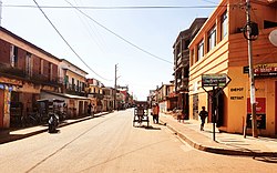
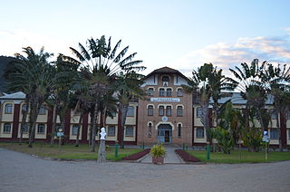
Tsiroanomandidy is a city in central-western Madagascar, approximately 210 kilometres west of the capital Antananarivo.

Vakinankaratra is a region in central Madagascar. The capital of the region is Antsirabe. Vakinankaratra covers an area of 16,599 kilometres, and had a population of 2,074,358 in 2018.
Analamanga is a region in central Madagascar, containing the capital Antananarivo and its surrounding metropolitan area. The region has an area of 17,488 square kilometres, and had a population of 4,325,226 in 2018.

Analanjirofo is a region in northeastern Madagascar. Until 2009 it was a part of Toamasina Province. It borders Sava Region to the north, Sofia Region to the west, Alaotra-Mangoro Region to the southwest and Atsinanana Region to the south.

Alaotra-Mangoro is a region in eastern Madagascar. It borders Sofia Region in north, Analanjirofo in northeast, Atsinanana in east, Vakinankaratra in southwest, Analamanga in west and Betsiboka in northwest. The capital of the region is Ambatondrazaka, and the population was 1,255,514 in 2018. The area of the region is 31,948 km2 (12,335 sq mi).

Amoron'i Mania is a region in central Madagascar bordering Vakinankaratra Region in north, Atsinanana in northeast, Fitovinany in southeast, Haute Matsiatra in south, Atsimo-Andrefana in southwest and Menabe in west.

Boeny is a region in northwestern Madagascar. It borders Sofia Region to the northeast, Betsiboka to the south and Melaky to the southwest. The capital of the region is Mahajanga, and the population was 931,171 in 2018. The area of Boeny is 31,046 km2 (11,987 sq mi).

Melaky is a region in northwestern Madagascar. It borders Boeny Region in northeast, Betsiboka in east, Bongolava in southeast and Menabe in south. The capital of the region is Maintirano. The population was estimated to be 309,805 in 2018 within the area of 38,852 km2 (15,001 sq mi). Melaky has the smallest population and the lowest population density of all Malagasy regions.
Betsiboka is a region of Madagascar. It borders Boeny Region in north, Sofia in northeast, Alaotra-Mangoro in east, Analamanga and Bongolava in south and Melaky in west. The capital of the region is Maevatanana. Until 2009 Betsiboka belonged to Mahajanga Province. The population was 394,561 in 2018 within the area of 30,025 km2 (11,593 sq mi). Betsiboka is one of the least densely populated regions in Madagascar.

Itasy is a region in central Madagascar. It borders Analamanga region in northeast, Vakinankaratra in south and Bongolava in northwest. The capital of the region is Miarinarivo, and the population was 897,962 in 2018. It is the smallest of all the 22 regions in area with 6,993 km2 (2,700 sq mi), and is the most densely populated region after Analamanga.

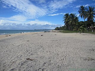
Atsinanana is a coastal region in eastern Madagascar. It borders Analanjirofo region in the north, Alaotra-Mangoro in the west, Vakinankaratra and Amoron'i Mania in the southwest, and Vatovavy in the south. The region contains over 285km of coastline, which includes many beaches and cultural heritage sites.
Haute Matsiatra is a region in Madagascar. It borders Amoron'i Mania region in north, Vatovavy-Fitovinany in east, Ihorombe in south and Atsimo-Andrefana in west. The capital of the region is Fianarantsoa, and the population was 1,447,296 in 2018. The area is 21,080 km2 (8,139 sq mi).
Ihorombe is a region in Madagascar. It borders Haute Matsiatra region in north, Atsimo-Atsinanana in east, Anosy in south and Atsimo-Andrefana in west. The capital is Ihosy and the population was 418,520 in 2018. The area of Ihorombe is 26,391 km2 (10,190 sq mi) and it has one of the lowest population densities of the Malagasy regions.

Atsimo-Andrefana is a region of Madagascar. It borders Menabe in north, Amoron'i Mania and Haute Matsiatra in northeast, Ihorombe and Anosy in east and Androy in southeast. The capital is Toliara and the population was 1,799,088 in 2018. Atsimo Andrefana is geographically the largest of all Malagasy regions with an area of 66,236 km2 (25,574 sq mi).
Ambatolampy is a town and commune in Madagascar. It belongs to the district of Tsiroanomandidy, which is a part of Bongolava Region. The population of the commune was estimated to be approximately 13,000 in 2001 commune census.

Ankadinondry Sakay, anciently Babetville is a town and commune in Madagascar. It belongs to the district of Tsiroanomandidy, which is a part of Bongolava Region.
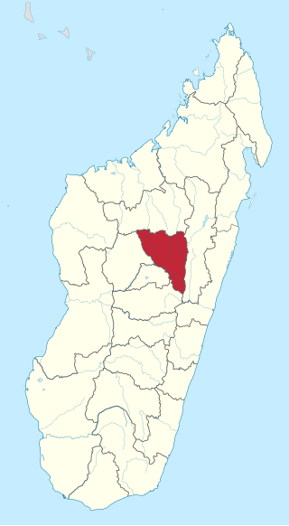
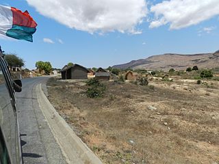
Tsiroanomandidy is a district of Bongolava in Madagascar. The district has an area of 10,559 km2 (4,077 sq mi), and the estimated population in 2020 was 521,372.
Fierenana, Tsiroanomandidy is a town and commune in Madagascar. It belongs to the district of Tsiroanomandidy, which is a part of Bongolava Region. The population of the commune was estimated to be approximately 21,224 in 2018.