Bradley Stoke is a town and civil parish in South Gloucestershire, England, situated 6 miles north-northeast of Bristol city centre. The town is the northernmost part of the Bristol built-up area.

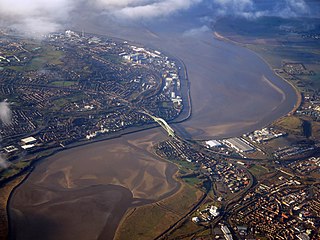
Runcorn is an industrial town and cargo port in the Borough of Halton, Cheshire, England. Its population in 2021 was 62,100. Runcorn is on the southern bank of the River Mersey, where the estuary narrows to form the Runcorn Gap. It lies on the southern shore of the River Mersey 15 miles upstream from the port of Liverpool.

Stevenage is a town and borough in Hertfordshire, England, about 27 miles (43 km) north of London. Stevenage is east of junctions 7 and 8 of the A1(M), between Letchworth Garden City to the north and Welwyn Garden City to the south. In 1946, Stevenage was designated the United Kingdom's first New Town under the New Towns Act.

Halton is a local government district with borough status in the ceremonial county of Cheshire, North West England. The borough was created in 1974 and contains the towns of Runcorn and Widnes and the civil parishes of Daresbury, Hale, Halebank, Moore, Preston Brook, and Sandymoor. Since 1998, Halton Borough Council has been a unitary authority, being a district council which also performs the functions of a county council. Since 2014, it has been a member of the Liverpool City Region Combined Authority.

Blackley is an area of Manchester, England. Historically in Lancashire, it is approximately 5 miles (8.0 km) north of Manchester city centre, on the River Irk.

Prestwich is a town in the Metropolitan Borough of Bury, Greater Manchester, England, 3 miles (4.8 km) north of Manchester, 3 miles (5 km) north of Salford and 5 miles (8.0 km) south of Bury.

Weaver Vale was a constituency in Cheshire represented in the House of Commons of the UK Parliament.

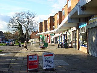
Halton, formerly a separate village, is now part of the town of Runcorn, Cheshire, England. The name Halton has been assumed by the Borough of Halton, which includes Runcorn, Widnes and some outlying parishes.

Emmer Green is the northernmost suburb of Reading in Berkshire, England, centred around 2 miles (3.2 km) north of the town centre. Having most of its own commerce, sport and other amenities, Emmer Green has an arbitrary divide with larger Caversham and a border with Oxfordshire, the county in which both places formerly stood.
Easterside is an area in the Ladgate ward of Middlesbrough, North Yorkshire, England. It is bounded to the east by Marton Road (A172) and by B1380 to the south. It had a population of 2,842 in 2011.

Widnes is an industrial town in the Borough of Halton, Cheshire, England, which at the 2021 census had a population of 62,400.

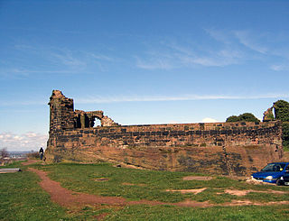
Runcorn is an industrial town in Halton, Cheshire, England, on the south bank of the River Mersey where it narrows at Runcorn Gap. In the town are the 61 buildings that are recorded in the National Heritage List for England as designated listed buildings in the current urban area of Runcorn, including the districts of Runcorn, Halton, Weston, Weston Point, and Norton. Two of these are classified as being in Grade I, nine in Grade II*, and 51 in Grade II.

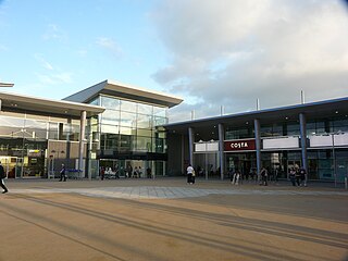
Runcorn Shopping City is a medium-sized indoor shopping centre in Runcorn, England. Opened by Queen Elizabeth II in 1972, it is the main shopping area in Runcorn and is visited around 6.5 million times per year. It was the largest enclosed shopping centre in Europe at the time of its construction and remains the largest in Cheshire.

Halton Borough Council is the local authority for Halton, a local government district with borough status in the ceremonial county of Cheshire, England. Since 1998 the council has been a unitary authority, being a district council which also performs the functions of a county council. Since 2014 the council has been a member of the Liverpool City Region Combined Authority.
Headley Down is a village within the civil parish of Headley in the East Hampshire district of Hampshire, England, bounded on two sides by Ludshott Common, a National Trust heathland reserve. The village began with a few buildings in the 1870s and became a thriving community that in the 20th century outgrew the parish centre of Headley.

Sandymoor is a civil parish in Runcorn, Halton, Cheshire, England, with a population of approximately 3,700. The majority of housing in Sandymoor was built post-1990 and the parish was formed in 2008 by the Halton Order 2008. Sandymoor lies approximately 3 miles east of Runcorn town centre, 4 miles south-west from Warrington town centre and 2 miles north of the M56 motorway.
Floodbrook Clough is an ancient woodland and site of special scientific interest which cuts through the centre of the Beechwood area of Runcorn, Cheshire, England. Located in a steep valley around the Flood Brook stream, it is one of Cheshire's best examples of clough woodland on keuper marl. It covers a total area of 5.35 hectares. It is owned and managed by the Woodland Trust.

Hollowhill and Pullingshill Woods is a 23-hectare biological Site of Special Scientific Interest near Marlow in Buckinghamshire. It is in the Chilterns Area of Outstanding Natural Beauty, and the Chilterns Beechwoods Special Area of Conservation. The local planning authorities are Wycombe District Council and Buckinghamshire County Council. Pullingshill Wood is owned by the Woodland Trust, and Hollowhill Wood was formerly owned by Buckinghamshire County Council, but was transferred to the Berkshire, Buckinghamshire and Oxfordshire Wildlife Trust. Since November 2015 the 7.8-hectare site has been managed by the Trust as "Hog and Hollowhill Woods".

Town Park is a large urban park in Runcorn, Cheshire, England.


