Snaefell – is the highest mountain and the only summit above 2,000 feet (610 m) on the Isle of Man, at 2,037 feet (620.9 m) above sea level. The summit is crowned by a railway station, cafe and several communications masts.

The Point of Ayre is the northernmost point of the Isle of Man. It lies at the northern end of Ramsey Bay 6 miles (10 km) north of the town of Ramsey. The point can be accessed by the A16 road from Bride. Point of Ayre lighthouse, the oldest lighthouse on the Isle of Man, is located here.
Ballaugh is a small village in the Isle of Man in the parish of the same name, in the sheading of Michael. It is the only village in the parish.
Jurby is one of the seventeen parishes of the Isle of Man. It is located in the north-west of the island in the sheading of Michael.

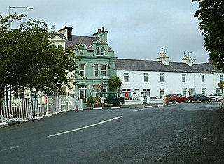
Sulby is a village in the Isle of Man. It is 4 miles from Ramsey and is located in the parish of Kirk Christ Lezayre on the A3 Castletown road.

Keppel Gate, Isle of Man is part of a former UK HM Commissioners of Woods and Forest estate, including a series of former highway mountain gates. It is now Common land in public ownership and is one of three purpose built former Crown Road sections of the A18 Snaefell Mountain Road used for the Isle of Man TT races. The area of Keppel Gate including a nearby private residence of Kate's Cottage at the adjacent 34th TT Milestone road-side marker is located between the 4th Milestone and 5th Milestone road-side markers on the primary A18 Snaefell Mountain Road in the parish district of Kirk Onchan in the Isle of Man.

Barregarrow is a district in the Isle of Man. It is a hilly area and is part of the Isle of Man TT motorcycle race course.
Rhencullen including Birkin's Bend is adjacent to the 17th milestone of the TT course, on the primary A3 Castletown to Ramsey road in the Isle of Man.
Laurel Bank is situated between the 10th Milestone and 11th Milestone road-side markers on the primary A3 Castletown to Ramsey Road between Ballacraine and Glen Helen in the parish of Kirk German in the Isle of Man.

Brandywell, Isle of Man or is an area of Mountain Lands of heath moorland and coniferous woodland plantations situated in the Northern Upland Massif in the parish of Kirk Michael in the Isle of Man. The area was previously used by local shepherds due to a local stream and a nearby former venerated water well which was known for its distinctive quality and "brandy" colour of the water.

Kate's Cottage, Isle of Man is a cottage and one of the named corners of the Snaefell Mountain Course used in Grand Prix-style motorcycle racing along public roadways of the Isle of Man. It has been asserted in the Isle of Man's program of Registered Buildings that the cottage was built by 1869.

Greeba Bridge is situated between the 6th milestone and 7th road milestones on the primary A1 Douglas to Peel road and the junction with the Greeba Mill Road in the parish of Kirk German in the Isle of Man.
Ballagarraghyn is a farm situated between the 7th milestone and 8th Milestone road-side markers on the primary A1 Douglas to Peel road in the parish of German in the Isle of Man.

Ballacrye is situated adjacent to the 19th Milestone of the TT Course, on the primary A3 Castletown to Ramsey road at the junction with the B9 Ballacrye Road, in the parish of Ballaugh in the Isle of Man.
Cronk Urleigh is a stretch of road situated at the 15th Milestone on the primary A3 Castletown to Ramsey in the parish of Kirk Michael in the Isle of Man.

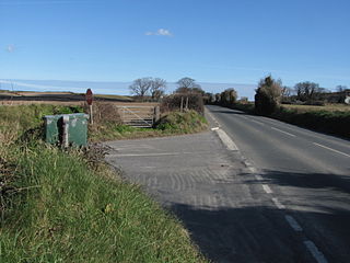
Glen Duff is situated adjacent to the 23rd road milestone on the A3 Castletown to Ramsey road with the junction with the B14 Bernaharra Road in the parish of Kirk Christ Lezayre in the Isle of Man.

North Barrule is the second highest peak in the Isle of Man at 565 metres (1,854 ft). From the summit the northern plain of the Isle of Man can be viewed along with the coastlines of Ireland, Cumbria, Wales and Scotland.
Orrisdale North is situated adjacent the 16th TT Milestone on the primary A3 Castletown to Ramsey road with the nearby junction with the tertiary C19 Orrisdale Loop Road and D13 Bollyn Road in the parish of Ballaugh in the Isle of Man.
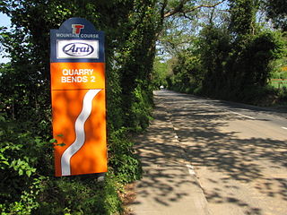
Quarry Bends is situated adjacent to the 20th Milestone road-side marker on the primary A3 Castletown to Ramsey, in the parishes of Ballaugh and Kirk Christ Lezayre in the Isle of Man.

Ballagarey is located between the third and fourth milemarkers used for recognition of the Snaefell Mountain Course road-racing circuit on the primary A1 Douglas to Peel road, in the parish of Marown in the Isle of Man.