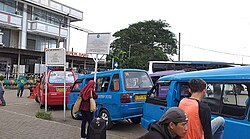
Depok is a landlocked city in West Java province. It is located directly south of Jakarta, it is the third largest urban centre in the Greater Jakarta metropolitan area after Jakarta and Bekasi and it has an area of 199.91 km2. It had a population of 1,738,600 at the 2010 census and 2,056,400 at the 2020 census; the official estimate as at mid 2023 was 2,145,400, resulting in a density of 10,731.8 people per km2. Depok was created as a separate city on 20 April 1999, having previously been part of Bogor Regency. It constitutes the second most populous suburban city in Indonesia, and the tenth most populous suburban city globally.

South Jakarta, abbreviated as Jaksel, is one of the five administrative cities which form the Special Capital Region of Jakarta, Indonesia. South Jakarta is not self-governed and does not have a city council, hence it is not classified as a proper municipality. It covers a land area of 141.27 km2, and had a population of 2,062,232 at the 2010 census and 2,226,812 at the 2020 census, and 2,409,380 as at mid 2022 according to the official estimates. It is the third most populous among the five administrative cities of Jakarta, after East Jakarta and West Jakarta. The administrative centre is at Kebayoran Baru.
Cinere is a town and an administrative district (kecamatan) of the city of Depok, in West Java Province of Indonesia. It covers an area of 10.53 km2 and had a population of 107,461 at the 2010 Census and 101,700 at the 2020 Census; the official estimate was 101,600. Cinere District borders to its east on the Jagakarsa District and to its north on the Cilandak District, both being part of South Jakarta City; to the west it borders on the Ciputat Timur District and the Pamulang District of South Tangerang City within Banten Province; and to the south it borders on the Limo District of Depok City. Cinere has a large multi-racial population as a result of long-term transmigration from elsewhere in West Java and from Banten, which began in the late 1960s.

Grogol Petamburan is a district of West Jakarta, Indonesia, roughly bounded by the West Flood Canal to the east, Angke Canal to the west and to the north, and Jakarta-Merak Tollway to the south. It has an area of 9.99 km2. As of 2004, the use of the land was 58.0% for housing, 12.5% for offices, 3.8% in parkland, and 2.2% in farmland with the remainder in other uses or idle. The official estimate of population as at mid 2023 was 237,367.

Tanah Bumbu is one of the regencies in the Indonesian province of South Kalimantan. It was formerly part of Kotabaru Regency, but was split off on 25 February 2003 to form a separate regency, following dissatisfaction on the Kalimantan mainland territories with administration from Laut Island. It covers an area of 4,890.3 km2 and had a population of 267,929 at the 2010 Census and 322,646 at the 2020 Census; the latest official estimate is 343,741. The regency's capital is the town of Batulicin.

Labuhanbatu Regency, alternatively written in space as Labuhan Batu Regency, is a regency of North Sumatra Province in Indonesia. Its administrative seat is Rantau Prapat. An original regency of the province, it had an area of 9,703 km2 as at early 2008, prior to the separation out of its southern and its north-western districts respectively to create the new South Labuhanbatu and North Labuhanbatu Regencies on 21 July 2008.

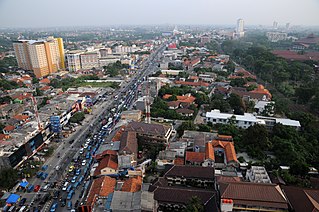
South Tangerang is a city in the province of Banten, Indonesia. Located 30 km (19 mi) on the southwestern border of Jakarta, the city forms part of the Greater Jakarta metropolitan area. It was administratively separated from Tangerang Regency on 26 November 2008. According to the 2020 Census, the city population was 1,354,350 inhabitants, while the official estimate as at mid 2023 was 1,404,785 - comprising 700,754 males and 704,031 females. The total area is 164.85 km2 (63.65 sq mi). It is the second-largest city in Banten in terms of population, and has grown rapidly, not only as Jakarta's satellite city, but also the development of business districts and commerce due to presence of large-scale planned town by private developers.

Paser Regency is the southernmost regency (kabupaten) within the East Kalimantan province of Indonesia. It was created in 1959, originally spelt "Pasir Regency", but renamed "Paser" in 2007; however its northeastern districts were split off on 10 April 2002 to form the new Penajam North Paser Regency. The residual regency covers an area of 11,603.94 km2, and it had a population of 230,316 at the 2010 Census and 275,452 at the 2020 Census; the official estimate as at mid-2023 was 303,424. Its administrative centre is the town of Tana Paser.

Sungai Penuh is a city in Indonesia, in western Jambi province, on the island of Sumatra. It is an enclave within Kerinci Regency, of which it was formerly part but from which it became administratively separate on 24 June 2008. The city, whose name means "Penuh River", is also known as Siulak. It covers an area of 391.50 km2 and had a population of 82,293 at the 2010 Census and 96,610 at the 2020 Census; the official estimate as at mid 2023 was 99,771.

East Kotawaringin Regency is one of the thirteen regencies which comprise the Central Kalimantan Province on the island of Kalimantan (Borneo), Indonesia. It originally covered a much larger part of the province, having been split from a single Kotawaringin Regency on 26 June 1959 into separate regencies for East and West Kotawaringin, but on 10 April 2002 several districts in the west of the regency were split off to form the new Seruyan Regency, and several districts in the east of the regency were similarly split off to form the new Katingan Regency. The area of the residual East Kotawaringin Regency is 16,796 km2, and its population was 374,175 at the 2010 Census, and 428,900 at the 2020 Census; the official estimate as at mid 2023 was 443,359. The town of Sampit is the capital of East Kotawaringin Regency.

Cimanggis is an administrative district (kecamatan) within the city of Depok, in the province of West Java, Indonesia. Cimanggis is located in the north of Depok, immediately south of Jakarta. It covers an area of 21.78 km2 and had a population of 241,979 at the 2010 Census and 252,000 at the 2020 Census; the latest official estimate is 252,370.
Sawangan is a town and an administrative district in the city of Depok, in West Java province of Indonesia. It covers an area of 26.07 km2 and had a population of 123,571 at the 2010 census and 178,900 at the 2020 Census; the latest official estimate is 197,170.
Sukmajaya is a town and an administrative district (kecamatan) within the city of Depok, in the province of West Java, Indonesia, within the Jakarta metropolitan area. It covers an area of 17.37 km2 and had a population of 232,308 at the 2010 Census and 252,500 at the 2020 Census; the official estimate as at mid 2023 is 256,060. It is one of the most densely populated areas in Depok. Many housing areas and educational institutions are located in this district. Moreover Depok Dua Tengah and Depok Dua Timur are also located within the district. In addition, Pesona Square shopping mall is located in this district.
Serpong is a town and an administrative district (kecamatan) of South Tangerang city, in Banten Province on Java, Indonesia. Before South Tangerang City became an autonomous city, Serpong District was one of the districts of Tangerang Regency. It covers an area of 28.27 km2, and had a population of 137,212 at the 2010 Census and 154,744 at the 2020 Census; the official estimate as at mid 2023 was 163,451. The district is sub-divided into nine kelurahan.
Pancoran Mas is a town and an administrative district (kecamatan) within the city of Depok, in the province of West Java, Indonesia. It covers an area of 18.05 km2 and had a population of 210,514 at the 2010 Census and 245,000 at the 2020 Census; the latest official estimate is 253,360.
Limo is a town and an administrative district (kecamatan) within the city of Depok, in the province of West Java, Indonesia. It covers an area of 11.89 km2 and had a population of 87,953 at the 2010 Census and 115,700 at the 2020 Census; the latest official estimate is 124,020.
Cipayung is a town and an administrative district (kecamatan) within the city of Depok, in the province of West Java, Indonesia. It covers an area of 11.375 km2 and had a population of 127,917 at the 2010 Census and 171,600 at the 2020 Census; the latest official estimate is 184,930.
Cilodong is a town and an administrative district (kecamatan) within the city of Depok, in the province of West Java, Indonesia. It covers an area of 15.38 km2 and had a population of 125,014 at the 2010 Census and 168,200 at the 2020 Census; the latest official estimate is 181,410.
Tapos is a town and an administrative district (kecamatan) within the city of Depok, in the province of West Java, Indonesia. It covers an area of 33.43 km2 and had a population of 216,215 at the 2010 Census and 263,400 at the 2020 Census; the latest official estimate is 276,010.
Bojongsari is a town and an administrative district (kecamatan) within the city of Depok, in the province of West Java, Indonesia. It covers an area of 19.41 km2 and had a population of 99,735 at the 2010 Census and 135,700 at the 2020 Census; the latest official estimate is 146,810.