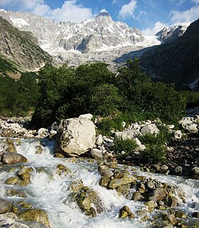
The Lauberhorn is a mountain in the Bernese Alps of Switzerland, located between Wengen and Grindelwald, north of the Kleine Scheidegg. Its summit is at an elevation of 2,472 m (8,110 ft) above sea level.

The Gletscherhorn is a mountain of the Bernese Alps, located on the border between the Swiss cantons of Bern and Valais. It forms the eastern edge of the Lauterbrunnen Wall, south of the Jungfrau.

Piz Bernina is the highest mountain in the Eastern Alps, the highest point of the Bernina Range, and the highest peak in the Rhaetian Alps. It rises 4,048.6 m (13,283 ft) and is located south of Pontresina and near the major Alpine resort of St. Moritz, in the Engadin valley. It is also the most easterly mountain higher than 4,000 m (13,000 ft) in the Alps, the highest point of the Swiss canton of Graubünden, and the fifth-most prominent peak in the Alps. Although the summit lies within Switzerland, the massif is on the border with Italy. The "shoulder" known as La Spedla is the highest point in the Italian Lombardy region.

Crans-Montana is a municipality in the district of Sierre in the canton of Valais, Switzerland. On 1 January 2017 the former municipalities of Chermignon, Mollens, Montana and Randogne merged to form the new municipality of Crans-Montana.

The Strahlhorn is a mountain of the Swiss Pennine Alps, located south of Saas-Fee and east of Zermatt in the canton of Valais. It lies on the range that separates the Mattertal from the Saastal and is located approximately halfway between the Rimpfischhorn and the Schwarzberghorn.

The Chasseral is a mountain of the Jura Mountains, overlooking Lake Biel in the Swiss canton of Bern. With an elevation of 1,606 metres above sea level, the Chasseral is the highest summit in the canton of Bern outside the Alps. It is also both the northernmost and easternmost mountain reaching over 1,500 metres in the Jura Mountains. West of the summit is located the Chasseral Ouest, where runs the border with the canton of Neuchâtel. The Chasseral Pass is located further on the west.
The Pointe d'Orny is a mountain of the Mont Blanc massif, located west of Orsières in the canton of Valais. It lies north-east of the Plateau du Trient.

The Aiguille du Tour is a mountain in the Mont Blanc massif, located on the border between Switzerland and France. The voie normale on the mountain is graded F (facile) and can be climbed from either the Albert Premier Hut on the French side or the Trient Hut on the Swiss side.

The Tour Noir is a mountain in the Mont Blanc massif on the Swiss-French border. It is located between the Aiguille d'Argentière and Mont Dolent.
The Grande Lui is a mountain of the Mont Blanc massif, located west of La Fouly in the canton of Valais. It lies east of the Aiguille de l'A Neuve, on the range between the glaciers of Saleina and L'A Neuve.
The Grande Pointe des Planereuses is a mountain of the Mont Blanc massif, located west of Praz de Fort in the canton of Valais, Switzerland. It lies on the range south of the Saleina Glacier.
The Unterrothon is a mountain of the Swiss Pennine Alps, overlooking Zermatt in the canton of Valais. It is located west of the Oberrothorn, on the range north of the Findel Glacier.

Mont Tendre is a mountain of the Jura, located between the valley of Joux and the basin of Lake Geneva in the canton of Vaud. With an elevation of 1,679 metres above sea level, it is the highest summit of the Swiss portion of the Jura Mountains and, therefore, the highest summit of Switzerland outside the Alps. It is also the most isolated mountain of the canton. It is found in the community of Montricher.

The Aiguille de l'A Neuve is a mountain of the Mont Blanc massif, located on the border between Switzerland and France. It lies close to the Tour Noir to the south.

The Hasenmatt is a mountain of the Jura range, located north of Grenchen and Solothurn in the Swiss canton of Solothurn. Reaching a height of 1,445 metres above sea level, it is the highest summit in the canton of Solothurn. The Hasenmatt is also the easternmost summit above 1,400 metres of the Jura Mountains.
The Petit Col Ferret is an Alpine pass between the canton of Valais and the Aosta Valley.


