Alternative spellings are Bellampalle and Bellampally.
History
Bellampalli is noted for its coal mines belonging to Singareni Collieries Company Limited.So Goleti is named as bellampally area .Bellampalli has in past the most coal mines and opencast mines in the state of Telangana. The first coal mine was established in 1936 by the British government. Later, the town developed very rapidly with the discovery and excavation of many more coal mines. The coal production from the SCCL is catering to the needs of the National Thermal Power Corporation, Ramagundam and many surrounding industrial buildings such as cement plants in Devapur, steel factory in Visakhapatnam and power plants in Maharashtra[5]
According to the 2001 India census,[8] Bellampalli had a population of 66,660. Males constitute 51% of the population and females 49%. Bellampalli has a literacy rate of 66%, higher than the national average of 60%, with 57% of the males and 43% of females literate. 11% of the population is under 6 years of age.
Government and politics
Civic administration
Bellampalle Municipality was constituted in 1987 and is classified as a second grade municipality with 32 election wards. The jurisdiction of the civic body is spread over an area of 35.06km2 (13.54mi2).[3]
Bellampalli has been a traditional stronghold and birthplace of the CPI, also known as the Communist Party of India. CPI leader Gunda Mallesh won the MLA seat for Bellampally in the 2009 elections. Gunda Mallesh is a senior politician from Bellampally and the CPI. The former MLA's of this of constituency are Amurajula Sreedevi and Pati Subadra. Bellampalli assembly constituency comes under Peddapalli Lok Sabha constituency. Gaddam Vamshi krishna is present MP.
Coal production has been very important to the economic history of Bellampalli and it is thus known as an industrial town.[citation needed] However, the average income of Rs. 5000/- per capita according to 1989 figures mean that the average person is living in poverty.[10]
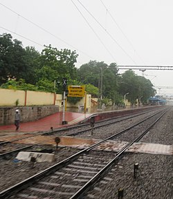
Transport
Bellampalli is well connected by road and train.
NH 363 A new National Highway is being constructed from Mancherial to chandrapur passes through Bellampalli
12"Urban Local Body Information"(PDF). Directorate of Town and Country Planning. Government of Telangana. Archived from the original(PDF) on 15 June 2016. Retrieved 28 June 2016.
↑TelanganaPradesh (India). Bureau of Economics and Statistics (1987). Statistical abstract of Andhra Pradesh. Bureau of Economics and Statistics. Retrieved 22 March 2012.
This page is based on this Wikipedia article Text is available under the CC BY-SA 4.0 license; additional terms may apply. Images, videos and audio are available under their respective licenses.