Barron Gorge National Park is a protected area in the Cairns Region, Queensland, Australia. It is predominantly within the locality of Barron Gorge.

Japoon is a national park in Queensland, Australia, 1,306 km northwest of Brisbane. The park forms part of the Wooroonooran Important Bird Area, identified as such by BirdLife International because it supports populations of a range of bird species endemic to Queensland's Wet Tropics.

Girringun National Park is a national park in Queensland, Australia, approximately 50 kilometres (31 mi) southwest of Ingham, 110 kilometres (68 mi) north of Townsville and 1,290 kilometres (800 mi) northwest of Brisbane. The park is one of the Wet Tropics World Heritage Area series of national parks, and is a gazetted World Heritage site.

Tully Gorge is a national park in Queensland, Australia, 1,338 km northwest of Brisbane. The park forms part of the Wooroonooran Important Bird Area, identified as such by BirdLife International because it supports populations of a range of bird species endemic to Queensland's Wet Tropics.
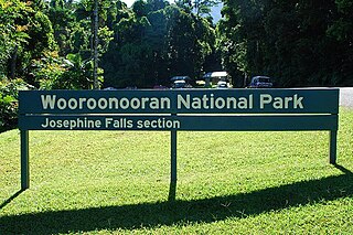
Wooroonooran [Aboriginal - "Black Rock"] is a national park in Queensland (Australia), 1367 km northwest of Brisbane, between Innisfail and Cairns.

Mount Bartle Frere is the highest mountain in Queensland at an elevation of 1,611 metres (5,285 ft). The mountain was named after Sir Henry Bartle Frere, a British colonial administrator and then president of the Royal Geographical Society by George Elphinstone Dalrymple in 1873. Bartle Frere was British Governor of Cape Colony at the outset of the Zulu Wars. The Aboriginal name for the mountain is Chooreechillum.

The Wet Tropics of Queensland World Heritage Site consists of approximately 8,940 km² of Australian wet tropical forests growing along the north-east Queensland portion of the Great Dividing Range. The Wet Tropics of Queensland meets all four of the criteria for natural heritage for selection as a World Heritage Site. World Heritage status was declared in 1988, and on 21 May 2007 the Wet Tropics were added to the Australian National Heritage List.

The Daintree Rainforest is a region on the northeast coast of Queensland, Australia, north of Mossman and Cairns. At around 1,200 square kilometres (460 sq mi), the Daintree is a part of the largest continuous area of tropical rainforest on the Australian continent. The Daintree Rainforest is a part of the Wet Tropics of Queensland Rainforest, that spans across the Cairns Region. The Wet Tropics Rainforest is the oldest continually surviving tropical rainforest in the world. Along the coastline north of the Daintree River, tropical forest grows right down to the edge of the sea.

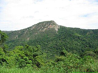
Mount Bellenden Ker is the second-highest mountain in Queensland, Australia, with a height of 1,593 metres (5,226 ft). It is named after the botanist John Bellenden Ker Gawler. Located 60 km (37 mi) south of Cairns near Babinda, it is adjacent to Mount Bartle Frere, the state's highest peak, part of the Bellenden Ker Range which is also known as the Wooroonooran Range. The two mountains dominate the Josephine Falls section of the Wooroonooran National Park. Both peaks are made of resistant granite and are remnants of an escarpment that has been eroded by the Russell and Mulgrave Rivers.

The Mulgrave River, incorporating the East Mulgrave River and the West Mulgrave River, is a river system located in Far North Queensland, Australia. The 70-kilometre (43 mi)-long river flows towards the Coral Sea and is located approximately 50 kilometres (31 mi) south of Cairns.

The geography of Queensland in the north-east of Australia, is varied. It includes tropical islands, sandy beaches, flat river plains that flood after monsoon rains, tracts of rough, elevated terrain, dry deserts, rich agricultural belts and densely populated urban areas.

The Wooroonooran Important Bird Area comprises some 5125 km2 of mainly forested land in the Wet Tropics of Queensland World Heritage Site, of Far North Queensland, Australia.
Catalepidia is a genus of a sole described species of medium-sized trees, constituting part of the plant family Proteaceae. The species Catalepidia heyana grows naturally only in a restricted mountain region (endemic) of the wet tropics rain forests of north-eastern Queensland, Australia. Common names include Hey's nut or Hey's nut oak.

Eucryphia wilkiei is a species of rainforest shrubs endemic to restricted areas of cloud forests on mountain tops in the Wet Tropics region of northeastern Queensland, Australia. As of November 2013, botanists classify Eucryphia in the family Cunoniaceae.
The Russell River is a river in Far North Queensland, Australia. The 59-kilometre (37 mi)-long river flows towards the Coral Sea and is located approximately 60 kilometres (37 mi) south of Cairns.
Hollandaea diabolica is a species of Australian rainforest trees, constituting part of the plant family Proteaceae.

Goldsborough is a locality in the Cairns Region, Queensland, Australia. In the 2016 census, Goldsborough had a population of 929 people.

Wooroonooran is a locality split among the Cairns Region, the Cassowary Coast Region, and the Tablelands Region in Queensland, Australia. In the 2016 census, Wooroonooran had no population.

Ngatjan is a locality split between the Cassowary Coast Region and the Cairns Region, Queensland, Australia. In the 2016 census, Ngatjan had no population. The term is derived from the ethnonym of the local Ngatjan people.

Leptospermum wooroonooran, commonly known as wurunuru or mountain teatree, is a species of stunted tree that is endemic to Queensland where it grows on exposed mountain ridges. It has thin, fibrous or flaky bark, lance-shaped leaves with the narrower end towards the base, white flowers arranged singly on short side shoots and fruit remain on the plant at maturity.
