Berezanka

Last updated • 2 min readFrom Wikipedia, The Free Encyclopedia
Berezanka
Березанка
Berezanka Street.jpg
Berezanka prapor.png
Berezanka gerb.png
Map of Ukraine under russian occupation, grey (2014-2022).svg
Red pog.svg
Berezanka
Location of Berezanka
Nikolaiv oblast location map.svg
Red pog.svg
Berezanka
Berezanka (Mykolaiv Oblast)
Coordinates: 46°51′18″N31°23′15″E / 46.85500°N 31.38750°E / 46.85500; 31.38750
Country Ukraine
Oblast Mykolaiv Oblast
Raion Mykolaiv Raion
Population
 (2022) [1]
  Total4,000
Time zone UTC+2 (EET)
  Summer (DST) UTC+3 (EEST)

Berezanka (Ukrainian : Березанка, Russian : Береза́нка) is a Rural settlement in Mykolaiv Raion in the south of Mykolaiv Oblast, Ukraine. It hosts the administration of Berezanka settlement hromada, one of the hromadas of Ukraine. [2] Population: 4,000 (2022 estimate). [1]

Contents

Berezanka is located on the banks of the Sasik, a tributary of the Black Sea.

History

The settlement was founded in 1866 by German settlers as Alexanderfeld. It belonged to Odessky Uyezd of Kherson Governorate and was the administrative center of Aleksandrfeldskaya Volost. In 1914, after the start of World War I, it was renamed Suvorovo, to commemorate Alexander Suvorov, in a wave of eliminating German names. [3] On 16 April 1920, Odesa Governorate split off, and Odessky Uyezd was moved to Odesa Governorate. In 1923, uyezds in Ukrainian Soviet Socialist Republic were abolished, and the governorates were divided into okruhas. In 1923, Suvorovo was renamed Tylihulo-Berezanka, and in 1966 Berezanka. [3] [4]

In 1923, Tylihulo-Berezanka became part of Anatolivka Raion of Odesa Okruha, with the administrative center in Anatolivka. In the same year, the center of the raion was moved to Tylihulo-Berezanka, and later raion was renamed Tylihulo-Berezanka. [4] In 1925, the governorates were abolished, and okruhas were directly subordinated to Ukrainian SSR. In 1926, Tylihulo-Berezanka was renamed Berezanka. [3] In 1930, okruhas were abolished, and on 27 February 1932, Odesa Oblast was established, and Tylihulo-Berezanka Raion was included into Odesa Oblast. On 22 September 1937, Mykolaiv Oblast split off Odesa Oblast, and Tylihulo-Berezanka Raion became part of newly created Mykolaiv Oblast. In January 1963, during the abortive Khrushchyov administrative reform, Tylihulo-Berezanka Raion was abolished, and Berezanka was included into Mykolaiv Raion. In 1966, Berezanka Raion was re-established in the area previously occupied by Tylihulo-Berezanka Raion. [5] Simultaneously, Berezanka was granted urban-type settlement status. [6]

On 18 July 2020, Berezanka Raion was abolished as part of the administrative reform of Ukraine, which reduced the number of raions of Mykolaiv Oblast to four. The area of Berezanka Raion was merged into Mykolaiv Raion. [7] [8] On 26 January 2024, a new law entered into force which abolished the status of urban-type settlement status, and Berezanka became a rural settlement. [9]

Economy

Transportation

The M14 highway, which connects Odesa and Mykolaiv, runs immediately south of Berezanka. This stretch of the highway coincides with the European route E58.

People from Berezanka

Related Research Articles

<span class="mw-page-title-main">Mykolaiv Raion</span> Subdivision of Mykolaiv Oblast, Ukraine

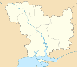
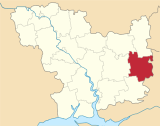
Mykolaiv Raion is a raion (district) in Mykolaiv Oblast, Ukraine with a pre-war population of 636,832. Its administrative center is the city of Mykolaiv.

Veselynove is a rural settlement in Voznesensk Raion of Mykolaiv Oblast in southern Ukraine. It is located in the Chychyklia. Veselynove hosts the administration of Veselynove settlement hromada, one of the hromadas of Ukraine. Population: 5,566.

<span class="mw-page-title-main">Berezanka Raion</span> Former subdivision of Mykolaiv Oblast, Ukraine

Berezanka Raion was a subdivision of Mykolaiv OblastUkraine. Its administrative center was the urban-type settlement of Berezanka. The raion was abolished on 18 July 2020 as part of the administrative reform of Ukraine, which reduced the number of raions of Mykolaiv Oblast to four. The area of Berezanka Raion was merged into Mykolaiv Raion. The last estimate of the raion population was 22,422

<span class="mw-page-title-main">Bereznehuvate Raion</span> Former subdivision of Mykolaiv Oblast, Ukraine

Bereznehuvate Raion was a subdivision of Mykolaiv Oblast of Ukraine. Its administrative center was the urban-type settlement of Bereznehuvate. The raion was abolished on 18 July 2020 as part of the administrative reform of Ukraine, which reduced the number of raions of Mykolaiv Oblast to four. The area of Bereznehuvate Raion was merged into Bashtanka Raion. The last estimate of the raion population was 19,344

<span class="mw-page-title-main">Bratske Raion</span> Former subdivision of Mykolaiv Oblast, Ukraine

Bratske Raion was a subdivision of Mykolaiv Oblast of Ukraine. Its administrative center was the urban-type settlement of Bratske. The raion was abolished on 18 July 2020 as part of the administrative reform of Ukraine, which reduced the number of raions of Mykolaiv Oblast to four. The area of Bratske Raion was merged into Voznesensk Raion. The last estimate of the raion population was 17,129

<span class="mw-page-title-main">Pervomaisk Raion</span> Subdivision of Mykolaiv Oblast, Ukraine

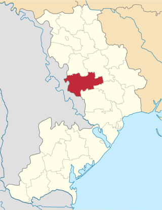
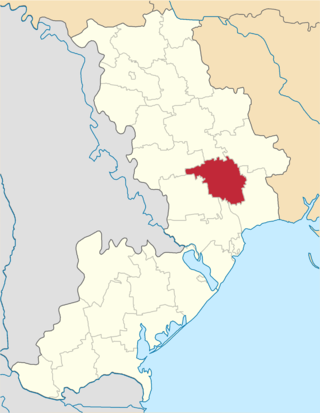
Pervomaisk Raion is a raion (district) in Mykolaiv Oblast, Ukraine. Its administrative center is the town of Pervomaisk. Population: 145,213.

<span class="mw-page-title-main">Velyka Mykhailivka Raion</span> Former subdivision of Odesa Oblast, Ukraine

Velyka Mykhailivka Raion was a raion (district) in Odesa Oblast of Ukraine. Its administrative center was the urban-type settlement of Velyka Mykhailivka. The raion was abolished on 18 July 2020 as part of the administrative reform of Ukraine, which reduced the number of raions of Odesa Oblast to seven. The area of Velyka Mykhailivka Raion was merged into Rozdilna Raion. The last estimate of the raion population was 30,166.

<span class="mw-page-title-main">Ivanivka Raion, Odesa Oblast</span> Former subdivision of Odesa Oblast, Ukraine

Ivanivka Raion was a raion (district) in Odesa Oblast of Ukraine. Its administrative center was the urban-type settlement of Ivanivka. The Velykyi Kuialnyk flowed through the district. The raion was abolished on 18 July 2020 as part of the administrative reform of Ukraine, which reduced the number of raions of Odesa Oblast to seven. The area of Ivanivka Raion was merged into Berezivka Raion. The last estimate of the raion population was 25,743.

<span class="mw-page-title-main">Arbuzynka</span> Rural locality in Mykolaiv Oblast, Ukraine

Arbuzynka is a rural settlement in Pervomaisk Raion in the north of Mykolaiv Oblast, Ukraine. It hosts the administration of Arbuzynka settlement hromada, one of the hromadas of Ukraine. Population: 5,954.

Kostiantynivka is a rural settlement in Voznesensk Raion in the north of Mykolaiv Oblast, Ukraine. It belongs to Yuzhnoukrainsk urban hromada, one of the hromadas of Ukraine. Population: 2,154.

<span class="mw-page-title-main">Bereznehuvate</span> Rural locality in Mykolaiv Oblast, Ukraine

Bereznehuvate is a rural settlement in Bashtanka Raion in the east of Mykolaiv Oblast, Ukraine. It hosts the administration of Bereznehuvate settlement hromada, one of the hromadas of Ukraine. Population: 7,259.

Bratske is a rural settlement in Voznesensk Raion in the north of Mykolaiv Oblast, Ukraine. It hosts the administration of Bratske settlement hromada, one of the hromadas of Ukraine. Population: 4,953.

Domanivka is a rural settlement in Voznesensk Raion in the west of Mykolaiv Oblast, Ukraine. It hosts the administration of Domanivka settlement hromada, one of the hromadas of Ukraine. Population: 5,728.

<span class="mw-page-title-main">Kazanka, Ukraine</span> Rural locality in Mykolaiv Oblast, Ukraine

Kazanka is a rural settlement in Bashtanka Raion in the northeast of Mykolaiv Oblast, Ukraine. It host the administration of Kazanka settlement hromada, one of the hromadas of Ukraine. Population: 6,523.

<span class="mw-page-title-main">Kryve Ozero</span> Rural locality in Mykolaiv Oblast, Ukraine

Kryve Ozero is a Rural settlement in Pervomaisk Raion in the northwest of Mykolaiv Oblast, Ukraine. It hosts the administration of Kryve Ozero settlement hromada, one of the hromadas of Ukraine. Population: 7,262.

<span class="mw-page-title-main">Oleksandrivka, Oleksandrivka settlement hromada, Voznesensk Raion, Mykolaiv Oblast</span> Rural locality in Mykolaiv Oblast, Ukraine

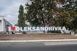
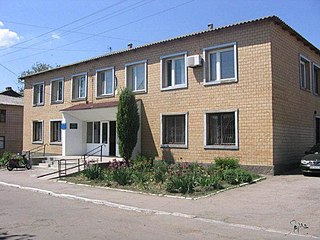
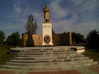
Oleksandrivka is a rural settlement in Voznesensk Raion, Mykolaiv Oblast, Ukraine. It hosts the administration of Oleksandrivka settlement hromada, one of the hromadas of Ukraine. Population: 5,040.

Yelanets is a rural settlement in Voznesensk Raion. Mykolaiv Oblast, Ukraine. It hosts the administration of Yelanets settlement hromada, one of the hromadas of Ukraine. Population: 4,636.

<span class="mw-page-title-main">Velyka Mykhailivka</span> Rural locality in Odesa Oblast, Ukraine

Velyka Mykhailivka is a rural settlement in Rozdilna Raion in the west of Odesa Oblast, Ukraine. It hosts the administration of Velyka Mykhailivka settlement hromada, one of the hromadas of Ukraine. Velyka Mykhailivka previously served as the administrative center of Velyka Mykhailivka Raion. Population: 5,303

<span class="mw-page-title-main">Ivanivka, Odesa Oblast</span> Rural locality in Odesa Oblast, Ukraine

Ivanivka is a rural settlement in Berezivka Raion, in the west of Odesa Oblast, Ukraine. It hosts the administration of Ivanivka settlement hromada, one of the hromadas of Ukraine. Population: 2,362.

<span class="mw-page-title-main">Shyriaieve</span> Rural locality in Odesa Oblast, Ukraine

Shyriaieve is a rural settlement in the west of Odesa Oblast, Ukraine. It hosts the administration of Shyriaieve settlement hromada, one of the hromadas of Ukraine. Population: 6,326

References

  1. 1 2 Чисельність наявного населення України на 1 січня 2022 [Number of Present Population of Ukraine, as of January 1, 2022](PDF) (in Ukrainian and English). Kyiv: State Statistics Service of Ukraine. Archived (PDF) from the original on 4 July 2022.
  2. "Березанская громада" (in Russian). Портал об'єднаних громад України.
  3. 1 2 3 Дизендорф, В.Ф. (2011). Немцы России, населённые пункты и места поселения: Энциклопедический словарь (in Russian). Moscow: ЭРН. p. 24.
  4. 1 2 "История района" (in Russian). Berezanka Deanery. Archived from the original on 29 November 2017. Retrieved 5 March 2016.
  5. "Районы Николаевской области" (in Russian). Николаевская область. Электронная историческая энциклопедия. Retrieved 6 March 2016.
  6. Украинская ССР - Административно-территориальное деление на 1 января 1979 года. Kyiv: Ukrainian Soviet Encyclopedia. 1979.
  7. "Про утворення та ліквідацію районів. Постанова Верховної Ради України № 807-ІХ". Голос України (in Ukrainian). 2020-07-18. Retrieved 2020-10-03.
  8. "Нові райони: карти + склад" (in Ukrainian). Міністерство розвитку громад та територій України.
  9. "Что изменится в Украине с 1 января". glavnoe.in.ua (in Russian). 1 January 2024.