It has been requested that the title of this article be changedto Bernese Oberland. Please see the relevant discussion. The page should not be moved unless the discussion is closed; summarizing the consensus achieved in support of the move.
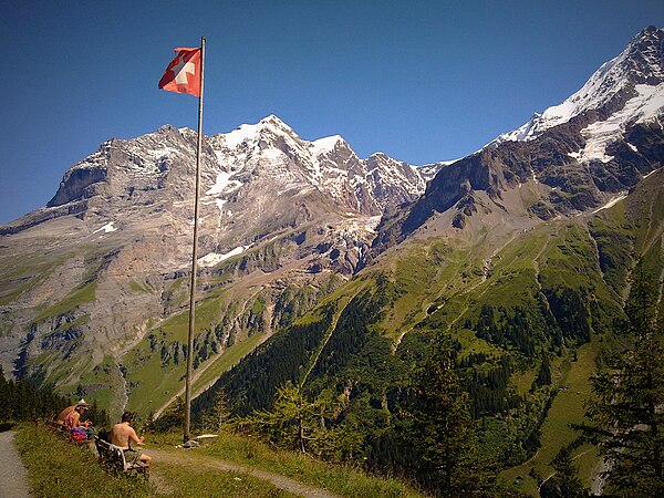
Obersteinberg in the Berner Oberland
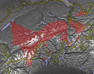
The Berner Oberland (German; English: Bernese Highlands, also referred to in the English-speaking tourism sector as the Bernese Oberland), is the higher part of the canton of Bern, Switzerland, in the southern end of the canton, and one of the canton's five administrative regions (in which context it is referred to as Oberland without further specification).
German is a West Germanic language that is mainly spoken in Central Europe. It is the most widely spoken and official or co-official language in Germany, Austria, Switzerland, South Tyrol in Italy, the German-speaking Community of Belgium, and Liechtenstein. It is also one of the three official languages of Luxembourg and a co-official language in the Opole Voivodeship in Poland. The languages which are most similar to German are the other members of the West Germanic language branch: Afrikaans, Dutch, English, the Frisian languages, Low German/Low Saxon, Luxembourgish, and Yiddish. There are also strong similarities in vocabulary with Danish, Norwegian and Swedish, although those belong to the North Germanic group. German is the second most widely spoken Germanic language, after English.
English is a West Germanic language that was first spoken in early medieval England and eventually became a global lingua franca. It is named after the Angles, one of the Germanic tribes that migrated to the area of Great Britain that later took their name, as England. Both names derive from Anglia, a peninsula in the Baltic Sea. The language is closely related to Frisian and Low Saxon, and its vocabulary has been significantly influenced by other Germanic languages, particularly Norse, and to a greater extent by Latin and French.
The canton of Bern or Berne is the second-largest of the 26 Swiss cantons by both surface area and population. Located in west-central Switzerland, it borders the canton of Jura and the canton of Solothurn to the north. To the west lie the canton of Neuchâtel, the canton of Fribourg and canton of Vaud. To the south lies the canton of Valais. East of the canton of Bern lie the cantons of Uri, Nidwalden, Obwalden, Lucerne and Aargau.
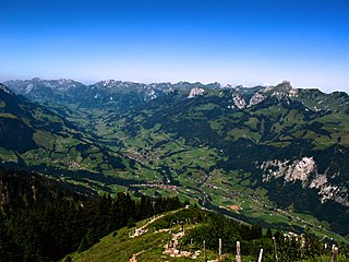
The region consists of the area around Meiringen and Hasliberg up to Grimsel Pass (2,164m [7,100ft]), around Lake Thun (558m [1,831ft]) and Lake Brienz, and the valleys of many high mountains with the towering Jungfrau Peak (4,158m [13,642ft]), the area southwest of the Lake Thun with Kandersteg (connection to the Valais) and Adelboden, and the area round Gstaad and Lenk in the Simmental. The mountain range in the Berner Oberland south of the Aare and north of the Rhône are collectively called the Bernese Alps.
Meiringen is a municipality in the Interlaken-Oberhasli administrative district in the canton of Bern in Switzerland. Besides the village of Meiringen, the municipality includes the settlements of Balm, Brünigen, Eisenbolgen, Hausen, Prasti, Sand, Stein, Unterbach, Unterheidon, Wylerli and Zaun.
Hasliberg is a Swiss municipality in the Interlaken-Oberhasli administrative district in the canton of Bern. Hasliberg is situated on a south-west facing terrace above the valley of the river Aare. The four villages spread out along this terrace are, from west to east, Hohfluh, Wasserwendi, Goldern and Reuti.
The Grimsel Pass is a mountain pass in Switzerland, crossing the Bernese Alps at an elevation of 2,164 metres (7,100 ft). The pass connects the Haslital, the upper valley of the river Aare, with the upper valley of the Rhône. In so doing, and as the Aare is a tributary of the Rhine, the pass crosses the continental divide between the North Sea and the Mediterranean Sea.
The flag of the Berner Oberland consists of a black eagle in a gold field (in reference to the region's old status as reichsfrei) over two fields in the cantonal colours of red and black.
Swiss German is any of the Alemannic dialects spoken in the German-speaking part of Switzerland and in some Alpine communities in Northern Italy bordering Switzerland. Occasionally, the Alemannic dialects spoken in other countries are grouped together with Swiss German as well, especially the dialects of Liechtenstein and Austrian Vorarlberg, which are closely associated to Switzerland's.
Highest Alemannic (Hegschtalemannisch) is a branch of Alemannic German and is often considered to be part of the German language, even though mutual intelligibility with Standard German and other non-Alemannic German dialects is very limited.
Bernese German is the dialect of High Alemannic German spoken in the Swiss plateau (Mittelland) part of the canton of Bern and in some neighbouring regions. A form of Bernese German is spoken by the Swiss Amish affiliation of the Old Order Amish in Adams County, Indiana, United States and their daughter settlements.
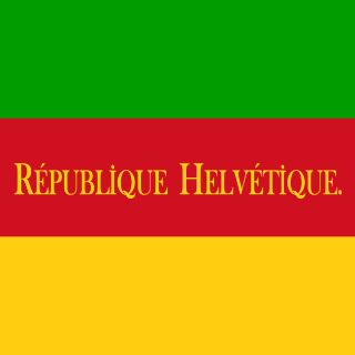
In Swiss history, the Helvetic Republic (1798–1803) represented an early attempt to impose a central authority over Switzerland, which until then had consisted of self-governing cantons united by a loose military alliance.
Oberland was the name of a canton of the Helvetic Republic (1798–1803), corresponding to the area of the Bernese Oberland, with its capital at Thun.
Prehistorically the Berner Oberland was crossed by hunters or traders, but the first known settlements were from the Roman era. The Romans settled along the river and the lakes. They used a number of alpine passes including; the Brünig, Susten (with a Roman mansio), Grimsel, Lötschen, Gemmi, Rawil, Sanetsch and the Col du Pillon.
The territory of modern Switzerland was a part of the Roman Republic and Empire for a period of about six centuries, beginning with the step-by-step conquest of the area by Roman armies from the 2nd century BC and ending with the decline of the Western Roman Empire in the 5th century AD.
The Brünig Pass, at an altitude of 1,008 m (3,307 ft), connects the Bernese Oberland and central Switzerland, linking Meiringen in the canton of Bern and Lungern in the canton of Obwalden. It is on the watershed between the upper reaches of the Aare, which flows through Lake Brienz and Lake Thun, and the Sarner Aa, which flows into Lake Lucerne.
Susten Pass is a mountain pass in the Swiss Alps. The pass road, built from 1938–1945, connects Innertkirchen in the canton of Bern with Wassen in the canton of Uri. A 300-metre long tunnel crosses the pass at 2,224 metres.
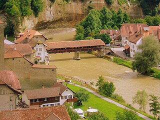
During the High Middle Ages, a number of Berner Oberland villages grew around valley parish churches which were religious and cultural centers within each surrounding valley. During Middle Ages, the Berner Oberland first belonged to the Kingdom of Burgundy followed by the Dukes of Zähringen. After the extinction of the Zähringen line, the Berner Oberland was ruled by a number of local Barons (including Oberhofen, Strättligen, Brienz-Ringgenberg, Wädenswil, Weissenburg). For a time, some of the Walser barons (Raron, vom Turn) ruled portions of the Berner Oberland. The Saanen valley was ruled by the Counts of Gruyères. Portions of the alpine passes were held, until the 19th century, by the Bishop of Sion.[1]
The expansionist policy of the city of Bern led them into the Berner Oberland. Through conquest, purchase, mortgage or marriage politics Bern was able to acquire the majority of the Berner Oberland from the indebted local barons between 1323 and 1400. Under Bernese control, the five valleys enjoyed extensive rights and far-reaching autonomy in the Bäuerten (farming cooperative municipalities) and Talverbänden (rural alpine communities). Throughout the Late Middle Ages, the Berner Oberland, as a whole or in part, revolted several times against Bernese authority. The Evil League (Böser Bund) in 1445 fought against Bernese military service and taxes following the Old Zürich War,[2] in 1528 the Berner Oberland rose up in resistance to the Protestant Reformation and in 1641 Thun revolted.
During the Middle Ages, the settlement pattern in the Berner Oberland was somewhat consistent. A main settlement grew on the valley floor below an elevation near 1,100m (3,600ft). This main settlement had a market and often a castle or other fortifications. This market town was surrounded by scattered villages, hamlets and individual farm houses to an elevation of 1,600m (5,200ft). During the 14th-16th centuries, the Berner Oberland villages began extensive trading with the Bernese grain producing towns in the lowlands. This allowed the alpine villages to renounce self-sufficiency in grain and focus on raising cattle in the high alpine pastures and bringing them down into the valleys in the winter (transhumance). They then exported cattle over the passes into Italy and into the Bernese lowlands. Around 1500, in addition to the seven medieval markets, eleven new cattle markets opened to allow the Berner Oberland villagers to sell their cattle.[1]
After the Napoleonic invasion of Switzerland in 1798, the old Bernese order was fractured and the Berner Oberland was separated from the canton of Bern, forming the canton of Oberland. Within this new canton, historic borders and traditional rights were not considered. As there had been no previous separatist feeling amongst the conservative population, there was little enthusiasm for the new order.
The 1801 Malmaison Constitution proposed reuniting the canton of Oberland with Bern, but it was not until the Act of Mediation, two years later, with the abolition of the Helvetic Republic and the partial restoration of the ancien régime, that the two cantons were reunited.[3]
In 1729, Albrecht von Haller published the poem Die Alpen about his travels through the alpine regions. This combined with other reports and alpine paintings started the tourism industry in the Berner Oberland. By 1800 there were resorts on Lake Thun and Lake Brienz (especially at Interlaken between the two lakes). Shortly thereafter the resorts expanded into the alpine valleys (Lauterbrunnen, Grindelwald), and began attracting English guests. However, because of the widespread poverty of the 19th century many residents of the Simmen valley and the Interlaken district emigrated to North America, Germany or Russia.
In the late 19th century, new transportation links made it easier for people to travel into the valleys. The Bern-Lötschberg-Simplon railway opened in 1913 and became the largest privately owned railroad in Switzerland. The collapse of the hotel industry during both world wars forced a diversification of the economy. After 1950 a new wave of hotel construction of hotels and holiday homes and apartments, led to a strong population growth. Starting in the 1930s and increasingly after 1950 funiculars, cable cars and chair lifts opened up many of the high alpine villages for winter sports and tourism.[1]
Geography
The Berner Oberland designates primarily an area around the upper valley of the Aare with its many larger and smaller side-valleys.
Above of Brienz on the northeastern shore of Lake Brienz soars the Brienzer Rothorn, the highest summit of the 30-kilometre-long (19mi) prominent mountain range dominating the north shore of the Lake Brienz as far as its western end above Interlaken with the Harder. On the north side of the Brienzer Rothorn lies the resort Sörenberg in the Mariental in canton of Lucerne (LU).
South of Interlaken the short valley of the Lütschine opens to the most well-known valleys of the Bernese Highlands, namely the Lauterbrunnental to the south, and the valley of the Schwarze Lütschine to the east with Grindelwald situated just below the Eiger, Schreckhorn, and Wetterhorn. Grindelwald and Lauterbrunnen are separated by the Kleine Scheidegg pass, which is accessible from both sides via a rack railway, and which is the starting point of the Jungfrau Railway to the Jungfraujoch, a saddle between the Jungfrau and Mönch (literally, German Joch translates to yoke).
On the southeastern side of the mountain range formed by Eiger, Mönch and Jungfrau lies the head of the largest glacier of the Alps, the Aletsch Glacier, which however entirely lies on the soil of the canton of Valais (VS). Via the upper, southern end of the Lauterbrunnental the experienced hiker can reach the Kandertal by traversing the Tschingel and Kander Neve from northeast to southwest. West of the Lauterbrunnental the Schilthorn rises, separating the valley of the Weisse Lütschine from the Kiental. The Lauterbrunnen Valley is connected to the Kiental via the Sefinafurgga, a high Alpine hiking pass, and further to the Kander Valley via the Hohtürli, another high Alpine hiking pass, on the north flank of the Blümlisalp range.
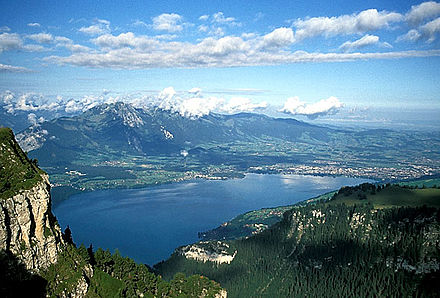
Kandersteg, at the north entrance of the old Lötschberg Tunnel (1913, 14km), which connects the Bernese Highlands with the German-speaking part of the Valais, opens up to the north to Frutigen where it is joined by the Entschligetal from the southwest, with the ski resort of Adelboden at its southern end. Adelboden and its sister resort Lenk join their respective areas to an extended and unified ski and hiking area across another mountain range. Lenk is situated at the southern end of the Obersimmental, the upper part of the Simmental, which again joins the Kander of the Kandertal just south of Spiez at the southern shore of Lake Thun after the Kander flows through the Frutigtal. Above Spiez rises the Niesen, offering a wide view over the Bernese part of the Swiss Plateau to the northwest.
Zweisimmen, still part of the Obersimmental, lies 8 kilometres (5.0mi) south of Boltigen, the junction of the upper and lower parts of the Simmental. From Erlenbach in the Niedersimmental, the lower valley of the Simme, one can access the Stockhorn by cable cars to the west, the one summit of the Bernese Oberland with the probably most unobstructive view over the Bernese Lowlands and Thun. Not far from Erlenbach, one can access the Diemtigtal to the south with the Gsür to its very south end, also rising directly above Adelboden.
Zweisimmen also connects to Saanen and Gstaad via the small pass of Saanenmöser, with the Louwene Valley and the upper valley of the Saane south of Gstaad. After flowing northwards, in Saanen the Saane turns to the west, firstly, in order to become La Sarine in the now French-speaking canton of Vaud (VD), and secondly, opens a railway connection to Montreux at the eastern shore of Lake Geneva.
North of Spiez, right across Lake Thun, on its northern shore, lies the Niederhorn, the south end of the northernmost mountain range of significant elevation of the Bernese Highlands, with the Gemmenalphorn and the Hohgant at the other end, separated by a small valley from the Harder on its southeast.
At the west end of Lake Thun, at the outlet of the river Aare, lies the town of Thun, which already belongs to the Swiss Plateau, not far from Bern to the northwest.
Administrative division
The flag of the Berner Oberland
Since 2010, the Berner Oberland covers one of five administrative regions of the canton of Berne (called German: Verwaltungsregion Oberland)[4] and consists of four administrative districts with 80 municipalities:[5]
The Bernese Alps are a mountain range of the Alps, located in western Switzerland. Although the name suggests that they are located in the Berner Oberland region of the canton of Bern, portions of the Bernese Alps are in the adjacent cantons of Valais, Fribourg and Vaud, the latter being usually named Fribourg Alps and Vaud Alps respectively. The highest mountain in the range, the Finsteraarhorn, is also the highest point in the canton of Bern.
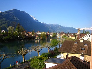
Interlaken is a Swiss town and municipality in the Interlaken-Oberhasli administrative district in the canton of Bern. It is an important and well-known tourist destination in the Bernese Highlands region of the Swiss Alps, and the main transport gateway to the mountains and lakes of that region.
The Schynige Platte Railway is a mountain railway in the Bernese Highlands area of Switzerland, which connects the town of Wilderswil, near Interlaken with the famous wildflower gardens of the Schynige Platte.
In contrast to centrally organised states, in the federally constituted Switzerland each canton is completely free to decide its own internal organisation. Therefore, there exists a variety of structures and terminology for the subnational entities between canton and municipality, loosely termed districts.
The Sarine or Saane is a major river of Switzerland. It is 128 km (80 mi) long and has a drainage area of 1,892 km2 (731 sq mi). It is a tributary of the Aare.
Saanen is a municipality in the canton of Berne in Switzerland. It is the capital of the Obersimmental-Saanen administrative district.
The Simmental is an alpine valley in the Bernese Oberland of Switzerland. It expands from Lenk to Boltigen, in a more or less south-north direction (Obersimmental), and from there to the valley exit at Wimmis near Spiez it takes a west-east orientation (Niedersimmental). It comprises the municipalities of Lenk, St. Stephan, Zweisimmen, Boltigen, Oberwil, Därstetten, Erlenbach, Diemtigen and Wimmis. The Simme flows through the valley.
Interlaken Ost or Interlaken East is a railway station in the resort town of Interlaken in the Swiss canton of Bern. The station was previously known as Interlaken Zollhaus. The town has one other station, Interlaken West.
Tourists are drawn to Switzerland's diverse landscape as well as activities. Most interesting are the Alpine climate and landscapes, in particular for skiing and mountaineering.
The river Simme is a tributary of the river Kander in the Bernese Oberland in the canton of Bern in Switzerland. It is approximately 60 kilometres (37 mi) long and has a catchment area of 594 square kilometres (229 sq mi).
The Schynige Platte is a small mountain ridge and a viewpoint in the Bernese Highlands and belongs to the Schwarzhorn group. The mountain range consists of three peaks: Gumihorn, Tuba, and the closest summit next to the viewpoint, Geiss. The viewpoint lies at an altitude of about 2,000 metres (7,000 ft), at the western end of a prominent ridge of the Schwarzhorn group, which separates the valley of the Schwarze Lütschine from Lake Brienz.
The Lötschberg line is a railway in Switzerland, connecting Spiez in the canton of Bern with Brig in the canton of Valais. It crosses the Bernese Alps, from the Bernese Oberland to Upper Valais, through the Lötschberg Tunnel in the middle of the line. Together with the Simplon Tunnel south of Brig, it constitutes one of the major railways through the Alps and an important north-south axis in Europe. The Lötschberg axis is backed by the lower and longer Lötschberg Base Tunnel, part of the New Railway Links through the Alps project.
On 1 January 2010, the 26 old districts were combined into 10 new districts :
The Harderkulm is a viewpoint at 1,321 metres (4,334 ft) in the Berner Oberland region of Switzerland, overlooking the towns of Interlaken and Unterseen. It is located at the western end of the Harder, which in itself is the most western, forested ridge of the about 30 kilometres (19 mi) long, prominent mountain range dominating the north shore of the Lake of Brienz.
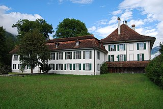
Interlaken Monastery was a convent of the Augustinian Canons Regular from about 1133 until 1528 at Interlaken in the Canton of Bern in Switzerland. It is a Swiss heritage site of national significance.
The Lake Thun railway line is a railway line in the Swiss canton of Bern. It links the towns of Thun, Spiez and Interlaken, running principally along the southern shore of Lake Thun. The line was opened in 1893 by the Lake Thun Railway company, but incorporates much of the earlier Bödeli Railway dating back to 1872.
The Evangelical Reformed Church of the Canton Bern-Jura-Solothurn is a Reformed state church in three cantons of Switzerland. It is located within the Canton of Bern, Canton of Jura, and Canton of Solothurn.
This page is based on this Wikipedia article Text is available under the CC BY-SA 4.0 license; additional terms may apply. Images, videos and audio are available under their respective licenses.