Bethamcherla

Last updated

Bethamcherla
Betamcherla
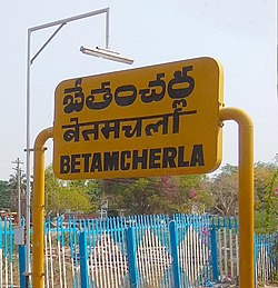
Bethamcherla Railway Station edited.jpg
Bethamcherla railway station
India Andhra Pradesh location map (current).svg
Red pog.svg
Bethamcherla
Location in Andhra Pradesh, India
Coordinates: 15°28′00″N78°10′00″E / 15.4667°N 78.1667°E / 15.4667; 78.1667
CountryFlag of India.svg  India
State Andhra Pradesh
Region Rayalaseema
District Nandyal
SettledCentury B.C.
Government
  Type Municipality
  Body Nagar panchayat
Population
 (2011) [1]
  Total38,994
Languages
  Official Telugu, తెలుగు
Time zone UTC+5:30 (IST)
PIN
518599
Telephone code (091)-8516

Bethamcherla is a town with Nagar panchayat civic status and mandal headquarters located in Nandyal district of the Indian state of Andhra Pradesh. It comes under Dhone assembly constituency and Nandyal Parliament Constituency. [2]

Contents


Governance
DepartmentIncharge
LegislativeDhone MLA, Bethamcherla Municipal Chairman
ExecutiveDhone RDO, Bethamcherla MRO
JudiciaryHon'ble Dhone Court and Banaganapalle Court Jury
Police Sub DivisionDhone DSP
HealthCHNC Banaganapalle
APSPDCL DivisionDhone DE
APSRTC Bus ServiceBanaganapalle Depot
TransportDhone MVI
Pincode518599, 518598, 518206


Demographics

As of 2011 census, the town had a population of 38,994. The total population constitute, 19,424 males and 19,570 females —a sex ratio of 1008 females per 1000 males. 4,882 children are in the age group of 0–6 years. The average literacy rate stands at 65.60% with 22,379 literates, lower than the state average of 67.41%. [1] [3]

Education

The primary and secondary school education is imparted by government, aided and private schools, under the School Education Department of the state. [4] [5]

Related Research Articles

<span class="mw-page-title-main">Srikakulam</span> City in Andhra Pradesh, India

Srikakulam is a city and the headquarters of Srikakulam district in the Indian state of Andhra Pradesh. As of 2011 census, it has a population of 165,735. There are many other places of Buddhist Tourism such as Salihundam, Kalinga Patnam, Dabbaka Vaani Peta, Nagari Peta, Jagati Metta, Singupuram etc. in Srikakulam District. The Buddhist heritage site of Salihundam has some unique features. It has a beautiful star atop a stupa, rock cut massive stupas inside chaitya grihas, brick stupas with wheel pattern plan, votive stupas, inscriptions on the steps leading to the stupas and museum housing over two dozen sculpted statue and figurines of Buddha, Jain Teerthankars and other deities

Yemmiganur is a town in Kurnool district of the Indian state of Andhra Pradesh. It is located in Yemmiganur mandal of Adoni revenue division.

<span class="mw-page-title-main">Bobbili</span> Town in Andhra Pradesh, India

Bobbili is a town in Vizianagaram district of the Indian state of Andhra Pradesh.

<span class="mw-page-title-main">Proddatur</span> City in Andhra Pradesh, India

Proddatur (1915) is a city in the YSR Kadapa District of Andhra Pradesh, located on the banks of the Penna River. The city is a municipality, and also the mandal headquarters of Proddatur mandal. It is the second-largest town in former Kadapa District. It is the oldest municipality which formed before Independence.

<span class="mw-page-title-main">Kovur, Nellore district</span> Village in Andhra Pradesh, India

Kovur is a village in Nellore district of the Indian state of Andhra Pradesh. The village is also the headquarters of the Kovur Mandal and Assembly Constituency. It is located in Kovur mandal of Nellore revenue division. It forms a part of Nellore Urban Development Authority. The poet "Thikkanna" was born in this place.

Bandarulanka is a census town in Amalapuram Mandal, Dr. B.R. Ambedkar Konaseema district of the Indian state of Andhra Pradesh.

<span class="mw-page-title-main">Kothavalasa</span> Suburb in Vizianagaram, Andhra Pradesh, India

Kothavalasa is a town in Vizianagaram district of the Indian state of Andhra Pradesh. It is located in Kothavalasa mandal of Vizianagaram revenue division. It is located 30 km from the city of Visakhapatanam

Narasaraopet is a city and district headquarters of Palnadu District of the Indian state of Andhra Pradesh. The town is a municipality and mandal headquarters of Narasaraopet mandal and Headquarters of Narasaraopet revenue division. The town also is the seat of the court of Additional District Judge. Narasaraopet acts as a melting point for the Palnadu and Delta regions of the district. The town is also referred as the 'Gateway of Palnadu'. The main offices of Nagarjuna Sagar Jawahar Canal Operation & Maintenance Lingamguntla Circle are located in this town. Also it is considered as holy place because it is the birth place of panguluri prasad

<span class="mw-page-title-main">Pamur</span> Town in Andhra Pradesh, India

Pamuru is a town in Prakasam district of the Indian state of Andhra Pradesh. It is the mandal headquarters of Pamuru mandal in Kanigiri revenue division. This is the border town of Prakasam district. This is near from Nellore than Ongole around 100 km and also near by Kadapa. It is 66 km away from Podili, 38 km away from Kanigiri, 60 km away from Kandukur.

<span class="mw-page-title-main">Repalle</span> Town in Andhra Pradesh, India

Repalle is a town in Bapatla district of the Indian state of Andhra Pradesh. The town is one of the 12 municipalities in Bapatla district and the headquarters of Repalle mandal under the administration of Repalle revenue division. It is situated near Krishna River in the Coastal Andhra region of the state.

<span class="mw-page-title-main">Salur</span> Town in Andhra Pradesh, India

Salur or Saluru is a municipal town and mandal headquarters in Parvathipuram Manyam district, of the Indian state of Andhra Pradesh.

<span class="mw-page-title-main">Sompeta</span> Census Town in Andhra Prades, India

Sompeta is a census town in Srikakulam district of the Indian state of Andhra Pradesh. It is the mandal headquarters of Sompeta mandal in Tekkali revenue division.

<span class="mw-page-title-main">Srisailam</span> Census Town in Andhra Pradesh, India

Srisailam is a census town in Nandyal district of the Indian state of Andhra Pradesh. It is the mandal headquarters of Srisailam mandal in Atmakur revenue division. It is located about 160 kilometres (99 mi) from the district headquarters Nandyal, 180 kilometres (112 mi) from Kurnool, and it is located about 264 kilometres (164 mi) from Vijayawada. The town is famous for Mallikarjuna Jyotirlinga Temple and is one of the holy pilgrimage sites for Saivism and Shaktism sects of Hinduism. The town is classified as both Jyotirlinga and Shakti Peetha.

<span class="mw-page-title-main">Yerraguntla</span> Town in Andhra Pradesh, India

Yerraguntla is a town and Nagar Panchayat in YSR Kadapa District. It is an industrial area in YSR Kadapa district, Andhra Pradesh. It is located in Yerraguntla mandal of Kadapa revenue division.

<span class="mw-page-title-main">Nagari, Andhra Pradesh</span> Town in Andhra Pradesh, India

Nagari is a town in Chittoor district of the Indian state of Andhra Pradesh. It is the mandal headquarters of Nagari mandal in Nagari revenue division.

Giddaluru is a town in the Prakasam district of the Indian state of Andhra Pradesh. It is the mandal headquarters of the Giddaluru mandal in Markapur revenue division. It was part of kurnool district till 1969 later it was merged into Prakasam district in 1970. Till 2008 it was under Nandyal parliament segment after delimitation it was moved to Ongole MP segment. Giddalur is also known as "3 zilla la muddu bidda " because during the Britishers rule it was in kadapa district later moved to kurnool then in 1970 merged in prakasam district. Giddalur is the only constituency in coastal districts which has Rayalseema culture,slang and traditions. Giddalur town has good transport connectivity to Nandyal, Markapur, Podili, Ongole, Kurnool, Kadapa.

<span class="mw-page-title-main">Dhone</span> Town in Andhra Pradesh, India

Dhone or Dronachalam is a town in Nandyal district of the Indian state of Andhra Pradesh. It is a municipality located in Dhone mandal. And it is the head quarters of Dhone revenue division.

<span class="mw-page-title-main">Kolakaluru</span> Neighborhood in Guntur, Andhra Pradesh, India

Kolakaluru is a neighborhood of Tenali city in Guntur district of the Indian state of Andhra Pradesh. It is located in Tenali mandal of Tenali revenue division. It forms a part of Andhra Pradesh Capital Region.

<span class="mw-page-title-main">Kollipara mandal</span> Mandal in Andhra Pradesh, India

Kollipara mandal is one of the 18 mandals in Guntur district of the state of Andhra Pradesh, India. It is under the administration of Tenali revenue division and the headquarters are located at Kollipara. The mandal is situated on the banks of the Krishna River, bordered by Duggirala, Tenali, Vemuru and Kollur mandal.

<span class="mw-page-title-main">Vaddeswaram</span> Census Town in Andhra Pradesh, India

Vaddeswaram is a census town in Guntur district of the Indian state of Andhra Pradesh. It is located at a distance of 5 km (3.1 mi) from Krishna River, in Tadepalle mandal part of Mangalagiri Tadepalle Municipal Corporation part of Guntur revenue division.

References

  1. 1 2 "Census 2011". The Registrar General & Census Commissioner, India. Retrieved 20 November 2014.
  2. "Mandal wise villages" (PDF). Revenue Department - AP Land. National Informatics Center. p. 9. Archived from the original (PDF) on 9 December 2014. Retrieved 20 November 2014.
  3. "Literacy of AP (Census 2011)" (PDF). Official Portal of Andhra Pradesh Government. p. 43. Archived from the original (PDF) on 14 July 2014. Retrieved 16 November 2014.
  4. "School Education Department" (PDF). School Education Department, Government of Andhra Pradesh. Archived from the original (PDF) on 27 December 2015. Retrieved 7 November 2016.
  5. "The Department of School Education - Official AP State Government Portal | AP State Portal". www.ap.gov.in. Archived from the original on 7 November 2016. Retrieved 7 November 2016.