Dhone

Last updated

Dhone
Dronachalam
Dhone Jn Railway station image.jpg
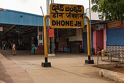
Dhone Junction Railway Station
India Andhra Pradesh location map (current).svg
Red pog.svg
Dhone
Location in Andhra Pradesh, India
Coordinates: 15°23′46″N77°52′19″E / 15.396°N 77.872°E / 15.396; 77.872
CountryIndia
State Andhra Pradesh
District Nandyal
Government
  Body Municipality
Area
[1]
  Total9.95 km2 (3.84 sq mi)
Population
 (2011) [2]
  Total59,272
  Rank2nd (in Nandyal District)
  Density6,000/km2 (15,000/sq mi)
Languages
  Official Telugu
Time zone UTC+5:30 (IST)
Telephone code +91–8516
Vehicle registration AP 21, AP 39

Dhone or Dronachalam is a town in Nandyal district of the Indian state of Andhra Pradesh. It is a municipality located in Dhone mandal, and it is the head quarters of Dhone revenue division. [3]

Contents

History

Dhone was formerly known as Dronachalam. [4] Dhone is the second biggest municipality in Nandyal district after Nandyal Municipality. According to local tradition, the name of the village is derived from the name of the tutor Dronacharya, a character in Mahabharata, who meditated on the hill in village. There is now a Hanuman temple, Dargah and church on the hill. Dhone has large deposits of high quality limestone, and it was previously the site of an active quarry. The quarry is no longer in operation. The oldest temple in Dhone is Sri Vasavi Temple, which was constructed in 1916. The Vasavi Temple celebrated 100 at the year 2017.

Geography

Dhone is surrounded by hills on its south. Geographically it is located on Erramala hills.

Demographics

According to 2011 census, Dhone had population of 59,272 of which 29,470 were male and 29,802 were female.

Population of children aged of 0-6 was 7,118, which is 12.01% of the total population of Dhone. The female sex ratio is of 1011 against state average of 993. Moreover, the child sex ratio in Dhone is around 954 compared to Andhra Pradesh state average of 939. Literacy rate of Dhone city is 72.33% higher than state average of 67.02%. In Dhone, male literacy is around 81.88% while female literacy rate is 62.96%.

Economy

Dhone has large deposits of high quality limestone. It also have good size of Granite and Polish slab Factories. Dhone is Industrially developing town.

Governance

Civic administration

Dhone is a Municipality in district of Nandyal, Andhra Pradesh. The Dhone city is divided into 32 wards for which elections are held every five years.

The municipality was established in the year 2005 and has an extent of 9.85 km2 (3.80 sq mi). During 2010–2011 period, total expenditure per annum was 431 crore (US$52 million), while the total income generated per annum was 515 crore (US$62 million). [5] The municipality provided 798 public taps, 186 bore-wells, length of 106.28 km (66.04 mi) roads, 1551 street lights, a park, public market, elementary and secondary schools etc. [6]

Revenue Division

Dhone Revenue Division have six mandals:

  1. Dhone
  2. Peapully
  3. Bethamcherla
  4. Banaganapalle
  5. Owk
  6. Koilakuntla.

Politics

Dhone is represented by Dhone (Assembly constituency) for Andhra Pradesh Legislative Assembly. Buggana Rajendranath Reddy is the present MLA of the constituency representing YSRCP. [7] [8] Kotla Vijaya Bhaskara Reddy elected as CM for Andhra Pradesh represented Dhone constituency.

Governance
DepartmentIncharge
LegislativeDhone MLA, Dhone Municipality Chairman
ExecutiveDhone RDO, Dhone MRO
JudiciaryHon'ble Dhone Court Judge
Police Sub DivisionDhone DSP
HealthCHNC Dhone
APSPDCL DivisionDhone DE
APSRTC Bus ServiceDhone Depot
TransportDhone MVI

Transport

Dhone Junction Dhone Railway Station 1B.jpg
Dhone Junction

Railways

Dhone Junction railway station is located in Guntakal railway division of the South Central Railway zone. This junction is one of the oldest railway junctions in India.Guntur - Hubli line and Secunderabad - Bengaluru line meet in the Dhone Junction Railway station. Dhone railway station is the biggest railway station in Nandyal district. [9]

Dhone Railway Station Terminal Building Dhone Railway Station 1A.jpg
Dhone Railway Station Terminal Building

Roadways

The Andhra Pradesh State Road Transport Corporation operates bus services from Dhone bus station. [10] Dhone has bus station situated near National Highway 44, which is called North - South corridor.

Dhone APSRTC New Bus Stand Dhone Bus Stand 1A.jpg
Dhone APSRTC New Bus Stand

Distance to major towns and cities

  1. Kurnool = 52 km (32 mi)
  2. Nandyal = 82 km (51 mi)
  3. Adoni = 100 km (62 mi)
  4. Bethamcherla = 36 km (22 mi)
  5. Banaganapalle = 47 km (29 mi)
  6. Gooty = 43 km (27 mi)
  7. Anantapuram = 95 km (59 mi)
  8. Kadapa = 180 km (110 mi)
  9. Tirupati = 316 km (196 mi)
  10. Bellary = 130 km (81 mi)
  11. Hyderabad = 263 km (163 mi)
  12. Bengaluru = 310 km (190 mi)
  13. Vijayawada = 395 km (245 mi)
  14. Visakhapatnam = 745 km (463 mi)
  15. Guntur = 357 km (222 mi)
Dhone town bird view 3.jpg
Dhone Town Bird view

Villages

Related Research Articles

<span class="mw-page-title-main">Banaganapalli</span> Town in Andhra Pradesh, India

Banaganapalli is a town in the state of Andhra Pradesh, India. It lies in Nandyal district, 38 km west of the city of Nandyal. Banaganapalli is famous for its mangoes and has a cultivar, Banaganapalli, named after it. Between 1790 and 1948, Banaganapalli was the capital of the princely state of the same name, Banganapalle State.

<span class="mw-page-title-main">Kurnool district</span> District of Andhra Pradesh, India

Kurnool district is one of the eight districts in the Rayalaseema region of the Indian state of Andhra Pradesh after the districts are reorganised in April 2022. It is located in the north western part of the state and is bounded by Nandyal district in the east, Anantapur district in the south, Raichur district of Karnataka in the northwest, Bellary district of Karnataka in the west, and Jogulamba Gadwal district of Telangana in the north. It has a population of 2,271,686 based on the 2011 census. The city of Kurnool is the headquarters of the district.

Rajampeta is a Municipality in Annamayya district of the Indian state of Andhra Pradesh, located in the Rayalaseema Region formed on the banks of Cheyyeru River. The town has an average elevation of 139 meters (456 ft). Rajampet is a Grade II Municipality which upgraded in 2019 and has an area of 35.38 square kilometres (13.66 sq mi). It consists of 29 election wards.

Nandyal is a city and District headquarters of Nandyal district of the Indian state of Andhra Pradesh. It is a municipality and the headquarters of Nandyal mandal in Nandyal revenue division.

<span class="mw-page-title-main">Markapur</span> Town in Andhra Pradesh, India

Markapuram is a town in Prakasam district of the Indian state of Andhra Pradesh. It is a municipality and is the headquarters of Markapuram mandal in Markapuram revenue division. Markapuram is notable for the Chennakesava Swamy Temple, built by King Sri Krishnadevaraya. During Ratha Yatra there occurs a popular carnival; the town is also famous for Chenna Kesavaswamy on the day of Rathsapthami, which is attended by thousands of people coming from different parts of the state. It is the second-largest town in Prakasam district after Ongole and it is the main place within West Prakasam district to avail all facilities.

<span class="mw-page-title-main">Hindupur</span> City in Andhra Pradesh, India

Hindupuram is a city in Sri Sathya Sai district of the Indian state of Andhra Pradesh. It is located to the edge of the Andhra–Karnataka border and is the headquarters of Hindupuram mandalam. Hindupuram is the Parliamentary Constituency in the newly formed District Sri Sathya Sai. It is located about 67 km from district headquarters Puttaparthi, 100 km from Bengaluru the capital of Karnataka, 95 km From Kadiri.

Narasaraopeta is a city and district headquarters of Palnadu District of the Indian state of Andhra Pradesh. The town is a municipality and mandal headquarters of Narasaraopet mandal and Headquarters of Narasaraopet revenue division. The town also is the seat of the court of Additional District Judge. Narasaraopet acts as a melting point for the Palnadu and Delta regions of the district. The town is also referred as the 'Gateway of Palnadu'. The main offices of Nagarjuna Sagar Jawahar Canal Operation & Maintenance Lingamguntla Circle are located in this town. Also it is considered as holy place.

Ponnur is a major city/town in Guntur district of the Indian state of Andhra Pradesh. A road to Chandole goes south-east and comes to Nidubrolu, where there is a temple with a stone bearing inscription recording the erection of 90 temple in A.D. 1132. An ancient Telugu manuscript entitled 'Ponnuru-Chandavolu Shasanam' was present in Potti Sreeramulu Telugu University. Kilari Venkata Rosaiah of YSRCP party is the current MLA of the constituency, who won the 2019 Andhra Pradesh Legislative Assembly election. It is a municipality and the mandal headquarter of Ponnur mandal under Tenali revenue division.

<span class="mw-page-title-main">Rayadurgam</span> Town in Andhra Pradesh, India

Rayadurgam is a town in Anantapur District in the Indian state of Andhra Pradesh. It is governed by a municipal council. Rayadurgam is known for its production of textile goods and textile manufacturing industry. Rayadurgam is in Southern India about 451.6 km (280.6 mi) from Hyderabad. Rayadurgam is now slowly developing with proper transportation, modern amenities. Rayadurgam is well connected with other cities in Andhra Pradesh and Karnataka through well infrastructure of NH 544DD Highway. The nearest airport is Ballari Airport in Karnataka followed by Kurnool, Puttaparthi and Bengaluru. Rayadurgam also has a train station with major stations nearby such as Ballari, Guntakal, Gooty & Anantapur.

<span class="mw-page-title-main">Srisailam</span> Census Town in Andhra Pradesh, India

Srisailam is a census town in Nandyal district of the Indian state of Andhra Pradesh. It is the mandal headquarters of Srisailam mandal in Atmakur revenue division. It is located about 160 kilometres (99 mi) from the district headquarters Nandyal, 180 kilometres (112 mi) from Kurnool, and it is located about 264 kilometres (164 mi) from Vijayawada. The town is famous for the Mallikarjuna Jyotirlinga Temple and is one of the holy pilgrimage sites for the Shaivism and Shaktism sects of Hinduism. The town is classified as both a Jyotirlinga and a Shakti pitha.

<span class="mw-page-title-main">Vinukonda</span> Town in Andhra Pradesh, India

Vinukonda is a town in Palnadu district of the Indian state of Andhra Pradesh. It is a municipality and the headquarters of Vinukonda mandal and administered under Narasaraopet revenue division.

<span class="mw-page-title-main">Yerraguntla</span> Town in Andhra Pradesh, India

Yerraguntla is a town and Nagar Panchayat in YSR Kadapa District. It is an industrial area in YSR Kadapa district, Andhra Pradesh. It is located in Yerraguntla mandal of Kadapa revenue division.

<span class="mw-page-title-main">Pakala, Tirupati district</span> Town in Andhra Pradesh, India

Pakala is a town in Tirupati district of the Indian state of Andhra Pradesh. It is the mandal headquarters of Pakala mandal. It comes under Tirupati revenue division.

Aspari is a village under the adoni revenue division in Kurnool district of Andhra Pradesh, India.

Veldurthi is a mandal in Kurnool district of Andhra Pradesh, India.

<span class="mw-page-title-main">Allagadda</span> Town in Andhra Pradesh, India

Allagadda is a town in Nandyal district of the Indian state of Andhra Pradesh. It is located in Nandyal Revenue division. The town is located at 15°08′00″N78°31′00″E.

<span class="mw-page-title-main">Koilakuntla</span> Town in Andhra Pradesh, India

Koilakuntla is a town in Nandyal district of the Indian state of Andhra Pradesh. It is Head quarter of Koilakuntla mandal. in Dhone revenue division

<span class="mw-page-title-main">Atmakur, Nandyal district</span> Town in Andhra Pradesh, India

Atmakur is a town in the Nandyal district of Andhra Pradesh, India.

Chilakaluripet is a city in Palnadu district of the Indian state of Andhra Pradesh. It is the Mandal headquarters of Chilakaluripet Mandal in Narasaraopet Revenue Division.

<span class="mw-page-title-main">Dhone Junction railway station</span> Railway Station in Andhra Pradesh

Dhone Junction railway station is the primary railway station serving Dhone in Andhra Pradesh, India. The station comes under the jurisdiction of Guntakal division of South Coast Railways. It is a biggest railway junction in Kurnool district, Andhra Pradesh. The station has three platforms. The station is situated at junction of three lines branching towards Guntur, Kacheguda and Guntakal.

References

  1. "Municipalities, Municipal Corporations & UDAs" (PDF). Directorate of Town and Country Planning. Government of Andhra Pradesh. Archived from the original (PDF) on 28 January 2016. Retrieved 29 January 2016.
  2. "District Census Handbook – Kurnool" (PDF). Census of India. Office of the Registrar General & Census Commissioner, India. pp. 12, 50. Archived from the original (PDF) on 26 March 2022. Retrieved 18 April 2024.
  3. "Guntur District Mandals" (PDF). Census of India. pp. 344, 364. Retrieved 19 January 2015.
  4. Raju, P. Yenadi (2003). Rayalaseema during colonial times : a study un Indian nationalism. New Delhi: Northern Book Centre. ISBN   8172111398 . Retrieved 24 April 2015.
  5. "Basic Information of Municipality". Commissioner & Director of Municipal Administration. Municipal Administration & Urban Development Department, Govt. of Andhra Pradesh. Archived from the original on 6 July 2012. Retrieved 11 November 2014.
  6. "Public services/amenities". Commissioner & Director of Municipal Administration. Municipal Administration & Urban Development Department, Govt. of Andhra Pradesh. Archived from the original on 7 July 2012. Retrieved 11 November 2014.
  7. "MLA". AP State Portal. Archived from the original on 8 October 2014. Retrieved 12 October 2014.
  8. "Dhone Assembly 2014 Election Results". Elections.in. Retrieved 13 October 2014.
  9. "Doubling work through on Guntur-Guntakal section". The Hindu. 4 December 2020. ISSN   0971-751X . Retrieved 26 April 2021.
  10. "Bus Stations in Districts". Andhra Pradesh State Road Transport Corporation. Archived from the original on 22 March 2016. Retrieved 9 March 2016.