
Kurnool is a city in the state of Andhra Pradesh, India. It formerly served as the capital of Andhra State (1953–1956). The city is often referred to as "The Gateway of Rayalaseema". Kurnool is also famous for Diamond hunting as diamonds can be found in the barren land of Kurnool after the top layers of soil are washed away by the monsoon rains. It also serves as the district headquarters of its Kurnool district. As of 2011 census, it is the fifth most populous city in the state with a population of 484,327. It is located on the banks of the Tungabhadra river. Although the area has been inhabited for thousands of years, modern Kurnool was founded in the 16th century CE with the construction of the Konda Reddy Fort.
Yemmiganur is a town in Kurnool district of the Indian state of Andhra Pradesh. It is located in Yemmiganur mandal of Adoni revenue division.

Anantapur district, officially Ananthapuramu district, is one of the eight districts in the Rayalaseema region of the Indian state of Andhra Pradesh. The district headquarters is located in Anantapur city. It is one of the driest places in South India. In the year 2022, as part of re-organisation of districts, Sri Sathya Sai district was carved out.
Kurnool district is one of the eight districts in the Rayalaseema region of the Indian state of Andhra Pradesh after the districts are reorganised in April 2022. It is located in the north western part of the state and is bounded by Nandyal district in the east, Anantapur district in the south, Raichur district of Karnataka in the northwest, Bellary district of Karnataka in the west, and Jogulamba Gadwal district of Telangana in the north. It has a population of 2,271,686 based on the 2011 census. The city of Kurnool is the headquarters of the district. Konda Reddy Fort, Mantralayam and Orvakal Rock Garden, Kurnool are tourist places of interest in the district.
Rajampet is a town in Annamayya district of the Indian state of Andhra Pradesh, located in the Rayalaseema Region formed on the banks of Cheyyeru River. The town has an average elevation of 139 meters (456 ft).
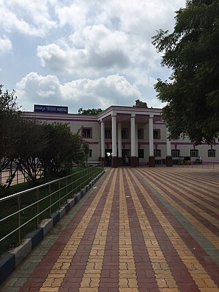
Nandyal, commonly called as Nandyala, is a city and the district headquarters of Nandyal district of the Indian state of the Andhra Pradesh. It is a Municipal corporation and the headquarters of Nandyal mandal in Nandyal revenue division.

Proddatur (1915) is a city in the YSR Kadapa District of Andhra Pradesh, located on the banks of the Penna River. The city is a municipality, and also the mandal headquarters of Proddatur mandal. It is the second-largest town in former Kadapa District. It is the oldest municipality which formed before Independence.

Markapuram is a town in Prakasam district of the Indian state of Andhra Pradesh. It is a municipality and is the headquarters of Markapuram Municipality in Markapuram revenue division. Markapuram is notable for the Chennakesava Swamy Temple, built by King Sri Krishnadevaraya. During Ratha Yatra there occurs a popular carnival; the town is also famous for Chenna Kesavaswamy on the day of Rathsapthami, which is attended by thousands of people coming from different parts of the state. It is the second-largest town in Prakasam district after Ongole and it is the main place within West Prakasam district to avail all facilities.
Narasaraopeta is a city and district headquarters of Palnadu District of the Indian state of Andhra Pradesh. The town is a municipality and mandal headquarters of Narasaraopet mandal and Headquarters of Narasaraopet revenue division. The town also is the seat of the court of Additional District Judge. Kotappakonda in Narasaraopeta was famous for Kotappakonda Tirunalla and is considered a holy place. The town is also referred as the 'Gateway of Palnadu'. The main offices of Nagarjuna Sagar Jawahar Canal Operation & Maintenance Lingamguntla Circle known as NSJC O&M Circle, Lingamguntla are located in this town.

Srisailam is a census town in Nandyal district of the Indian state of Andhra Pradesh. It is the mandal headquarters of Srisailam mandal in Atmakur revenue division. It is located about 160 kilometres (99 mi) from the district headquarters Nandyal, 180 kilometres (112 mi) from Kurnool, and it is located about 264 kilometres (164 mi) from Vijayawada. The town is famous for the Mallikarjuna Jyotirlinga Temple and is one of the holy pilgrimage sites for the Shaivism and Shaktism sects of Hinduism. The town is classified as both a Jyotirlinga and a Shakta pitha.

Tadipatri is a city in Anantapur district of the Indian state of Andhra Pradesh at the border of Nandyala district and Kadapa district. It is a Selection Grade Municipality City Council. Tadipatri is a headquarters of Tadipatri mandal in Anantapur revenue division. The Chintala Venkataramana Temple is located on a five-acre site in Tadipatri. The Bugga Ramalingeswara Temple is located one kilometer from the city, overlooking the Penna River.
Nandikotkur is a municipality and capital of Nandikotkur mandal in Nandyal district of Andhra Pradesh, India.

Dhone or Dronachalam is a town in Nandyal district of the Indian state of Andhra Pradesh. It is a municipality located in Dhone mandal, and it is the headquarters of Dhone revenue division.

Allagadda is a town in Nandyal district of the Indian state of Andhra Pradesh. It is located in Nandyal Revenue division. The town is located at 15°08′00″N78°31′00″E.
Sattenapalle is a town in Palnadu district of the Indian state of Andhra Pradesh. It is a municipality and the headquarters of Sattenapalle mandal under Sattenapalle revenue division. It is also part of APCRDA region.

Nagarkurnool district is a district in the southern region of the Indian state of Telangana. The town of Nagarkurnool is the district headquarters. It was part of the Mahbubnagar district prior to re-organisation of districts in the state. The district shares boundaries with Nalgonda, Rangareddy, Mahabubnagar, Wanaparthy districts and with the state boundary of Andhra Pradesh with Nandyal, Palnadu and Prakasam Districts.
Srisailam mandal is one of the 54 mandals in Nandyal district of the Indian state of Andhra Pradesh. It is under the administration of new formed Atmakur revenue division and the headquarters are located at Srisailam Project (RFC) Township.

Nandyal district is a district in the Indian state of Andhra Pradesh with Nandyal as its administrative headquarters, it was formed on 4 April 2022 to become one of the resultant 26 districts. It is part of the Rayalaseema region. The district consists of Nandyal revenue division and a newly formed Dhone revenue division and Atmakur revenue division from Kurnool district.

Atmakur revenue division is an administrative division in Nandyal district in the Indian state of Andhra Pradesh. It is one of the three revenue divisions in the district and has 10 mandals under its administration.


