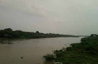
Banaganapalli is a town in the state of Andhra Pradesh, India. It lies in Nandyal district, 38 km west of the city of Nandyal. Banaganapalli is famous for its mangoes and has a cultivar, Banaganapalli, named after it. Between 1790 and 1948, Banaganapalli was the capital of the princely state of the same name, Banganapalle State.
Chicacao is a town and municipality in the Suchitepéquez department of Guatemala. It is situated at 600 metres above sea level. The town has a population of 26,309. Originally a German settlement, it is famous for a clock that is now over 100 years old.

Salur or Saluru is a municipal town and mandal headquarters in Parvathipuram Manyam district, of the Indian state of Andhra Pradesh.

Saroornagar is a neighbourhood in Hyderabad. It is located in the Rangareddy district of Indian state of Telangana. It is located in Saroornagar mandal of Kandukur revenue division. This circle (5) comes under L. B. Nagar of Greater Hyderabad Municipal Corporation. There are five wards in this circle namely Saroornagar (19), Rama Krishna Puram (20), Kothapet (21), Chaitanyapuri (22) and Gaddiannaram (23).
Mentada is a village in Vizianagaram district of the Indian state of Andhra Pradesh, India.
Kotabommali is a mandal in the Srikakulam district of the Indian state of Andhra Pradesh.

Udayagiri is a town in Udayagiri Mandal in the Nellore district of the state of Andhra Pradesh in India.
Baireddipalle is a Mandal in Palamaner Revenue Division and Chittoor district of the Indian state of Andhra Pradesh. It is the mandal headquarters of Baireddipalle mandal.
Somala is a small town in Chittoor district of the Indian state of Andhra Pradesh. It is the mandal headquarters of Somala mandal.

Koilakuntla is a town in Nandyal district of the Indian state of Andhra Pradesh. It is Head quarter of Koilakuntla mandal. It is in Dhone revenue division.
Devanakonda is a mandal in the Kurnool district of Andhra Pradesh, India. It comes under Adoni revenue division. It is under Alur M.L.A and Kurnool M.P constituencies. The Mandal contains 15 various villages.
Sivarampuram or Sivaramapuram is a village panchayat in Salur mandal of Parvathipuram Manyam district in Andhra Pradesh, India.
Sultanabad is a town in Sultanabad mandal of Peddapalli district in the state of Telangana, India. It was earlier known as Osmannagar.

Banganapalle State was one of the princely states of India during the period of the British Raj. The state was founded in 1665 and had its capital in Banganapalle. Its rulers were Shia Muslims and the last one signed the accession to the Indian Union on 23 February 1948.
Samsthan Narayanapur is a Mandal in Bhuvanagiri district of Telangana State, India. Narayanapur Mandal Headquarters is Narayanapur town. It belongs to Telangana region. It is located 39 km towards west from District headquarters Bhongir.

Udayagiri Assembly constituency is a constituency in Nellore district of Andhra Pradesh that elects representatives to the Andhra Pradesh Legislative Assembly in India. It is one of the seven assembly segments of the Nellore Lok Sabha constituency.
Mottu Palle is a village in Komarolu mandal Prakasam district of the Indian state of Andhra Pradesh. Mottu Palle is 9 km (5.6 mi) from Komarolu

Nandyal district is a district in the Indian state of Andhra Pradesh with Nandyal as its administrative headquarters, it was formed on 4 April 2022 to become one of the resultant 26 districts. It is part of the Rayalaseema region. The district consists of Nandyal revenue division and a newly formed Dhone revenue division and Atmakur revenue division from Kurnool district.

Yerragundla is a village midway between Kurnool and Kadapa on National Highway-40 in Sirivella mandal of Nandyal District of Andhra Pradesh, India.
Govindapalle is a village in Sirvella Mandal ofNandyal district of Andhra Pradesh, India.


