
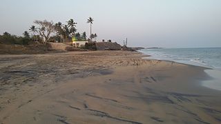
Odisha, formerly Orissa, is an Indian state located in south-eastern coastal India. It is the 8th largest state by area, and the 11th largest by population. The state has the third largest population of Scheduled Tribes in India.. It neighbors the states of West Bengal and Jharkhand to the north, Chhattisgarh to the west and Andhra Pradesh to the south. Odisha has a coastline of 485 kilometres (301 mi) along the Bay of Bengal. The region is also known as Utkala and is mentioned in India's national anthem, "Jana Gana Mana". The language of Odisha is Odia, which is one of Classical Languages of India.

Koraput is a district of India in southern Odisha, with headquarters at Koraput. The district is located in the Eastern Ghats and known for rich and diverse types of mineral deposits. It is a tribal dominated district, and the Desia dialect and culture is very different from the rest of the state.
Kendrapara District is an administrative district of Odisha state in eastern India. The town of Kendrapara is the district headquarters. Kendrapara District is situated in the eastern portion of the state, and is bounded on the north by Bhadrak District, on the east by the Bay of Bengal, on the south by Jagatsinghpur District, on the west by Cuttack District on the northwest by Jajpur District.

Gajapati is a district of Odisha, India. It was created from Ganjam District in October, 1992. Gajapati district was named after Maharaja Sri Krushna Chandra Gajapati Narayan Dev, the Raja Sahib of the Paralakhemundi estate, who is remembered for his contribution in the formation of a separate state, and inclusion of the Paralakhemundi estate in Odisha. The district headquarters at Paralakhemundi, formerly a princely estate, has been clustered within a radius of approximately 5 kilometers around the geometric centre of Paralakhemundi. The District is a part of the Red Corridor.

Dhenkanal District is an administrative division of Odisha, India.

Visakhapatnam District is one of the nine districts in the Coastal Andhra region of the Indian state of Andhra Pradesh, headquartered at Visakhapatnam. It is one of the nine coastal districts of the state, bounded by Odisha in the north, Vizianagaram district in the east, East Godavari district in the south-west and Bay of Bengal in the south.

Boudh District is an administrative and a municipal district, one of the thirty in the Odisha, India. The district headquarters of the Boudh District is the city of Boudh.

Anakapalle is a suburb of Visakhapatnam in the Indian state of Andhra Pradesh. The municipality was merged with Greater Visakhapatnam Municipal Corporation. It has the second largest jaggery market of the country.

Chatrapur is a town and a Municipality in Ganjam district in the state of Odisha, India. It is the district headquarters town of Ganjam district. Chhatrapur is a Tehsil / Block (CD) in the Ganjam District of Odisha. According to Census 2011 information the sub-district code of Chhatrapur block is 03085. Total area of Chhatrapur is 124 km2 (48 sq mi) including 119.92 km2 (46.30 sq mi) rural area and 4.40 km2 (1.70 sq mi) urban area. Chhatrapur has a population of 94,683 people. There are 20,415 houses in the sub-district. There are about 46 villages in Chhatrapur block
Dhenkanal is a town and a municipality in Dhenkanal district in the state of Odisha, India.
Byasanagar or Vyasanagar is a town and a municipality in Jajapur district in the state of Odisha, India. Colloquially it is also called Jajpur Road. It is home to an industrial belt and hosts several steel companies including Neelachal Ispat Nigam Limited, MESCO, Tata Steel, Jindal Steel etc. According to district officials there are around 14 major companies and several small companies in the vicinity. The city is also home to some eminent people in Odisha, including P. C. Ghadei, Late Ashok Das, Ram Chandra Khuntia (Congress) Priti Ranjan Ghadei (MLA), actor Akash Dasnayak, and his actress aunt the veteran Ms. Anita Dash, actress Naina Das, political leader Giridhari Barik (BJD). its come under the Korei vidhan shabha

Khallikote is a town and a Notified Area Council in Ganjam district in the Indian state of Odisha.
Kodala is a town and a Notified Area Council in Ganjam District in the Indian State of Odisha.
Pipili is a town and a NAC under jurisdiction of Puri district in the Indian state of Odisha. It is famous for designing beautiful Applique handicrafts. It is a town of artisans famous for their colourful fabrics.
Polasara is a town and a notified area council in Ganjam district in the Indian state of Odisha.

Kendujhar District, also known as Keonjhar District is an administrative district of Odisha. The district is one of the fifth Scheduled Areas of Odisha. The town of Kendujhar is the district headquarters. The district has 3 Sub-Divisions, Anandapur, Champua, and Keonjhar.
Lodhi is a Munda language, or dialect cluster, of India. Kharia Thar is only spoken by one quarter of ethnic Lodhi in Orissa. However, while admitting that Lodhi is related to Sora, a Munda language, Ethnologue classifies it as Indic (Bengali–Assamese), and it is considered a variety of Hindi in the Indian census. It may be that there are both Munda and Indic varieties subsumed under the name Lodhi.
Padmapur is a village in the Rayagada district of Odisha, India. It is the most populated village and one of the identified tourist centers of the district. A hillock adjoins the village to its northern side to enhance the scenic beauty of the place. A 7th century inscription found here, in the Nilakantheswar Temple, indicates that the Jagamanda hill, located close by, once housed the monastery of the famous Buddhist logician-philosopher Dharmakirti.
Turumunga is a village located in Patna Block of Kendujhar district in Odisha. The village has a population of 2164 of which 1117 are males while 1047 are females as per the Population Census 2011. The PIN Code of Turumunga is 758046.