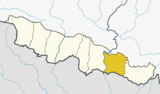
Arnama Lalpur is a village development committee in Siraha District in the Sagarmatha Zone of south-eastern Nepal. At the time of the 2011 Nepal census it had a population of 6841 people living in 1255 individual households.
Bastipur, Sagarmatha is a village development committee in Siraha District in the Sagarmatha Zone of south-eastern Nepal. At the time of the 2011 Nepal census it had a population of 6361 people living in 1158 individual households.
Belaha is a village development committee in Siraha District in the Sagarmatha Zone of south-eastern Nepal. At the time of the 2011 Nepal census it had a population of 6240 people living in 1036 individual households.
Balhi is a village development committee in Siraha District in the Sagarmatha Zone of south-eastern Nepal. At the time of the 2011 Nepal census it had a population of 4014 people living in 824 individual households.
Bhagawanpur is a Village Development Committee in Siraha District in the Sagarmatha Zone of south-eastern Nepal. At the time of the 1991 Nepal census it had a population of 2845 people residing in 455 individual households.
Bhagawatipur is a village development committee in Siraha District in the Sagarmatha Zone of south-eastern Nepal. At the time of the 2011 Nepal census it had a population of 4495 people living in 865 individual households.
Bhawanipur is a village development committee in Siraha District in the Sagarmatha Zone of south-eastern Nepal. At the time of the 2011 Nepal census it had a population of 5497 people living in 1092 individual households.
Bhawanpur Kalabanjar is a village development committee in Siraha District in the Sagarmatha Zone of south-eastern Nepal. At the time of the 2011 Nepal census it had a population of 3796 people living in 740 individual households.
Bishnupur Pra. Ma. is a village development committee in Siraha District in the Sagarmatha Zone of south-eastern Nepal. At the time of the 2011 Nepal census it had a population of 5208.
Bishnupur Pra. Ra. is a village development committee in Siraha District in the Sagarmatha Zone of south-eastern Nepal. At the time of the 2011 Nepal census it had a population of 5020.
Chandra Ayodhyapur is a village development committee in Siraha District in the Sagarmatha Zone of south-eastern Nepal. At the time of the 2011 Nepal census it had a population of 7211.
Chandralalpur is a village development committee in Siraha District in the Sagarmatha Zone of south-eastern Nepal. At the time of the 2011 Nepal census it had a population of 7211 people living in 1307 individual households.
Chatari is a village development committee in Siraha District in the Sagarmatha Zone of south-eastern Nepal. At the time of the 2011 Nepal census it had a population of 2711 people living in 485 individual households.
Chikana is a village development committee in Siraha District in the Sagarmatha Zone of south-eastern Nepal. At the time of the 1991 Nepal census it had a population of 3640 people living in 723 individual households.
Devipur is a village development committee in Siraha District in the Sagarmatha Zone of south-eastern Nepal. At the time of the 2011 Nepal census it had a population of 3981 people living in 761 individual households.
Maheshpur Patari is a village development committee in Siraha District in the Sagarmatha Zone of south-eastern Nepal. At the time of the 2011 Nepal census it had a population of 4396 people living in 753 individual households.

Bhokraha or Bhokraha Narsingh is a rural municipality (gaunpalika) out of six rural municipality located in Sunsari District of Province No. 1 of Nepal. There are a total of 12 municipalities in Sunsari in which 6 are urban and 6 are rural.
Bhagwanpur is a rural municipality in Siraha District in the Sagarmatha Zone of south-eastern Nepal. At the time of the 2011 Nepal census it had a population of 20957 people living.
Arnama is a rural municipality in Siraha District in the Sagarmatha Zone of south-eastern Nepal. At the time of the 2011 Nepal census it had a population of 22,912 people living.