Bhoom

Last updated

Bhoom
Bhum
town
India Maharashtra location map.svg
Red pog.svg
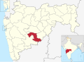
Bhoom
Location in Maharashtra, India
Coordinates: 18°27′35″N75°39′39″E / 18.45972°N 75.66083°E / 18.45972; 75.66083
CountryFlag of India.svg  India
State Maharashtra
District Osmanabad
Tahsil Bhoom
Population
 (2011)
  Total20,762
Languages
  Official Marathi
Time zone UTC+5:30 (IST)
PIN
413504
Telephone code912478
Vehicle registration MH25
Nearest cities Latur, Beed, Barshi and Solapur
Lok Sabha constituency Osmanabad
Vidhan Sabha constituency Paranda [1]

Bhoom is a town with a municipal council in Osmanabad district, Maharashtra, India, and it is the headquarters of Bhoom tahsil. Bhoom municipal corporation is established in 1948. Bhoom is a small town situated in a valley of the Banashankar hill ranges of Sahyadri. It is situated on the banks of the River Banaganga, which eventually flows into the Bhima. In 1717, Sambhaji II of Kolhapur gave Bhoom as jagir to Shrimant Senakhaskhel Yashwantrao Thorat (a chief and military leader of his troops) for his bravery. In 19th century Bhoom was under Nizam territory during the British raj in India. However it was independently ruled by the ' Thorat ' royal family. Shrimant Vijaysinh Amarsinh Thorat is the present head of Bhoom. He was the President of Bhoom Municipal Council from 1991 -2006.

Contents

History

At the starting of 17th century Bhoom was under Adilshah's territory. After 17th century it was under the Maratha Empire. In 1717 Sambhaji II of Kolhapur gave the Bhoom as Jagir to Shrimant Senakhaskhel Yashwantrao Thorat (a Chief and Military leader) for his bravery. He ruled Bhum till 1719. In 1719 he had died in a battle with Balaji Vishwanath near Panhala fort. After his death his ancestors ruled Bhoom till 15 August 1947.

Rulers of Bhoom

Shrimant Senakhaskhel Vijaysinh Thorat fourth ruler of the Bhoom Shrimant Senakhaskhel Vijaysinh Thorat - Fourth ruler of the Bhoom.jpg
Shrimant Senakhaskhel Vijaysinh Thorat fourth ruler of the Bhoom

Demographics

In the 2001 Indian census, Bhum Tahsil had a population of 116,894, with 60,620 (51.9%) males and 56,274 (48.1%) females, for a gender ratio of 928 females per thousand males. [2]

In the 2011 census, Bhum Tahsil had 137,217 inhabitants [3] and a gender ratio of 905 females per thousand males. [4] The tahsil was 86.4% rural. [3] The literacy rate in 2011 was 73.08% overall in Bhum Tahsil, with a rate of 82.86% for males and 62.45% for females. [5] In 2011 in Bhum Tahsil, 11.5% of the population was 0 to 6 years of age. In Bhoom City, since 21/07/2000 Hi-Infotech Computer Education Statred Computer Education—till today, there are approximately 10,000 students and employees who have successfully completed the Computer Course.

[3] Bhoom is divided into two areas, Kasba and Peth by the Banganga River. Kasba is the more traditional village type area with most of the people involved in farming. Peth is more cosmopolitan where people of various professions live together. At the end of the 20th century and the beginning of the 21st, Bhoom added more white collar jobs due to the educated peoples and new colonies near the college. Banganga and Ramganga dams provide water for drinking.

The residences places of Bhoom includes BIRBALE Galli, veer Sawarkar chowk Gandhi Chowk, Sambhaji Chowk, Maskar-Shendge Galli, Wadar Galli, Bagwan Galli, Nagoba Galli, Koshti Galli, Galib Nagar, Pardhi Pedhi, Ramhari Nagar, Kusum Nagar, Bhim Nagar, Shivaji Nagar and Samarth nagar, Farshi Galli, Lakshmi Nagar, Kasba. In Bhoom City Samarth Nagar is located in central city. Hi-Infotech Computer Education is started in 21-07-2000. Now 10000 + students successfully education MS-CIT.

Related Research Articles

<span class="mw-page-title-main">Bajirao I</span> Prime minister of the Maratha Empire (reigned 1720–40)

Bajirao I, born as Visaji, was the 7th Peshwa of the Maratha Confederacy.

<span class="mw-page-title-main">Miraj</span> City in Sangli District, Maharashtra State, India

Miraj is a city part of the Sangli metropolitan region in Sangli district, Maharashtra. Founded in the early 10th century. It was an important jagir of the Adil Shahi court of Bijapur.

<span class="mw-page-title-main">Satara (city)</span> City in Maharashtra, India

Satara is a city located in the Satara District of Maharashtra state of India, near the confluence of the river Krishna and its tributary, the Venna. The city was established in the 16th century and was the seat of the Chhatrapati of Maratha Empire, Shahu I.

<span class="mw-page-title-main">Osmanabad district</span> District of Maharashtra in India

Osmanabad District officially known as Dharashiv District, is an administrative district in the Marathwada region in the Indian state of Maharashtra. The district headquarter is located at Osmanabad. The District of Osmanabad derives its name from the last ruler of Hyderabad, the 7th Nizam, Mir Osman Ali Khan, of which the region was a part till 1947. This region was earlier part of The Hyderabad State until Independence.This primarily rural district occupies an area of 7,569 km2 (2,922 sq mi) of which 241.4 km2 (93.2 sq mi) is urban and has a population of 1,657,576 of which 16.96% were urban.

<span class="mw-page-title-main">Balaji Vishwanath</span> Peshwa of the Maratha Empire

Balaji Vishwanath Bhat (1662–1720) was the first of a series of hereditary Peshwas hailing from the Bhat family who gained effective control of the Maratha Empire and the Mughal vassals of the Marathas during the early 18th century. Balaji Vishwanath assisted a young Maratha king Shahu to consolidate his grip on a kingdom that had been racked by civil war and persistently intruded on by the Mughals under Aurangzeb. He was called the Second Founder of the Maratha State. He secured a grant from the Mughal court that confirmed Shahu as the legitimate Mughal vassal, at the expense of his rival Sambhaji. Later, his son Bajirao I became the Peshwa.

<span class="mw-page-title-main">Osmanabad</span> City in Maharashtra, India

Osmanabad, officially known as Dharashiv, is a city and a municipal council in Osmanabad district in the Indian state of Maharashtra. The city is the administrative headquarter of Osmanabad district. It is the seventh largest city in Marathwada, and the 39th largest city in Maharashtra by population.

Kurundwad is a town on the banks of the Panchganga river, 55 km from Kolhapur in the Indian state of Maharashtra.

<span class="mw-page-title-main">Chiplun</span> City in Maharashtra, India

Chiplun ( [t͡ʃipɭuːɳ]) is a city in Ratnagiri district in the state of Maharashtra, India. It is one of the financial and commercial Hubs of Ratnagiri district, and the headquarters of Chiplun taluka. It is about 250 km south of Mumbai and 90 km North of Ratnagiri in the Konkan region of Maharashtra, on the Mumbai–Goa highway (NH-66). It has a long history and a strong cultural background. Recent decades have seen much industrial development in it and its and surrounding areas.

Shirur is an administrative subdivision of the Pune district in the Indian state of Maharashtra. It is located on the eastern boundary of the district, on the banks of the Ghod River. The town is also called Ghodnadi to distinguish it from other locations that have the same name. Ghodnadi in Marathi Language means Ghod River.

Chakan is a census town in India, in Pune district of the Indian state of Maharashtra. While agriculture remains an important factor, the town's industrial development is quickly urbanizing the area. The Independent referred Chakan as India's "Motor City".

Atpadi is an administrative town of the Atpadi Taluka of Sangli District in the Indian state of Maharashtra. Atpadi is located north-east of Sangli District and shares borders with the adjacent Solapur and Satara Districts. The town has a taluka administrative office, a courthouse, a police station, a government-run primary hospital, various schools and colleges and a theater. Atpadi's economy is based on the cultivation and sale of agricultural products, with pomegranates and cotton constituting the core of the industry. The town is also home to the Manganga Sahakari Sugar factory, a Pomegranate auction center and various small scale industries in fields such as manufacturing, processing, servicing and repairs.

<span class="mw-page-title-main">Ramchandra Pant Amatya</span> Prime minister to Maratha King chatrapati Shivaji

Ramchandra Neelkanth Bawadekar (1650–1716), also known as Ramchandra Pant Amatya, served on the Council of 8 as the Finance Minister (Amatya) to Emperor (Chhatrapati) Shivaji, dating from 1674 to 1680. He then served as the Imperial Regent to four later emperors, namely Sambhaji, Rajaram, Shivaji II and Sambhaji II. He authored the Adnyapatra, a famous code of civil and military administration, and is renowned as one of the greatest civil administrators, diplomats and military strategists of the Maratha Empire.

<span class="mw-page-title-main">Latur</span> City in Maharashtra, India

Latur is a city in the Indian state of Maharashtra, and is one of the largest cities of the Marathwada region. It is the administrative headquarters of Latur district and Latur Taluka. The city is a tourist hub surrounded by many historical monuments, including Udgir Fort and Kharosa Caves. The people in Latur are called Laturkar. The most spoken language in Latur is Marathi. The city's quality of education attracts students from all over Maharashtra. It is a drought prone area with acute water shortage in its city and rural areas. The economy is agriculture intensive, but in recent years is also dependent on Educational sector & its allied activities. Industrial development is minimal in the district. Latur is 43 kilometers from the epicenter of the devastating 1993 Latur earthquake.

<span class="mw-page-title-main">Kolhapur State</span> Maratha princely state of India

Kolhapur State or Kolhapur Kingdom (1710–1949) was a Maratha princely State of India, under the Deccan Division of the Bombay Presidency, and later the Deccan States Agency. It was considered the most important of the Maratha principalities with the others being Baroda State, Gwalior State and Indore State. Its rulers, of the Bhonsle dynasty, were entitled to a 19-gun salute – thus Kolhapur was also known as a 19-gun state. The state flag was a swallow-tailed saffron pennant.

Walwa is a taluka in Sangli district in the Indian state of Maharashtra. It is also known as Walwa-Islampur Taluka. There are ninety-five panchayat villages in Walwa Taluka.

<span class="mw-page-title-main">Sangli State</span> Princely state of India

Sangli State was one of the 11-gun salute Maratha princely states of British India. It was under the Kolhapur-Deccan Residency in the Bombay Presidency, and later the Deccan States Agency.

Bhoom Tahsil is a tehsil in Osmanabad district, Maharashtra on the Deccan Plateau of India. The town of Bhoom is the administrative headquarters of the tahsil. There are seventy-four panchayat villages in Bhoom Tahsil. In 19th century Bhoom was under Nizam territory during the British raj in India. However it was independently ruled by the Thorat royal family. Shrimant Vijaysinh Amarsinh Thorat is the present head of Bhoom. He was the President of Bhoom Municipal Council from 1991 -2006.

Although a parliamentary democracy, Indian politics has increasingly become dynastic, possibly due to the absence of a party organization, independent civil society associations that mobilize support for the party, and centralized financing of elections. Family members have also led the Congress party for most of the period since 1978 when Indira Gandhi floated the then Congress(I) faction of the party. It also is fairly common in many political parties in Maharashtra. The dynastic phenomenon is seen from national level down to district level and even village level.The three-tier structure of Panchayati Raj established in the 1960s also helped to create and consolidate the dynastic phenomenon in rural areas. Apart from government,political families also control cooperative institutions, mainly cooperative sugar factories,district cooperative banks in the state, and since the 1980s private for profit colleges. The ruling Bharatiya Janata Party also features several senior leaders who are dynasts. In Maharashtra, the NCP has particularly high level of dynasticism.

<span class="mw-page-title-main">Ninam, Satara</span> Village in Maharashtra

Ninam is a census village in Satara district, in the Indian state of Maharashtra. It is a village surrounded by greenery and farms but also mountains. Agriculture is the main land use in the village with more than 75% of the total area being used for agricultural activities. The village close to historic Ajinkyatara fort, which is to the north. The large Jyotirlinga temple is in the center of the village.

<span class="mw-page-title-main">Yashwantrao Thorat</span> Military commander in 18th-century India (died 1979)

Yashwantrao Thorat or Yesaji was a military commander and the main supporter of Sambhaji II of Kolhapur from 1717 to 1719. Before 1717, he served Shahu for a brief period. After the battle of Vadgaon he changed the side and support the Sambhaji II. He had the title of 'Senakhaskhel'. He had jagir in the territory of Warana. He successfully launched many campaign against Shahu with the help of Udaji Chavan. Sambhaji II gave him the area of 9 lakh income as saranjam in Bijapur territory. In 1719, he died in the Battle of Panhala against Balaji Vishwanath. After his death his wife Godabai perform Sati.

References

  1. "Assembly Constituencies-Post delimitation: Maharashtra: Osmanabad District" (PDF). National Informatics Centre, Government of India. Archived from the original (PDF) on 5 May 2013.
  2. "Census 2001 Population Finder: Maharashtra: Osmanabad: Bhum". Office of The Registrar General & Census Commissioner, Ministry of Home Affairs, Government of India.
  3. 1 2 3 "Population, Child Population in the age-group 0-6 and Literates by residence and sex, State, Districts, Tahsils 2011: Maharashtra" (PDF). Press Information Bureau, Mumbai. p. 40.
  4. "Sex ratio of Population and Child Population in the age-group 0-6, State, Districts, Tahsils 2011: Maharashtra" (PDF). Press Information Bureau, Mumbai. p. 8.
  5. "Literacy rates by residence and sex, State, Districts, Tahsils 2011: Maharashtra" (PDF). Press Information Bureau, Mumbai. p. 17.