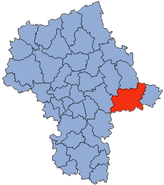
Siedlce County is a unit of territorial administration and local government (powiat) in Masovian Voivodeship, east-central Poland. It came into being on January 1, 1999, as a result of the Polish local government reforms passed in 1998. Its administrative seat is the city of Siedlce, although the city is not part of the county. The only town in Siedlce County is Mordy, which lies 18 km (11 mi) east of Siedlce.

Gmina Kotuń is a rural gmina in Siedlce County, Masovian Voivodeship, in east-central Poland. Its seat is the village of Kotuń, which lies approximately 14 kilometres (9 mi) west of Siedlce and 74 km (46 mi) east of Warsaw.
Stara Wieś is a village in the administrative district of Gmina Mordy, within Siedlce County, Masovian Voivodeship, in east-central Poland. It lies approximately 5 kilometres (3 mi) north-east of Mordy, 22 km (14 mi) east of Siedlce, and 107 km (66 mi) east of Warsaw.
Błogoszcz is a village in the administrative district of Gmina Siedlce, within Siedlce County, Masovian Voivodeship, in east-central Poland. It lies approximately 8 kilometres (5 mi) north-east of Siedlce and 94 km (58 mi) east of Warsaw.
Chodów is a village in the administrative district of Gmina Siedlce, within Siedlce County, Masovian Voivodeship, in east-central Poland. It lies approximately 7 kilometres (4 mi) north-west of Siedlce and 85 km (53 mi) east of Warsaw.

Golice is a village in the administrative district of Gmina Siedlce, within Siedlce County, Masovian Voivodeship, in east-central Poland. It lies approximately 7 kilometres (4 mi) north-east of Siedlce and 93 km (58 mi) east of Warsaw.
Grubale is a village in the administrative district of Gmina Siedlce, within Siedlce County, Masovian Voivodeship, in east-central Poland. It lies approximately 8 kilometres (5 mi) east of Siedlce and 95 km (59 mi) east of Warsaw.
Nowe Opole is a village in the administrative district of Gmina Siedlce, within Siedlce County, Masovian Voivodeship, in east-central Poland. It lies approximately 7 kilometres (4 mi) west of Siedlce and 81 km (50 mi) east of Warsaw.
Osiny is a village in the administrative district of Gmina Siedlce, within Siedlce County, Masovian Voivodeship, in east-central Poland. It lies approximately 11 kilometres (7 mi) east of Siedlce and 97 km (60 mi) east of Warsaw.

Pruszyn is a village in the administrative district of Gmina Siedlce, within Siedlce County, Masovian Voivodeship, in east-central Poland. It lies approximately 11 kilometres (7 mi) east of Siedlce and 97 km (60 mi) east of Warsaw.

Strzała is a village in the administrative district of Gmina Siedlce, within Siedlce County, Masovian Voivodeship, in east-central Poland.

Ujrzanów is a village in the administrative district of Gmina Siedlce, within Siedlce County, Masovian Voivodeship, in east-central Poland. It lies approximately 5 kilometres (3 mi) south-east of Siedlce and 91 km (57 mi) east of Warsaw.
Wólka Leśna is a village in the administrative district of Gmina Siedlce, within Siedlce County, Masovian Voivodeship, in east-central Poland. It lies approximately 11 kilometres (7 mi) east of Siedlce and 97 km (60 mi) east of Warsaw.
Żabokliki is a village in the administrative district of Gmina Siedlce, within Siedlce County, Masovian Voivodeship, in east-central Poland. It lies approximately 4 kilometres (2 mi) north-east of Siedlce and 90 km (56 mi) east of Warsaw.
Grodzisk is a village in the administrative district of Gmina Zbuczyn, within Siedlce County, Masovian Voivodeship, in east-central Poland. It lies approximately 3 kilometres (2 mi) south-west of Zbuczyn, 15 km (9 mi) south-east of Siedlce, and 99 km (62 mi) east of Warsaw.
Izdebki-Błażeje is a village in the administrative district of Gmina Zbuczyn, within Siedlce County, Masovian Voivodeship, in east-central Poland. It lies approximately 11 kilometres (7 mi) east of Zbuczyn, 23 km (14 mi) east of Siedlce, and 110 km (68 mi) east of Warsaw.
Izdebki-Kośmidry is a village in the administrative district of Gmina Zbuczyn, within Siedlce County, Masovian Voivodeship, in east-central Poland. It lies approximately 12 kilometres (7 mi) east of Zbuczyn, 25 km (16 mi) east of Siedlce, and 111 km (69 mi) east of Warsaw.
Izdebki-Wąsy is a village in the administrative district of Gmina Zbuczyn, within Siedlce County, Masovian Voivodeship, in east-central Poland. It lies around 10 kilometres (6 mi) east of Zbuczyn, 22 km (14 mi) east of Siedlce, and 108 km (67 mi) east of Warsaw.
Sobicze is a village in the administrative district of Gmina Zbuczyn, within Siedlce County, Masovian Voivodeship, in east-central Poland. It lies approximately 14 kilometres (9 mi) east of Zbuczyn, 26 km (16 mi) east of Siedlce, and 113 km (70 mi) east of Warsaw.
Tchórzew is a village in the administrative district of Gmina Zbuczyn, within Siedlce County, Masovian Voivodeship, in east-central Poland. It lies approximately 6 kilometres (4 mi) east of Zbuczyn, 18 km (11 mi) south-east of Siedlce, and 104 km (65 mi) east of Warsaw.
