Bihanga

Last updated

Bihanga
Uganda location map.svg
Red pog.svg
Bihanga
Map of Uganda showing the location of Bihanga.
Coordinates: 00°04′40″N30°36′35″E / 0.07778°N 30.60972°E / 0.07778; 30.60972 Coordinates: 00°04′40″N30°36′35″E / 0.07778°N 30.60972°E / 0.07778; 30.60972
Country Uganda
District Ibanda District
Elevation
1,198 m (3,930 ft)
Time zone UTC+3 (EAT)

Bihanga is a settlement in Ibanda District in the Western Region of Uganda. [1] It is the location of the headquarters of Bihanga Parish, Nyamarebe sub-county. [2]

Contents

Location

Bihanga is approximately 81 kilometres (50 mi), by road, north of Ibanda, the largest town in Ibanda District and the location of the district headquarters. [3] This is about 154 kilometres (96 mi), north of Mbarara, the largest town in the Western Region of Uganda. [4] Bihanga is approximately 303 kilometres (188 mi), by road, southwest of Kampala, Uganda's capital and largest city. [5]

The geographical coordinates of Bihanga are:0°04'40.0"N, 30°36'35.0"E (latitude:0.077778; longitude:30.609722). [6] The settlement is located at an average elevation of 1,198 metres (3,930 ft), above sea level. [7]

Overview

Bihanga lies on the old, dysfunctional metre-gauge railway, from Kampala to Kasese, that was built by the British colonialists in the 1950s. [7] The location is also on the plans for the planned Uganda Standard Gauge Railway (Uganda SGR). The KampalaMpondwe Section or the Western Line of the Uganda SGR, intersects with the Bihanga–Mirama Hills Section or the Southwestern Line of the Uganda SGR, at Bihanga. [8]

Bihanga is also the location of Bihanga Military Training School, one of the military schools in Uganda, owned and operated by the Uganda People's Defense Force. [9] [10] [11]

Bihanga is located near Rwamwanja Refugee Settlement, approximately 13 kilometres (8 mi), by road, north of town. [12] The town is served by Rwamwanja Health Centre III, administered by the Ibanda District Administration. [13]

Other points of interest nearby, include: [13] (a) Katonga Wildlife Reserve and (b) Katonga River, as it flows westwards from the game reserve into Lake George. [13]

As part of Bihanga Military Training School (Bihanga Training Camp), the European Union built Bihanga Airfield, a combined military and civilian airstrip for use by the military and by local administrators. [14] The airstrip can be clearly seen on this map, south of the red arrow. [6]

See also

Related Research Articles

Kamwenge District District in Uganda

Kamwenge District is a district in Western Uganda. It is named after its 'chief town', Kamwenge, where the district headquarters are located. Kamwenge District is part of the Kingdom of Toro, one of the ancient traditional monarchies in Uganda. The kingdom is coterminous with Toro sub-region. The districts that constitute the sub-region are: (a) Bunyangabu District (b) Kabarole District (c) Kamwenge District (d) Kyegegwa District (e) Kitagwenda District and (f) Kyenjojo District.

Ibanda Place in Ibanda District

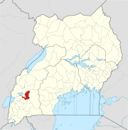
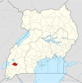
Ibanda is a town in the Western Region of Uganda. It is the main political, administrative, and commercial centre of Ibanda District and the site of the district headquarters. It started wayback in 1990s and was elevated from a trading centre to a town board, town council and in 2016 it was granted a Municipality status. The Municipal Council has three Divisions of Kagongo, Bisheshe and Bufunda with 21 wards of Kyaruhanga, Bufunda, Nyamirima, Nsasi, Kayenje, Kashangura, Rwenshuri, Kigarama, Rugazi, Rwobuzizi, Kakatsi, Bugarama, Karangara, Kabaare, Kanyansheko,Nyakatookye, Kyeikucu, Kikoni, Kagongo,Ruyonza and Katongore ward. Ibanda Municipal Council has over 230 villages. Ibanda Municipal council commenced its operations on 1 July 2016 after being elevated from a Town Council and other sub counties that were annexed to..

Mbarara Regional Referral Hospital, commonly known as Mbarara Hospital, is a hospital in Mbarara in the Western Region of Uganda. It is the referral hospital for the region and specifically for the districts of Mbarara, Bushenyi, Ntungamo, Kiruhura, Ibanda, and Isingiro. The hospital serves as the teaching hospital for the Mbarara University of Science and Technology.

Lweeza Place in Central Region, Uganda

Lweeza, also Lweza, is a neighborhood in the Buganda Region of Uganda. The correct phonetic spelling consistent with the local Ganda language is Lweeza.

Buhweju District District in Uganda

Buhweju District is a district in Western Uganda. It is one of the districts that constitute the Ankole sub-region. Its 'chief town', is Nsiika.

The Nyakahita–Kazo–Kamwenge–Fort Portal Road is a road in the Western Region of Uganda, connecting the towns of Nyakahita and Kazo in Kiruhura District, Ibanda in Ibanda District, Kamwenge in Kamwenge District, and Fort Portal in Kabarole District.

Nyakahita Place in Western Region of Uganda

Nyakahita is a sparsely populated settlement in the Western Region of Uganda.

Kazo, Uganda Place in Western Region

Kazo is a town in the Western Region of Uganda.

Kimwanyi Place in Wakiso District, Uganda

Kimwanyi is a neighborhood in Kira Municipality, Wakiso District, in the Buganda Region of Uganda. Kimwanyi also refers to Kimwanyi Parish, in Kira sub-county, Kyaddondo County, Wakiso District. It is one of the six parishes (wards) of Kira Municicipality, namely; Kimwanyi, Kira, Kyaliwajjala, Kireka, Bweyogerere and Kirinnya.

The Masaka–Mbarara Road is a road in the Central and Western Regions of Uganda, connecting the cities of Masaka in Masaka District, Central Region and Mbarara in Mbarara District, Western Region.

Mateete Place in Uganda

Mateete is a town in the Central Region of Uganda.

Rubanda Place in Western Uganda, Uganda

Rubanda is a town in the extreme southwest of the Western Region of Uganda. It serves as the commercial, political and administrative center of Rubanda District.

Mparo, Rukiga Place in Western Uganda, Uganda

Mparo is a town in the Western Region of Uganda. It is the political and administrative center of Rukiga District. However, the largest town in the district and its major commercial center is Muhanga.

Ibanda University (IU) is a private, co-educational Ugandan university in the Western Region of Uganda.

Nkenda Place in Western Uganda, Uganda

Nkenda is a hill in Kasese District in the Western Region of Uganda. The name is also applied to the settlement at the bottom of that hill.

The Uganda Standard Gauge Railway is a planned railway system linking the country to the neighboring countries of Kenya, Rwanda, Democratic Republic of the Congo and South Sudan. The new Standard Gauge Railway (SGR), is intended to replace the old, inefficient metre-gauge railway system.

Mbalwa Place in Central Region of Uganda, Uganda

Mbalwa is a neighborhood in Kyaliwajjala Parish, Kira Municipality, Wakiso District in the Central Region of Uganda.

Lorengecora Place in Napak District, Uganda

Lorengecora is a settlement in the Northern Region of Uganda. It is the headquarters of Lorengecora Parish, in Iriri sub-county, in Bokora County, in Napak District, in the Karamoja sub-region.

Kijabijo Place in Buganda, Uganda

Kijabijo is a neighborhood in Kira Town, in Wakiso District in the Buganda Region of Uganda.

Lwensinga Place in Lwengo District, Uganda

Lwensinga is a town in the Buganda Region of Uganda.

References

  1. National Geospatial-Intelligence Agency (16 July 2018). "Geographical Names: Bihanga, Uganda". Bethesda, Maryland, USA: Geographic.Org Quoting National Geospatial-Intelligence Agency . Retrieved 16 July 2018.
  2. LCMT.Com (16 July 2018). "Bihanga Parish, Nyamarebe sub-county, Ibanda District, Western Region, Uganda" (Includes A Map). LCMT.Com. Retrieved 16 July 2018.
  3. Globefeed.com (16 July 2018). "Distance between Ibanda, Uganda and Bihanga, Uganda". Globefeed.com. Retrieved 16 July 2018.
  4. Globefeed.com (16 July 2018). "Distance between Main Post Office, Mbarara, Uganda and Bihanga, Uganda". Globefeed.com. Retrieved 16 July 2018.
  5. "Distance between Uganda Post Office, Kampala Road, Kampala, Uganda and Bihanga, Uganda". Globefeed.com. 16 July 2018. Retrieved 16 July 2018.
  6. 1 2 Google (16 July 2018). "Location of Bihanga, Ibanda District, Western Region, Uganda" (Map). Google Maps . Google. Retrieved 16 July 2018.
  7. 1 2 Mapcarta.com (16 July 2018). "Elevation of Bihanga, Ibanda District, Western Region, Uganda, East Africa, Africa". Mapcarta.com. Retrieved 16 July 2018.
  8. Muhame, Giles (5 November 2016). "Standard Gauge Railway to Save Uganda USD 2 Billion Annually". Kampala: Chimp Reports Uganda.
  9. Njoroge, John (15 December 2010). "1000 TFG Somali Soldiers Passed Out At Bihanga Military Training School". Daily Monitor . Kampala. Retrieved 16 July 2018.
  10. Reuters Staff (23 January 2017). "Uganda says returns detained former Congo rebels to military camp". London: Reuters.com . Retrieved 16 July 2018.
  11. Robert Muhereza, and Albert Tumushabe (22 January 2017). "M23 men back at Bihanga barracks, army say". Daily Monitor . Kampala. Retrieved 16 July 2018.
  12. Globefeed.com (16 July 2018). "Distance between Bihanga, Uganda and Rwamwanja Refugee Settlement, Uganda". Globefeed.com. Retrieved 16 July 2018.
  13. 1 2 3 Google (16 January 2018). "Map Showing Bihanga (Red Arrow), Katonga Game Reserve, Katonga River And Rwamwanja Refugee Settlement" (Map). Google Maps . Google. Retrieved 16 January 2018.
  14. Ssengendo, Abdulkarim (16 October 2010). "Uganda: Ibanda Airfield Complete". New Vision via AllAfrica.com . Kampala. Retrieved 16 July 2018.