Bilk

Last updated • 3 min readFrom Wikipedia, The Free Encyclopedia
Map of Dusseldorf, showing Bilk (in red) within Borough 3 (in pink) Dusseldorf Stadtteil Bilk.svg
Map of Düsseldorf, showing Bilk (in red) within Borough 3 (in pink)

Bilk is a quarter ( Stadtteil ) of Düsseldorf. Together with Oberbilk, Unterbilk, Hamm, Flehe and Volmerswerth it constitutes Borough 3, which is the most populous borough of Düsseldorf. Bilk has an area of 6.07 km2 (2.34 sq mi), [1] and 41,150 inhabitants (2020). [2] Heinrich-Heine-University is in Bilk.

Contents

History

Old Saint Martin Church Duesseldorf Alt St Martin 1.jpg
Old Saint Martin Church
Observatory (Bilker Sternwarte) Bst-dist.jpg
Observatory (Bilker Sternwarte)

The first documentary mention of Bilk is in the year 799. The Old Church is older and seems to be from about 700 A.D., given by Saint Suitbert, but was destroyed by fire about 900, and is mentioned in 1019 for the first time. During the following centuries, the church was reconstructed frequently, especially in the 12th century and the 17th century.

Until the year 1206 the fishing settlement dusseldorp, located to the North of Bilk, belonged to the Bilk parish. After August 14 of 1288 (the Battle of Worringen) Düsseldorf got City Rights, the Old Bilk Church became a city church. In 1380 the County of Berg became the Duchy of Berg, Düsseldorf the capital of a duchy. In 1384 the village of Bilk (south of the Old Bilk Church, which belonged to Düsseldorf from beginning) became part of the city of Düsseldorf.

Starting in 1852 in the South of Düsseldorf there was a growth of factories during the Industrial Revolution. Düsseldorf grew to the south and the traditionally industrial centres of the city are still there today. In 1893 the Hammer Eisenbahnbrücke - a railway bridge across the river Rhine - was finished. Bilk got its own railway station, which today is only a station for regional trains. The Bilk Observatory was founded in 1843 and destroyed by bombing in 1943. In 1852 24 asteroids were found there, called the 24 Düsseldorf planets. The New Harbour of Düsseldorf was built between 1890 and 1896, but after a steel factory closed its production, the port losts its importance. In 1990 a great part of it was closed and filled in. The media industry settled on this land and a cultural centre grew. In 1999 the Gehry buildings completed the new assemble.

Infrastructure

Düsseldorf-Bilk station is now served only by the Rhine-Ruhr S-Bahn (slow regional trains) and is connected by the lines S 8, S 11 and S 28 to Neuss, Mönchengladbach, Kaarst, Wuppertal, Hagen, Erkrath, Mettmann, Dormagen, Cologne and other parts of Düsseldorf (Central station, Düsseldorf-Gerresheim,...).

Tram lines connect Bilk with the central district of Düsseldorf and a lot of other districts, especially with the south of the city, Neuss, Ratingen, and the university. Also, bus lines connect Bilk with other parts of the city and the neighboring towns.

Buildings and attractions

Saint Martin St. Martin in Duesseldorf-Bilk, von Suedwesten.jpg
Saint Martin

Famous people who lived in Bilk

Literature

Related Research Articles

<span class="mw-page-title-main">Gerresheim</span> City district of Düsseldorf, Germany

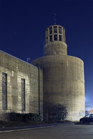
Gerresheim is one of the City of Düsseldorf, Germany's fifty quarters. Part of Borough 7, it is located in the eastern part of the municipality. Gerresheim is much older than Düsseldorf itself, having been an independent city with a rich history for over 1,000 years. Gerresheim merged voluntarily with Düsseldorf in 1909.

<span class="mw-page-title-main">Altstadt (Düsseldorf)</span> Quarter of Düsseldorf, Germany

The Altstadt is one of the 50 quarters of Düsseldorf, Germany; it belongs to central Borough 1. The Düsseldorfer Altstadt is known as "the longest bar in the world", because the small Old Town has more than 300 bars and discothèques; supposedly, each establishment's bar-counter connecting to one next door.

<span class="mw-page-title-main">Düsseldorf-Rath</span> City district of Düsseldorf, Germany

Rath is a quarter in northern Düsseldorf, part of Borough 6. It is about 5 km northeast of the city center, near the airport. It has an area of 10.42 km2 (4.02 sq mi), and 20,483 inhabitants (2020).

<span class="mw-page-title-main">Düsseldorf-Benrath</span> Quarter of Düsseldorf in North Rhine-Westphalia, Germany

Benrath is a quarter of Düsseldorf in the south of the city, part of Borough 9. It has been a part of Düsseldorf since 1929. Benrath has an area of 5.99 km2 (2.31 sq mi), and 17,178 inhabitants (2020).

<span class="mw-page-title-main">Heerdt</span> City district of Düsseldorf, Germany

Heerdt is one of the older quarters of the city of Düsseldorf, part of Borough 4. Heerdt and its neighbouring quarters Oberkassel, Niederkassel and Lörick lie on the left side of the river Rhine, opposite to the other districts of Düsseldorf and the central district. Heerdt has an area of 4.05 km2 (1.56 sq mi), and 12,395 inhabitants (2020).

<span class="mw-page-title-main">Flehe</span> City district of Düsseldorf, Germany

Flehe is a part of Düsseldorf, Germany, that lies directly on the river Rhine and is bordered by Volmerswerth, Himmelgeist and Bilk. It is part of Borough 3. It has an area of 1.99 km2 (0.77 sq mi), and 2,759 inhabitants (2020).

<span class="mw-page-title-main">Volmerswerth</span> City district of Düsseldorf, Germany

Volmerswerth is a Stadtteil (quarter) in western Düsseldorf, Borough 3, by the river Rhine. It borders the quarters Hamm, Bilk and Flehe. It has an area of 2.22 km2 (0.86 sq mi), and 2,336 inhabitants (2020).

<span class="mw-page-title-main">Düsseldorf-Hamm</span> Stadtteil of Düsseldorf in North Rhine-Westphalia, Germany

Hamm is an urban quarter of Düsseldorf, part of Borough 3. Hamm is located on the river Rhine, adjacent to the boroughs of Bilk, Volmerswerth, and the central harbour of Düsseldorf. It has an area of 4.10 km2 (1.58 sq mi), and 4,518 inhabitants (2020).

<span class="mw-page-title-main">Wersten</span> Stadtteil of Düsseldorf in North Rhine-Westphalia, Germany

Wersten is a quarter (Stadtteil) of Düsseldorf located in Borough 9 of the city. It is south of Eller and Oberbilk, east of Bilk, and north of Holthausen. It has an area of 4.42 km2 (1.71 sq mi), and 27,151 inhabitants (2020). It has been a part of Düsseldorf since 1909.

<span class="mw-page-title-main">Düsseldorf-Friedrichstadt</span> City district of Düsseldorf, Germany

Friedrichstadt is an urban quarter of Düsseldorf, part of Borough 3. It is south of the city centre of Düsseldorf, north of Bilk, west of Oberbilk, and east of Unterbilk. Friedrichstadt has an area of 1.00 km2 (0.39 sq mi), and 19,607 inhabitants (2020).

<span class="mw-page-title-main">Düsseldorf-Hafen</span> Stadtteil of Düsseldorf in North Rhine-Westphalia, Germany

Düsseldorf-Hafen is an urban quarter of Düsseldorf, Germany, part of Borough 3, located on the river Rhine and the location of the city's docks.

<span class="mw-page-title-main">Düsseldorf-Holthausen</span> Stadtteil of Düsseldorf in North Rhine-Westphalia, Germany

Holthausen is an urban quarter of Düsseldorf, part of Borough 9. It is located south of Oberbilk, west of Reisholz, north of Benrath and east of Itter and Himmelgeist. A natural border is the river Rhine. It has an area of 5.35 km2 (2.07 sq mi), and 12,775 inhabitants (2020).

<span class="mw-page-title-main">Oberbilk</span> City district of Düsseldorf, Germany

Oberbilk is an inner-city urban quarter in the south-east of the German city of Düsseldorf. The back exit of the Central Station leads to Oberbilk. The new District Court of Düsseldorf is located in Oberbilk since 2010, as is the main office of the Communal Library of Düsseldorf. Oberbilk is also home to the Mitsubishi Electric Halle, a concert arena with a capacity for 7,500.

<span class="mw-page-title-main">Unterbilk</span> City district of Düsseldorf, Germany

Unterbilk is an urban quarter in Borough 3 of the North Rhine-Westphalia state capital Düsseldorf. It is the seat of the Landtag of North Rhine-Westphalia, the Rheinturm tower and, together with the Düsseldorf docks is the centre of the media industry in Düsseldorf.

<span class="mw-page-title-main">Borough 1 (Düsseldorf)</span> Borough of Düsseldorf in North Rhine-Westphalia, Germany

Borough 1 is the central borough of Düsseldorf, the state capital of North Rhine-Westphalia, Germany and the city's commercial and cultural center. The borough covers an area of 11.31 square kilometres and has about 86,000 inhabitants.

<span class="mw-page-title-main">Borough 3 (Düsseldorf)</span> Borough of Düsseldorf in North Rhine-Westphalia, Germany

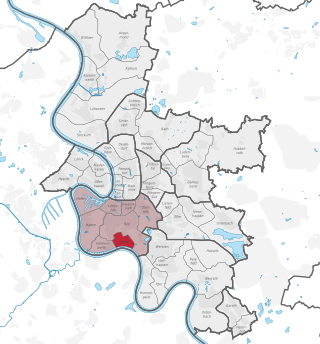
Borough 3 is a central borough of Düsseldorf, the state capital of North Rhine-Westphalia, Germany and the city's most populous and one of its most diverse boroughs.

<span class="mw-page-title-main">Borough 4 (Düsseldorf)</span> Borough of Düsseldorf in North Rhine-Westphalia, Germany

Borough 4 is a borough of Düsseldorf, the state capital of North Rhine-Westphalia, Germany. It covers an area of 12.62 square kilometres and has about 45,000 inhabitants (2020).

<span class="mw-page-title-main">Borough 5 (Düsseldorf)</span> Borough of Düsseldorf in North Rhine-Westphalia, Germany

Borough 5 is a northern borough of Düsseldorf, the state capital of North Rhine-Westphalia, Germany. Düsseldorf's International Airport is located in the borough. It is the largest borough by land area, but also the least populated. The borough covers an area of 50.75 square kilometres and has about 34,500 inhabitants.

<span class="mw-page-title-main">Borough 9 (Düsseldorf)</span> Borough of Düsseldorf in North Rhine-Westphalia, Germany

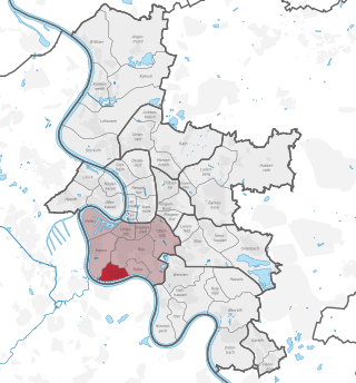
Borough 9 is a southern borough of Düsseldorf, the state capital of North Rhine-Westphalia, Germany. The borough covers an area of 36.57 square kilometres and has approximately 94,000 inhabitants, making it the city's second most populous borough after Borough 3.

<span class="mw-page-title-main">Bombing of Düsseldorf in World War II</span>

During World War II, Düsseldorf was heavily destroyed by Allied aerial bombardment. The most severe attack occurred on June 12, 1943, when a firestorm was ignited through targeted bombing by the British Royal Air Force, largely destroying the historical city center, downtown, and other adjacent neighborhoods.

References

  1. "Stadtgebietsprofile - Stadtbezirke und Stadtteile 03 Geografie" (PDF). Landeshauptstadt Düsseldorf. Retrieved 4 November 2022.
  2. "Stadtgebietsprofile - Stadtbezirke und Stadtteile 05 Bevölkerung" (PDF). Landeshauptstadt Düsseldorf. Retrieved 4 November 2022.

51°12′09″N6°46′47″E / 51.20250°N 6.77972°E / 51.20250; 6.77972