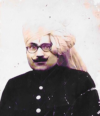
Etawah, also known as Ishtikapuri, is a city on the banks of Yamuna River in the state of Western Uttar Pradesh in India. It is the administrative headquarters of Etawah District. Etawah's population of 256,838 makes it the 180th most populous city in India. The city lies 300 km (190 mi) southeast of the national capital New Delhi, 230 km (140 mi) northwest of the state capital Lucknow, 120 km east of Agra and 140 km west of Kanpur. The city was an important centre for the Indian Rebellion of 1857. It is also the sangam or confluence of the Yamuna and Chambal rivers. It is the 26th most populous city in Uttar Pradesh.

Marwar is a region of western Rajasthan state in North Western India. It lies partly in the Thar Desert. The word 'maru' is Sanskrit for desert. In Rajasthani languages, "wad" means a protected area. English translation of the word 'marwar' is the region protected by desert.

Kurmi is traditionally a non-elite tiller caste in the lower Gangetic plain of India, especially southern regions of Awadh, eastern Uttar Pradesh and parts of Bihar. The Kurmis came to be known for their exceptional work ethic, superior tillage and manuring, and gender-neutral culture, bringing praise from Mughal and British administrators alike.

The Gahadavala dynasty also Gahadavalas of Kannauj was a Rajput dynasty that ruled parts of the present-day Indian states of Uttar Pradesh and Bihar, during 11th and 12th centuries. Their capital was located at Banaras in the Gangetic plains, and for a brief period, they also controlled Kannauj.

The Kachhwaha, or Kachhawa is a Rajput clan found primarily in India.
Auraiya is a city and a municipal board in Auraiya district in the state of Uttar Pradesh, India. NH 19 passes through the center of the town. Phaphund is the nearest railway station and Saifai Airstrip the nearest aviation facility, having limited private use. Etawah Safari Park is the nearest lion safari park. The nearest commercial airport is Kanpur Airport. Before becoming the district headquarters, it was the tehsil headquarters of Etawah district. This district is under Kanpur Mandal. [1] [2] [3] This is the heroic place of Sengar Rajputs. Sengar dynasty Kanardhani Maharajadhiraj Vishok Dev was married to Devkala, sister of Maharaja Jaichand Gaharwar (Rathore) of Kannauj. He had received this entire area in dowry. The famous Devkali Temple here was also built by him in the name of his wife Devkali. There are many famous villages of Kshatriya in which Ayana, Bhartaul, Jaswantpur, Bhurepur Kalan, Bhurepur Khurd, Sikharna, Fareha, Anepur, Senganpur, Barbatpur, Roshangpur, Manpur, Bhaupur, keontra, Phaphund, Aseva,Shahbadiya are very famous villages.
Chhibramau is a nagar palika parishad and a subdivision (tehsil) of Kannauj district in the northern state of Uttar Pradesh, India.
Sengar, also known as Sanghar, Singraur or Songar, are a king of Rajputs in India.
Dhadhor is a clan of inferior Ahirs and they are reckoned in the Tushreeh-ul-akwam amongst the Doab Ahirs.
General Nawab Khair Andesh Khan Kamboh was son of Nawab Muhabbat Khan. He was the most noted member of the illustrious family of the Kamboh Nawabs of Meerut and flourished during the reign of Shah Jehan and Aurangzeb.
Maharaja Ahibaran was a legendary Indian king (Maharaja) of Baran, a city of traders. Maharaja Ahibaran was born on 26 December.
Dor Rajput are a Chandarvanshi Rajput clan of India.

Auraiya district is one of the districts of Uttar Pradesh state of India, and Auraiya town is the district headquarters. It lies on the south-western portion of Uttar Pradesh and also forms a part of the Kanpur Division.

The Lodhi is a community of agriculturalists, found in India. There are many in Madhya Pradesh, to where they had emigrated from Uttar Pradesh. The Lodhi are categorised as an Other Backward Class, but claim Rajput ties and prefer to be known as "Lodhi-Rajput", although they have no account of their Rajput origin or prevailing Rajput traditions.
Badshapur is one of the 4 sub-division of Gurugram district of Haryana state, situated on the Gurugram-Sohna road (NH-248A). It is named after the Badshahpur Fort, which in turn was the abode of the wife of Mughal Emperor Bahadur Shah Zafar. Badshahpur is a part of Badshahpur assembly constituency of Haryana having majority of Rao Sahabs/Ahirs.

Rao Raj Kunwar Singh was a noted zamindar, known as Raja of Barauli Rao and member of legislative assembly in British India.
Raja Mir Syed Muhammad Baquar Ali Khan Bahadur (1842–1902) C.I.E., The Mir of Kotaha and the Raja of Morni and Pindrawal, was a noted zamindar and philanthropist from Morni who lived in Pindrawal in United Province of British India.
Bahreliya, also called Barholia, Bahrauliya or Bahrela) is a Rajput clan, found in and around the Barabanki district in the Indian state of Uttar Pradesh.
Bhojpur uprising refers to the class conflict manifested in armed uprising of the 1970s, that took place in the various villages of the Bhojpur district of Bihar. These clashes were part of the Naxalite-Maoist insurgency in the state, which mobilised the agricultural labourers and the poor peasants against the landlords, primarily belonging to upper-castes. A distinguished feature of these insurgencies were their confinement to the villages, and the nine towns of the Bhojpur district remained unaffected from the periodic skirmishes between the armed groups. One of the reason sought for this peculiar feature is the absence of modern industries in the district. The economy of the district was primarily agrarian, and the industrial proletariat class was absent.


