Ghumthang is a village in Sindhupalchok District in the Bagmati Zone of central Nepal. At the time of the 1991 Nepal census it had a population of 3975 and had 760 houses in the village.
Uiya is a village development committee in Gorkha District in the Gandaki Zone of northern-central Nepal. At the time of the 1991 Nepal census it had a population of 1,728 and had 382 houses.
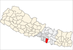
Subbagaun is a village development committee in Kabhrepalanchok District in the Bagmati Zone of central Nepal. At the time of the 1991 Nepal census it had a population of 3885 in 711 individual households.
'Amritganj' is a Municipality in Bara District in the Narayani Zone of south-eastern Nepal. At the time of the 2011 Nepal census it had a population of 9,133 persons living in 1466 individual households. There were 4,609 males and 4,524 females at the time of census.
Thaprek is a Village Development Committee in Nuwakot District in the Bagmati Zone of central Nepal. At the time of the 1991 Nepal census it had a population of 3585 people residing in 632 individual households.
Deurali, Tanahu is a village development committee in Tanahu District in the Gandaki Zone of central Nepal. At the time of the 1991 Nepal census it had a population of 2910 people living in 44 individual households.
Hariharpur Harinagari is a village development committee in Mahottari District in the Janakpur Zone of south-eastern Nepal. At the time of the 1991 Nepal census it had a population of 5223 people living in 1030 individual households.
Pashupatinagar is a Bardibas-9 municipality in Mahottari District in the Janakpur Zone of south-eastern Nepal. At the time of the 1991 Nepal census it had a population of 3,241 people living in 561 individual households. Pashupatinagar is situated 10 kilometers south of bardibas. Pashupatinagar produces maize consistent with agricultural production in the rest of the Terai Region. In pashupatinagar few 100 years ago there is only few home and lot of forest so, this village was called jhakhuletol and many monkeys are in Pashupatinagar forest so this village was called Bandra. There is one government school, shree rastriya higher secondary school banarjhulla-2. There is one police post which is in ward no.2. In pashupatinagar there is Mahato caste, including yadav, Sah, chamar, magar. There is one market in pathalaiya Bazar which is situated in ward number 9. There is only one source of water, which dries in the months of chait, baishakh and jestha.

Sithdipur is a village development committee in Udayapur District in the Sagarmatha Zone of south-eastern Nepal. At the time of the 1991 Nepal census it had a population of 2606 people living in 459 individual households.
Pipaladi is a village development committee in Kanchanpur District in Sudurpashchim Pradesh of south-western Nepal. At the time of the 1991 Nepal census it had a population of 11,071 people living in 1739 individual households.
Bhalohiya is a village development committee (VDC) in Rautahat District in the Narayani Zone of south-eastern Nepal. At the time of the 2011 Nepal census, it had a population of 4,877 people living in 805 individual households. Most of the people living in this village belong to the caste of Bhumihar (brahamins) called Pandey and other like sah, mahato and few thakur and jha. People are mainly involved in business, teacher and are in Nepal police. It is situated at the bank of the river Bagmati and is 13 km from Gaur and 3 km from sukdev chok. Recently, a private school called DH Academy had been established in order to provide a better facility and to improve and give quality education in VDC, so that people from this and from some other VDCs nearby should not send the children to study outside the district. A bachelor-degree level campus, called bagmati bahumukhi campus, is in this VDC. The village is facilitated with good health facilities with some of the private clinics and a hospital. There are pitch roads connecting the different places of the village. This VDC is facilitated with drinking water. Recently, CA of rautahat 1 madav nepal proposed a project of 1 crore for building a town hall in Bhalohiya.
Gangapipra is a village development committee in Rautahat District in the Narayani Zone of south-eastern Nepal. At the time of the 1991 Nepal census it had a population of 2547 people living in 514 individual households.
Harsaha is a village development committee in Rautahat District in the Narayani Zone of south-eastern Nepal. At the time of the 1991 Nepal census it had a population of 3026 people living in 535 individual households.
Lakshmipur is a village development committee in Rautahat District in the Narayani Zone of south-eastern Nepal. At the time of the 1991 Nepal census it had a population of 3459 people living in 594 individual households.
Sakhuwa is a village development committee in Rautahat District in the Narayani Zone of south-eastern Nepal. At the time of the 1991 Nepal census it had a population of 2821 people living in 505 individual households.
Phaparbari is a village development committee in Makwanpur District in the Narayani Zone of southern Nepal. At the time of the 1991 Nepal census it had a population of 13,063 people living in 2119 individual households.
Bandi Pokhara is a village development committee in Palpa District in the Lumbini Zone of southern Nepal. At the time of the 1991 Nepal census it had a population of 2913 people living in 845 individual households.
Barangdi is a village development committee in Palpa District in the Lumbini Zone of southern Nepal. At the time of the 1991 Nepal census it had a population of 2475 people living in 470 individual households.
Deurali is a village development committee in Palpa District in the Lumbini Zone of southern Nepal. At the time of the 1991 Nepal census it had a population of 2637 people living in 515 individual households.
Mainadi is a village development committee in Palpa District in the Lumbini Zone of southern Nepal. At the time of the 1991 Nepal census it had a population of 1315 people living in 273 individual households.