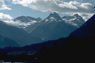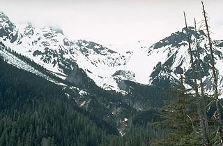
Mount Garibaldi is a dormant stratovolcano in the Garibaldi Ranges of the Pacific Ranges in southwestern British Columbia, Canada. It has a maximum elevation of 2,678 metres and rises above the surrounding landscape on the east side of the Cheakamus River in New Westminster Land District. In addition to the main peak, Mount Garibaldi has two named sub-peaks. Atwell Peak is a sharp, conical peak slightly higher than the more rounded peak of Dalton Dome. Both were volcanically active at different times throughout Mount Garibaldi's eruptive history. The northern and eastern flanks of Mount Garibaldi are obscured by the Garibaldi Névé, a large snowfield containing several radiating glaciers. Flowing from the steep western face of Mount Garibaldi is the Cheekye River, a tributary of the Cheakamus River. Opal Cone on the southeastern flank is a small volcanic cone from which a lengthy lava flow descends. The western face is a landslide feature that formed in a series of collapses between 12,800 and 11,500 years ago. These collapses resulted in the formation of a large debris flow deposit that fans out into the Squamish Valley.

The Garibaldi Volcanic Belt is a northwest–southeast trending volcanic chain in the Pacific Ranges of the Coast Mountains that extends from Watts Point in the south to the Ha-Iltzuk Icefield in the north. This chain of volcanoes is located in southwestern British Columbia, Canada. It forms the northernmost segment of the Cascade Volcanic Arc, which includes Mount St. Helens and Mount Baker. Most volcanoes of the Garibaldi chain are dormant stratovolcanoes and subglacial volcanoes that have been eroded by glacial ice. Less common volcanic landforms include cinder cones, volcanic plugs, lava domes and calderas. These diverse formations were created by different styles of volcanic activity, including Peléan and Plinian eruptions.

The Fraser Canyon is a major landform of the Fraser River where it descends rapidly through narrow rock gorges in the Coast Mountains en route from the Interior Plateau of British Columbia to the Fraser Valley. Colloquially, the term "Fraser Canyon" is often used to include the Thompson Canyon from Lytton to Ashcroft, since they form the same highway route which most people are familiar with, although it is actually reckoned to begin above Williams Lake at Soda Creek Canyon near the town of the same name.

The Lillooet Ranges are the southeasternmost subdivision of the Pacific Ranges of the Coast Mountains of British Columbia. They are located between the drainage of the Lillooet River and Harrison Lake on the west and the canyon of the Fraser River on the east, and by the lowland coastal valley of that river on the south.

The Pacific Ranges are the southernmost subdivision of the Coast Mountains portion of the Pacific Cordillera. Located entirely within British Columbia, Canada, they run northwest from the lower stretches of the Fraser River to Bella Coola and Burke Channel, north of which are the Kitimat Ranges. The Coast Mountains lie between the Interior Plateau and the Coast of British Columbia.

The Chilcotin Ranges are a subdivision of the Pacific Ranges of the Coast Mountains. They lie on the inland lea of the Pacific Ranges, abutting the Interior Plateau of British Columbia. Their northwestern end is near the head of the Klinaklini River and their southeast end is the Fraser River just north of Lillooet; their northern flank is the edge of the Plateau while their southern is the north bank of the Bridge River. In some reckonings they do not go all the way to the Fraser but end at the Yalakom River, which is the North Fork of the Bridge.

The Shulaps Range is a subrange of the Chilcotin Ranges subset of the Pacific Ranges of the Coast Mountains in southwest-central British Columbia. The range is 55 km NW–SE and 15 km SW–NE and 2,970 km2 (1,150 sq mi) in area.

The Camelsfoot Range is a sub-range of the Chilcotin Ranges subdivision of the Pacific Ranges of the Coast Mountains in British Columbia. The Fraser River forms its eastern boundary. The range is approximately 90 km at its maximum length and less than 30 km wide at its widest.

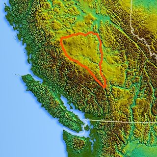
The Chilcotin Plateau is part of the Fraser Plateau, a major subdivision of the Interior Plateau of British Columbia. The Chilcotin Plateau is physically near-identical with the region of the same name, i.e. "the Chilcotin", which lies between the Fraser River and the southern Coast Mountains and is defined by the basin of the Chilcotin River and so includes montane areas beyond the plateau. East of the Chilcotin Plateau, across the Fraser River, is the Cariboo Plateau, while to the north beyond the West Road (Blackwater) River is the Nechako Plateau. West and south of the Chilcotin Plateau are various subdivisions of the Coast Mountains, including the Chilcotin Ranges which lie along the plateau's southwest.

The Black Tusk, known as Q̓elqámtensa ti Skenknápa in the St'at'imcets (Lillooet) language and as T'ákt'akmúten tl'a Ín7inyáx̱a7en in the Sḵwx̱wú7mesh (Squamish) language, is a stratovolcano and a pinnacle of volcanic rock in Garibaldi Provincial Park of British Columbia, Canada. At 2,319 m (7,608 ft) above sea level, the upper spire is visible from a great distance in all directions. It is particularly noticeable from the Sea-to-Sky Highway just south of Whistler, British Columbia. Distinctive and immediately identifiable, The Black Tusk is among the best known mountains in the Garibaldi Ranges of the Coast Mountains. The volcano is part of the Garibaldi Volcanic Belt which is a segment of the Canadian Cascade Arc, but it is not within the geographic boundary of the Cascade Range.

The Mount Meager massif is a group of volcanic peaks in the Pacific Ranges of the Coast Mountains in southwestern British Columbia, Canada. Part of the Cascade Volcanic Arc of western North America, it is located 150 km (93 mi) north of Vancouver at the northern end of the Pemberton Valley and reaches a maximum elevation of 2,680 m (8,790 ft). The massif is capped by several eroded volcanic edifices, including lava domes, volcanic plugs and overlapping piles of lava flows; these form at least six major summits including Mount Meager which is the second highest of the massif.

Mount Price is a small stratovolcano in the Garibaldi Ranges of the Pacific Ranges in southwestern British Columbia, Canada. It has an elevation of 2,049 metres and rises above the surrounding landscape on the western side of Garibaldi Lake in New Westminster Land District. The mountain contains a number of subfeatures, including Clinker Peak on its western flank, which was the source of two thick lava flows between 15,000 and 8,000 years ago that ponded against glacial ice. These lava flows are structurally unstable, having produced large landslides as recently as the 1850s. A large provincial park surrounds Mount Price and other volcanoes in its vicinity. It lies within an ecological region that surrounds much of the Pacific Ranges.

Heart Peaks, originally known as the Heart Mountains, is a mountain massif in the Northern Interior of British Columbia, Canada. It is 90 km (56 mi) northwest of the small community of Telegraph Creek and just southwest of Callison Ranch. With a maximum elevation of 2,012 m (6,601 ft), it rises above the surrounding landscape on the Nahlin Plateau, which is part of the western Stikine Plateau. Heart Peaks has been an area of prospecting since the 1980s with the discovery of precious metals.

The Itcha Range, also known as the Itchas, is a small isolated mountain range in the West-Central Interior of British Columbia, Canada. It is located 40 km (25 mi) northeast of the community of Anahim Lake. With a maximum elevation of 2,375 m (7,792 ft), it is the lowest of three mountain ranges on the Chilcotin Plateau extending east from the Coast Mountains. Two mountains are named in the Itcha Range; Mount Downton and Itcha Mountain. A large provincial park surrounds the Itcha Range and other features in its vicinity. More than 15 animal species are known to exist in the Itcha Range area, as well as a grassland community that is limited only to this location of British Columbia. The Itcha Range is within territory which has been occupied by aboriginal peoples for millennia. This area has a relatively dry environment compared to the Coast Mountains in the west.

The Cascade Volcanoes are a number of volcanoes in a volcanic arc in western North America, extending from southwestern British Columbia through Washington and Oregon to Northern California, a distance of well over 700 miles (1,100 km). The arc formed due to subduction along the Cascadia subduction zone. Although taking its name from the Cascade Range, this term is a geologic grouping rather than a geographic one, and the Cascade Volcanoes extend north into the Coast Mountains, past the Fraser River which is the northward limit of the Cascade Range proper.

Churn Creek is a tributary of the Fraser River in the Canadian province of British Columbia.

The Canadian Cascade Arc, also called the Canadian Cascades, is the Canadian segment of the North American Cascade Volcanic Arc. Located entirely within the Canadian province of British Columbia, it extends from the Cascade Mountains in the south to the Coast Mountains in the north. Specifically, the southern end of the Canadian Cascades begin at the Canada–United States border. However, the specific boundaries of the northern end are not precisely known and the geology in this part of the volcanic arc is poorly understood. It is widely accepted by geologists that the Canadian Cascade Arc extends through the Pacific Ranges of the Coast Mountains. However, others have expressed concern that the volcanic arc possibly extends further north into the Kitimat Ranges, another subdivision of the Coast Mountains, and even as far north as Haida Gwaii.

The Mount Cayley volcanic field (MCVF) is a remote volcanic zone on the South Coast of British Columbia, Canada, stretching 31 km (19 mi) from the Pemberton Icefield to the Squamish River. It forms a segment of the Garibaldi Volcanic Belt, the Canadian portion of the Cascade Volcanic Arc, which extends from Northern California to southwestern British Columbia. Most of the MCVF volcanoes were formed during periods of volcanism under sheets of glacial ice throughout the last glacial period. These subglacial eruptions formed steep, flat-topped volcanoes and subglacial lava domes, most of which have been entirely exposed by deglaciation. However, at least two volcanoes predate the last glacial period and both are highly eroded. The field gets its name from Mount Cayley, a volcanic peak located at the southern end of the Powder Mountain Icefield. This icefield covers much of the central portion of the volcanic field and is one of the several glacial fields in the Pacific Ranges of the Coast Mountains.

The Bridge River Vent is a volcanic crater in the Pacific Ranges of the Coast Mountains in southwestern British Columbia, Canada. It is located 51 km (32 mi) west of Bralorne on the northeastern flank of the Mount Meager massif. With an elevation of 1,524 m (5,000 ft), it lies on the steep northern face of Plinth Peak, a 2,677 m (8,783 ft) high volcanic peak comprising the northern portion of Meager. The vent rises above the western shoulder of the Pemberton Valley and represents the northernmost volcanic feature of the Mount Meager massif.

Mount Cayley is an eroded but potentially active stratovolcano in the Pacific Ranges of southwestern British Columbia, Canada. Located 45 km (28 mi) north of Squamish and 24 km (15 mi) west of Whistler, the volcano resides on the edge of the Powder Mountain Icefield. It consists of massif that towers over the Cheakamus and Squamish river valleys. All major summits have elevations greater than 2,000 m (6,600 ft), Mount Cayley being the highest at 2,385 m (7,825 ft). The surrounding area has been inhabited by indigenous peoples for more than 7,000 years while geothermal exploration has taken place there for the last four decades.


