Black Hammock, Florida | |
|---|---|
 Black Hammock, Florida  Black Hammock, Florida | |
| Coordinates: 28°42′39″N81°10′48″W / 28.71083°N 81.18000°W [1] | |
| Country | United States |
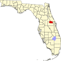
| State | Florida |
| County | Seminole |
| Area | |
• Total | 10.911 sq mi (28.26 km2) |
| • Land | 10.911 sq mi (28.26 km2) |
| • Water | 0 sq mi (0 km2) |
| Elevation | 10 ft (3 m) |
| Population | |
• Total | 1,144 |
| • Density | 100/sq mi (40/km2) |
| Time zone | UTC-5 (Eastern (EST)) |
| • Summer (DST) | UTC-4 (EDT) |
| Area codes | 321, 407/689 |
| GNIS feature ID | 2583330 [1] |
Black Hammock is an unincorporated community and census-designated place in Seminole County, Florida, United States on the southern shore of Lake Jesup. Its population was 1,144 as of the 2010 census. [2]