Indian Mound Village | |
|---|---|
 Indian Mound Village | |
| Coordinates: 28°48′12″N81°13′00″W / 28.80333°N 81.21667°W | |
| Country | United States |
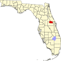
| State | Florida |
| County | Seminole |
| Elevation | 13 ft (4 m) |
| Time zone | UTC-5 (Eastern (EST)) |
| • Summer (DST) | UTC-4 (EDT) |
| Area codes | 407, 689 & 321 |
| GNIS feature ID | 284523 [1] |
Indian Mound Village is an unincorporated community in Seminole County, Florida, United States, located on the St. Johns River. [1] It is also where the Osteen Bridge is.
The community takes its name from a nearby Indian burial mound, likely Timucuan. [2] However, the namesake burial mounds have not been left intact, minimizing the archeological value. [3]