
The Black Rock Desert is a semi-arid region of lava beds and playa, or alkali flats, situated in the Black Rock Desert–High Rock Canyon Emigrant Trails National Conservation Area, a silt playa 100 miles (160 km) north of Reno, Nevada, that encompasses more than 300,000 acres (120,000 ha) of land and contains more than 120 miles (200 km) of historic trails. It is in the northern Nevada section of the Great Basin with a lakebed that is a dry remnant of Pleistocene Lake Lahontan.

The Santa Monica Mountains are a coastal mountain range in Southern California, next to the Pacific Ocean. It is part of the Transverse Ranges. The Santa Monica Mountains National Recreation Area encompasses this mountain range. Because of its proximity to densely populated regions, it is one of the most visited natural areas in California.

The Santa Rosa Mountains are a short mountain range in the Peninsular Ranges system, located east of the Los Angeles Basin and northeast of the San Diego metropolitan area of Southern California, in the Southwestern United States.
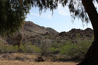
The Chuckwalla Mountains are a mountain range in the transition zone between the Colorado Desert—Sonoran Desert and the Mojave Desert, climatically and vegetationally, in Riverside County of southern California. The mountains are named after the chuckwalla lizards.
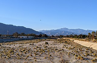
The Whitewater River is a small permanent stream in western Riverside County, California, with some upstream tributaries in southwestern San Bernardino County. The river's headwaters are in the San Bernardino Mountains, and it terminates at the Salton Sea in the Colorado Sonoran Desert. The area drained by the Whitewater River is part of the larger endorheic Salton Sea drainage basin.

The San Jacinto River is a 42-mile-long (68 km) river in Riverside County, California. The river's headwaters are in Santa Rosa and San Jacinto Mountains National Monument. The lower portion of the 765-square-mile (1,980 km2) watershed is urban and agricultural land. As a partially endorheic watershed that is contiguous with other Great Basin watersheds, the western side of the San Jacinto Basin is a portion of the Great Basin Divide.

Mount San Jacinto State Park is in the San Jacinto Mountains, of the Peninsular Ranges system, in Riverside County, California, United States. A majority of the park is within the Santa Rosa and San Jacinto Mountains National Monument. The park is near the Greater Los Angeles and San Diego metropolitan areas.
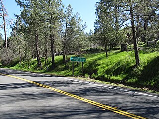
Mountain Center is an unincorporated community and census-designated place in the San Jacinto Mountains, within western central Riverside County, California.
The Black Hills are a small and low mountain range in the northern Peninsular Ranges System, in Riverside County, southern California. Its summit is 2,739 feet (835 m).

The Box Springs Mountains are a mountain range in northwest Riverside County, California, United States. The highest peak of the range is Box Springs Mountain, which stands just over 3,080 ft (940 m) tall.
The Kalmia Hills are a low mountain range of the Peninsular Ranges System, in northwestern Riverside County of southern California.
The Little Chuckwalla Mountains are a mountain range in southeastern Riverside County, California. The range lies southeast of the Chuckwalla Mountains, north of the Chocolate Mountains and south of I-10.
The Pedley Hills are a low mountain range of the northern Peninsular Ranges System, in northwestern Riverside County, California. They are named for William Pedley, a civil engineer, who emigrated to the United States from England.

The Tucalota Hills are a low mountain range of the Peninsular Ranges System, in Riverside County, California.

The West Riverside Mountains are a mountain range in eastern Riverside County, California. They extend about 0.75 miles into San Bernardino County. The Riverside Mountains are 1 mile southeast; the Turtle Mountains are 9 miles to the northwest.

The Temescal Mountains, also known as the Sierra Temescal, are one of the northernmost mountain ranges of the Peninsular Ranges in western Riverside County, in Southern California in the United States. They extend for approximately 25 mi (40 km) southeast of the Santa Ana River east of the Elsinore Fault Zone to the Temecula Basin and form the western edge of the Perris Block.

Oak Mountain is a mountain in the northern Peninsular Ranges System, in Riverside County, in southern California.

Tucalota Creek is a stream or arroyo in Riverside County, Southern California. It is a tributary of Santa Gertrudis Creek.

Cahuilla Mountain is a mountain summit of the Peninsular Ranges System, in Riverside County, California.


