
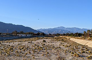
The Santa Rosa Mountains are a short mountain range in the Peninsular Ranges system, located east of the Los Angeles Basin and northeast of the San Diego metropolitan area of southern California, in the southwestern United States.

The Diablo Range is a mountain range in the California Coast Ranges subdivision of the Pacific Coast Ranges in northern California, United States. It stretches from the eastern San Francisco Bay Area at its northern end to the Salinas Valley area at its southern end.
The Mule Mountains of California are located in the southeastern part of the state in the United States. The range lies in a northeast-southwesterly direction south of the McCoy Mountains and west of the Palo Verde Valley and Colorado River. The mountain range is approximately 18 miles (29 km) long and is located just south of Interstate 10, about 5 mi (8 km) southeast of Chuckawalla Valley State Prison. The northern end of the range is in Riverside County, and the southern end is in Imperial County. Downtown Blythe, California is about 12 mi (19 km) to the northeast.
The Whitewater River is a small permanent stream in western Riverside County, California, with some upstream tributaries in southwestern San Bernardino County. The river's headwaters are in the San Bernardino Mountains, and it terminates at the Salton Sea in the Colorado Sonoran Desert. The area drained by the Whitewater River is part of the larger endorheic Salton Sea drainage basin.

Skinner Reservoir, also known as Lake Skinner, is a reservoir in western Riverside County, California, located at the foot of Bachelor Mountain in the Auld Valley, approximately 10 miles (16 km) northeast of Temecula. It was created in 1973 by the construction of the Skinner Clearwell Dam on Tucalota Creek, and currently has a capacity of 44,200 acre-feet (54,500,000 m3). Located north of Rancho California Road near the Temecula Valley Wine Country, The address of the reservoir is: 37701 Warren Road, Temecula, CA 92592.

Wittenberg Mountain, locally "the Wittenberg'', is a mountain in Ulster County, New York. It is part of the Burroughs Range of the Catskill Mountains. Wittenberg is flanked to the southwest by Cornell Mountain and to the northeast by Terrace Mountain.

The Bernasconi Hills are a low mountain range of the Peninsular Ranges, located in Riverside County, California, United States.

The Briones Hills form a low mountain range in western Contra Costa County, in the East Bay region of the San Francisco Bay Area, California, United States. The Briones Hills are the northernmost portion of the East Bay Hills, which refers geologically to all of the ranges east of the Bay from the Hayward Fault in the west to the Calaveras Fault in the east. The United States Geological Survey (USGS) Geographic Names Information System, however, includes the Briones Hills as part of the Diablo Range in its list of GPS coordinates for the latter.

The Jurupa Mountains, or Jurupa Hills, are a small mountain range of the Peninsular Ranges System, located in the southeastern Pomona Valley, within northwestern Riverside County and southwestern San Bernardino County of the Inland Empire region, southern California.
The Kalmia Hills are a low mountain range of the Peninsular Ranges System, in northwestern Riverside County of southern California.
The La Loma Hills are a low and short mountain range of the Peninsular Ranges System, in the urban Inland Empire region of Southern California.
The Pedley Hills are a low mountain range of the northern Peninsular Ranges System, in northwestern Riverside County, California. They are named for William Pedley, a civil engineer, who emigrated to the United States from England.
The Rawson Mountains are a mountain range in Riverside County, California. The Rawson Mountains are located south of the Diamond Valley Lake, southeast of Domenigoni Valley, east of French Valley, west of Goodhart Canyon and north of Bachelor Mountain, Auld Valley and Black Mountain. The Rawson Mountains are composed primarily of metamorphic rock of the Triassic - Jurassic French Valley formation, formed as a roof pendant of the Peninsular Range Batholith. The extreme western end of the range and various intrusions within it are Cretaceous granitic rock.

Calero Reservoir, also called Calero Lake, is a reservoir in San Jose, California, located in the Calero neighborhood of Almaden Valley in South San Jose. It is the site of Calero County Park, which also includes a large area covering the lake and hundreds of acres of hills around it.

The Juab Valley is a 40-mile (64 km) long valley located on the eastern edge of Juab County, Utah, United States.

The Temescal Mountains, also known as the Sierra Temescal, are one of the northernmost mountain ranges of the Peninsular Ranges in western Riverside County, in Southern California in the United States. They extend for approximately 25 mi (40 km) southeast of the Santa Ana River east of the Elsinore Fault Zone to the Temecula Basin and form the western edge of the Perris Block.
The Perris Block is the central block of three major fault-bounded blocks of the northern part of the Peninsular Ranges. The Perris Block lies between the Santa Ana Block to the west and the San Jacinto Block to the east. The Perris Block, was named by Walter A. English in 1925 for the city of Perris, located near the center of the block.
The Plains of Leon are named for the former gold mining town, Leon once located near the middle of the plain. It is a plain in the Perris Block, contiguous on the south with the Perris Plain including within it the Domenigoni Valley and western Diamond Valley, French Valley, Auld Valley, the upper part of the valley of Warm Springs Creek and connecting tablelands.

Murrieta Creek runs 13 miles (21 km) southeasterly through southwestern Riverside County, California, United States, through the cities of Wildomar, Murrieta, and Temecula, ending 0.5 miles (0.80 km) southeast of the city center of Temecula, where it has its confluence with Temecula Creek and forms the head of the Santa Margarita River.
Oak Mountain is a mountain in the northern Peninsular Ranges System, in Riverside County, in southern California.


