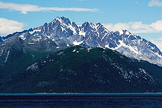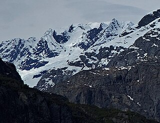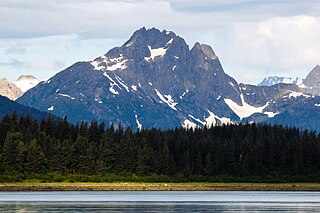
Mount Foresta is an 11,000+ ft multi-peak massif located in Wrangell–St. Elias National Park, in the Saint Elias Mountains of Alaska in the United States. Rising high above the lower western margin of the Hubbard Glacier, the summit of Mount Foresta is just over nine miles (14 km) from tidewater at Disenchantment Bay, 12 mi (19 km) northwest of Mount Seattle, 14.5 mi (23 km) southeast of Mount Vancouver, and 46 mi (74 km) north of Yakutat.

Mount Cooper is a 6780-foot (2067-meter) mountain summit located in the Fairweather Range of the Saint Elias Mountains, in southeast Alaska. The peak is situated in Glacier Bay National Park and Preserve at the entrance to Johns Hopkins Inlet, 100 mi (161 km) northwest of Juneau, and 5.6 mi (9 km) northeast of Mount Abbe, which is the nearest higher peak. Although modest in elevation, relief is significant since the mountain rises up from tidewater in less than two miles. Mount Cooper can be seen from Johns Hopkins Inlet which is a popular destination for cruise ships. The mountain's name was proposed in the 1950s for William Skinner Cooper (1884-1978), a plant ecologist who performed vegetation-glacier relationship studies in the Glacier Bay area, and was chairman of the committee of scientists which proposed establishing Glacier Bay National Monument. The mountain's name was officially adopted in 1980 by the United States Geological Survey following Cooper's death. The months May through June offer the most favorable weather for climbing Mount Cooper.

Mount Abdallah is a prominent 6,210-foot (1,893-meter) mountain summit located in the Alsek Ranges of the Saint Elias Mountains, in southeast Alaska. The mountain is situated in Glacier Bay National Park and Preserve, as the highest point between Tarr Inlet and Rendu Inlet, 93 mi (150 km) northwest of Juneau, and 10.5 mi (17 km) southeast of Mount Barnard, which is the nearest higher peak. Although modest in elevation, relief is significant since the mountain rises up from tidewater in less than three miles. The mountain was named in 1892 by Harry Fielding Reid, an American geophysicist, who in 1892 hired a small crew of men for an expedition to study glaciology in Glacier Bay. There is no record of who Reid named this mountain for, but a member of his expeditionary crew who accompanied him might be a possibility. The months May through June offer the most favorable weather for viewing Mount Abdallah. Weather permitting, Mount Abdallah can be seen from Glacier Bay, which is a popular destination for cruise ships.

Mount Forde, also known as Boundary Peak 161, is a 6,883-foot (2,098 m) mountain summit located in the Fairweather Range of the Saint Elias Mountains, on the Canada–United States border between southeast Alaska and British Columbia. The peak is situated on the boundary of Glacier Bay National Park and Preserve, near the head of Tarr Inlet, 109 mi (175 km) northwest of Juneau, and 4.4 mi (7 km) northeast of Mount Turner, which is the nearest higher peak. Although modest in elevation, relief is significant since the mountain rises up from tidewater in less than four miles.

Sentinel Peak is a 4,355-foot (1,327-meter) mountain summit located at the head of Glacier Bay's Queen Inlet in Glacier Bay National Park and Preserve, in the Alsek Ranges of the Saint Elias Mountains, in southeast Alaska. The mountain is situated immediately southwest of Carroll Glacier, 87 mi (140 km) northwest of Juneau, and 7.44 mi (12 km) east of Mount Abdallah. Although modest in elevation, relief is significant since the mountain rises up from tidewater in less than two miles. The mountain was named in 1892 by Harry Fielding Reid, an American geophysicist, who studied glaciology in Glacier Bay. He so named it because Carroll Glacier is guarded by Sentinel Peak, and a sentinel is a guard whose job is to stand and keep watch. Weather permitting, Sentinel Peak can be seen from Glacier Bay, which is a popular destination for cruise ships. The months May through June offer the most favorable weather for viewing or climbing the peak.

Mount Turner, also known as Boundary Peak 162, is an 8,661+ foot glaciated mountain summit located in the Fairweather Range of the Saint Elias Mountains, on the Canada–United States border between southeast Alaska and British Columbia. The peak is situated on the shared boundary of Glacier Bay National Park with Tatshenshini-Alsek Provincial Park, 8 mi (13 km) west of Tarr Inlet, and 4.4 mi (7 km) southwest of Mount Forde, which is the nearest peak. Turner is the highest point on the divide which separates Ferris Glacier from Margerie Glacier. The mountain's name was officially adopted by the Geographical Names Board of Canada on March 31, 1924. The mountain was named for George Turner (1850–1932), one of the US members of the 1903 Alaska Boundary Tribunal.

Mount Merriam is a prominent 5,083-foot (1,549-meter) mountain summit located in Glacier Bay National Park and Preserve, in the Alsek Ranges of the Saint Elias Mountains, in southeast Alaska. The mountain is situated 75 mi (121 km) northwest of Juneau, 3.1 mi (5 km) south of Mount Wordie, 3.5 mi (6 km) north of Black Cap Mountain, and 13.4 mi (22 km) southeast of Mount Abdallah which is the nearest higher peak. Although modest in elevation, relief is significant as the mountain rises up from tidewater in less than three miles, and it ranks 85th in prominence for all peaks in Alaska. The mountain was named by members of a 1941 Glacier Bay expedition for Dr. Clinton Hart Merriam (1855-1942), Chief of the U.S. Department of Agriculture (USDA) Biological Survey. Merriam was a zoologist for the 1899 Harriman Alaska expedition which explored Glacier Bay. Weather permitting, Mount Merriam can be seen from Glacier Bay, which is a popular destination for cruise ships. The months May through June offer the most favorable weather for viewing or climbing the peak.

Black Cap Mountain is a 3,321-foot (1,012-meter) mountain summit located in Glacier Bay National Park and Preserve, in the Alsek Ranges of the Saint Elias Mountains, in southeast Alaska. The mountain is situated immediately north of the entrance to Tidal Inlet, 80 mi (129 km) northwest of Juneau, and 3.5 mi (6 km) south of Mount Merriam, which is the nearest higher peak. Although modest in elevation, relief is significant as the mountain rises up from tidewater in less than two miles. The mountain's descriptive name was given by the U.S. Geological Survey in 1956 because the summit is composed of black limestone which contrasts with the color of the flanks of the mountain, making it visible for many miles. The mountain's name was officially adopted in 1960 by the U.S. Board on Geographic Names. Weather permitting, Black Cap Mountain can be seen from Glacier Bay, which is a popular destination for cruise ships. The months May through June offer the most favorable weather for viewing or climbing the peak.

Mount Wordie is a 4,700+ foot mountain summit located in Glacier Bay National Park and Preserve, in the Alsek Ranges of the Saint Elias Mountains, in southeast Alaska. The mountain is situated 80 mi (129 km) northwest of Juneau, 4 mi (6 km) south of Carroll Glacier, and 3.1 mi (5 km) north of Mount Merriam which is the nearest higher peak. Although modest in elevation, relief is significant as the mountain rises up from tidewater in less than two miles. Precipitation runoff from the mountain drains into Glacier Bay Basin. Weather permitting, Mount Wordie can be seen from Queen Inlet and Wachusett Inlet of Glacier Bay, which is a popular destination for cruise ships.

Mount Case is a prominent 5,545-foot (1,690 m) mountain summit located in the Alsek Ranges of the Saint Elias Mountains, in southeast Alaska. The mountain is situated in Glacier Bay National Park and Preserve, as the highest point between Adams Inlet and White Glacier, 65 mi (105 km) northwest of Juneau, and 2.47 mi (4 km) northeast of Mount Wright, which is the nearest peak. Although modest in elevation, relief is significant as the mountain rises up from tidewater in less than three miles, and it ranks 73rd in prominence for all peaks in Alaska. The mountain was named in 1890 by Harry Fielding Reid, an American geophysicist, who studied glaciology in Glacier Bay. Reid named this mountain for his school, the Case School of Applied Science, in Cleveland, Ohio. The months May through June offer the most favorable weather for viewing or climbing Mount Case. Weather permitting, Mount Case can be seen from Glacier Bay, which is a popular destination for cruise ships.

Marble Mountain is a 3,366-foot (1,026-meter) mountain summit located in the Fairweather Range of the Saint Elias Mountains, in southeast Alaska. The peak is situated in Glacier Bay National Park and Preserve at the entrance to Geikie Inlet, 68 mi (109 km) west-northwest of Juneau, and 10.7 mi (17 km) east-northeast of Blackthorn Peak. Although modest in elevation, relief is significant since the mountain rises up from tidewater in Shag Cove in less than one mile. The mountain's name was in local use as reported by the United States Geological Survey in 1951. Marble Mountain can be seen from Glacier Bay which is a popular destination for cruise ships. The months May through June offer the most favorable weather for viewing and climbing Marble Mountain.

Black Mountain is a prominent, 5,891-foot-high (1,796-meter) mountain summit located in the Alsek Ranges of the Saint Elias Mountains in southeast Alaska. The mountain is situated in Glacier Bay National Park and Preserve, 75 mi (121 km) northwest of Juneau, between the Riggs and McBride glaciers. The months May through June offer the most favorable weather for viewing or climbing Black Mountain. Weather permitting, Black Mountain can be seen from Muir Inlet of Glacier Bay, which is a popular destination for cruise ships.

Mount Huxley is a 12,216-foot glaciated mountain summit located in the Saint Elias Mountains of Wrangell-St. Elias National Park and Preserve, in the U.S. state of Alaska. The remote peak is situated 75 mi (121 km) northwest of Yakutat, and 8.7 mi (14 km) west-northwest of Mount Saint Elias. The peak rises above the Columbus Glacier and Bagley Icefield to its north, the Tyndall Glacier to the south, and the Yahtse Glacier to the west. Precipitation runoff from the mountain drains into the Gulf of Alaska. The mountain was named in 1886 by English mountaineer Harold Ward Topham for Thomas Henry Huxley (1825-1895), an English biologist. The mountain was officially named Huxley Peak in 1917, but the name was officially changed to Mount Huxley in 1968 by the U.S. Board on Geographic Names. The first ascent of the peak was made June 9, 1996 by Paul Claus who landed his plane at 11,500 feet elevation on the western flank and climbed the remaining distance to the summit. The second ascent of Mt. Huxley, and first complete ascent from base to summit, was made in June 2018 by Scott Peters, Andrew Peter, and Ben Iwrey starting from the Columbus Glacier.

Pyramid Peak is an 8,875-foot (2,705-meter) mountain summit located at the western edge of the Saint Elias Mountains, in the U.S. state of Alaska. The peak is situated in Wrangell-St. Elias National Park and Preserve, 22 mi (35 km) southeast of McCarthy, 7 mi (11 km) southeast of Williams Peak, and 6 mi (10 km) south-southeast of Joshua Green Peak. The peak's descriptive local name was reported in 1908 by the United States Geological Survey. Precipitation runoff from the mountain drains into tributaries of the Nizina River, which in turn is part of the Copper River drainage basin.

Fifty Years of Alaskan Statehood is an 8,599-foot (2,621 m) mountain summit in the US state of Alaska.

Mount Parker is a 3,170-foot (966 m) mountain summit in the US state of Alaska.

Gullied Peak is a 3,350-foot (1,021 m) mountain summit in the US state of Alaska.

Mount Favorite is a 2,500-foot (762 m) mountain summit in the US state of Alaska.

Serrated Peak is a 3,757-foot (1,145 m) mountain summit in the US state of Alaska.

Tlingit Peak is a 3,274-foot (998 m) mountain summit in the US state of Alaska.


