Blue Earth City Township, Faribault County, Minnesota

Last updated

Blue Earth City Township
USA Minnesota location map.svg
Red pog.svg
Blue Earth City Township
Location within the state of Minnesota
Usa edcp location map.svg
Red pog.svg
Blue Earth City Township
Blue Earth City Township (the United States)
Coordinates: 43°38′4″N94°4′24″W / 43.63444°N 94.07333°W / 43.63444; -94.07333
Country United States
State Minnesota
County Faribault
Area
  Total32.9 sq mi (85.3 km2)
  Land32.9 sq mi (85.3 km2)
  Water0.0 sq mi (0.0 km2)
Elevation
1,093 ft (333 m)
Population
 (2000)
  Total454
  Density13.8/sq mi (5.3/km2)
Time zone UTC-6 (Central (CST))
  Summer (DST) UTC-5 (CDT)
FIPS code 27-06706 [1]
GNIS feature ID0663625 [2]

Blue Earth City Township is a township in Faribault County, Minnesota, United States. The population was 454 at the 2000 census.

Contents

The township was organized in 1858 as Blue Earth Township. [3]

Geography

According to the United States Census Bureau, the township has a total area of 32.9 square miles (85 km2), of which 32.9 square miles (85 km2) is land and 0.04 square miles (0.10 km2) (0.06%) is water.

Demographics

As of the census [1] of 2000, there were 454 people, 165 households, and 147 families residing in the township. The population density was 13.8 inhabitants per square mile (5.3/km2). There were 173 housing units at an average density of 5.3 per square mile (2.0/km2). The racial makeup of the township was 98.46% White, 1.32% from other races, and 0.22% from two or more races. Hispanic or Latino of any race were 1.98% of the population.

There were 165 households, out of which 33.3% had children under the age of 18 living with them, 82.4% were married couples living together, 3.0% had a female householder with no husband present, and 10.9% were non-families. 10.3% of all households were made up of individuals, and 5.5% had someone living alone who was 65 years of age or older. The average household size was 2.75 and the average family size was 2.88.

In the township the population was spread out, with 24.0% under the age of 18, 5.7% from 18 to 24, 24.2% from 25 to 44, 32.4% from 45 to 64, and 13.7% who were 65 years of age or older. The median age was 42 years. For every 100 females, there were 100.0 males. For every 100 females age 18 and over, there were 98.3 males.

The median income for a household in the township was $52,500, and the median income for a family was $53,750. Males had a median income of $38,000 versus $22,083 for females. The per capita income for the township was $21,517. About 4.5% of families and 5.4% of the population were below the poverty line, including 2.0% of those under age 18 and 12.5% of those age 65 or over.

Related Research Articles

Elkton Township is a township in Clay County, Minnesota, United States. The population was 283 at the 2000 census.

Tansem Township is a township in Clay County, Minnesota, United States. The population was 222 at the 2000 census.

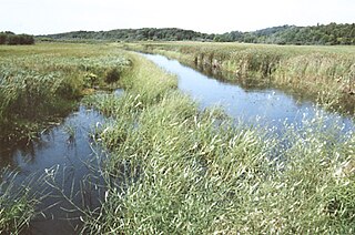
Moose Creek Township is a township in Clearwater County, Minnesota, United States. The population was 227 at the 2000 census. This township took its name from Moose Creek.

Mantorville Township is a township in Dodge County, Minnesota, United States. The population was 1,610 at the 2000 census.

Carrollton Township is a township in Fillmore County, Minnesota, United States. The population was 321 at the 2000 census.

<span class="mw-page-title-main">Wacouta Township, Goodhue County, Minnesota</span> Township in Minnesota, United States

Wacouta Township is a township in Goodhue County, Minnesota, United States. The population was 410 at the 2000 census.

Mantrap Township is a township in Hubbard County, Minnesota, United States. The population was 454 at the 2000 census.

Bigfork Township is a township in Itasca County, Minnesota, United States. The population was 321 at the 2010 census.

Splithand Township is a township in Itasca County, Minnesota, United States. The population was 250 at the 2010 census.

Brunswick Township is a township in Kanabec County, Minnesota, United States. The population was 1,263 at the 2000 census. Originally called Grass Lake Township, it was renamed after the community of Brunswick, Minnesota, in 1883.

Huntly Township is a township in Marshall County, Minnesota, United States. The population was 68 at the 2000 census.

Bear Park Township is a township in Norman County, Minnesota, United States. The population was 209 at the 2000 census.

Aurdal Township is a township in Otter Tail County, Minnesota, United States. The population was 1,362 at the 2000 census.

Dead Lake Township is a township in Otter Tail County, Minnesota, United States. The population was 452 at the 2000 census.

<span class="mw-page-title-main">Deer Creek Township, Otter Tail County, Minnesota</span> Township in Minnesota, United States

Deer Creek Township is a township in Otter Tail County, Minnesota, United States. The population was 348 at the 2000 census.

Everts Township is a township in Otter Tail County, Minnesota, United States. The population was 774 at the 2000 census.

Perham Township is a township in Otter Tail County, Minnesota, United States. The population was 931 at the 2000 census.

Ross Township is a township in Roseau County, Minnesota, United States. The population was 454 at the 2000 census.

Munson Township is a township in Stearns County, Minnesota, United States. The population was 1,466 at the 2010 census.

References

  1. 1 2 "U.S. Census website". United States Census Bureau . Retrieved January 31, 2008.
  2. "US Board on Geographic Names". United States Geological Survey. October 25, 2007. Retrieved January 31, 2008.
  3. Upham, Warren (1920). Minnesota Geographic Names: Their Origin and Historic Significance. Minnesota Historical Society. p.  184.