Blue Ridge Township, Piatt County, Illinois

Last updated

Blue Ridge Township
Map highlighting Blue Ridge Township, Piatt County, Illinois.svg
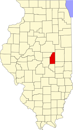
Location in Piatt County
Map of Illinois highlighting Piatt County.svg
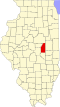
Piatt County's location in Illinois
Coordinates: 40°13′18″N88°32′42″W / 40.22167°N 88.54500°W / 40.22167; -88.54500
Country United States
State Illinois
County Piatt
EstablishedNovember 8, 1859
Area
  Total
63.71 sq mi (165.0 km2)
  Land63.65 sq mi (164.9 km2)
  Water0.06 sq mi (0.2 km2)  0.09%
Elevation
728 ft (222 m)
Population
 (2010)
  Estimate 
(2016) [1]
1,445
  Density23.3/sq mi (9.0/km2)
Time zone UTC-6 (CST)
  Summer (DST) UTC-5 (CDT)
FIPS code 17-147-06808

Blue Ridge Township is a township in Piatt County, Illinois, USA. As of the 2010 census, its population was 1,480 and it contained 641 housing units. [2]

Contents

Geography

According to the 2010 census, the township has a total area of 63.71 square miles (165.0 km2), of which 63.65 square miles (164.9 km2) (or 99.91%) is land and 0.06 square miles (0.16 km2) (or 0.09%) is water. [2]

Cities and towns

Extinct towns

Adjacent townships

Cemeteries

The township contains three cemeteries: Blue Ridge, Dunkard and Mansfield.

Major highways

Airports and landing strips

Demographics

Historical population
CensusPop.Note
2016 (est.)1,445 [1]
U.S. Decennial Census [3]

References

  1. 1 2 "Population and Housing Unit Estimates" . Retrieved June 9, 2017.
  2. 1 2 "Population, Housing Units, Area, and Density: 2010 - County -- County Subdivision and Place -- 2010 Census Summary File 1". United States Census. Archived from the original on February 12, 2020. Retrieved May 28, 2013.
  3. "Census of Population and Housing". Census.gov. Retrieved June 4, 2016.