La Place | |
|---|---|
Census-designated place (CDP) | |
 La Place | |
| Coordinates: 39°48′00″N88°43′03″W / 39.80000°N 88.71750°W [1] | |
| Country | United States |
| State | Illinois |
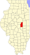
| County | Piatt |
| Township | Cerro Gordo |
| Area | |
• Total | 0.65 sq mi (1.69 km2) |
| • Land | 0.65 sq mi (1.69 km2) |
| • Water | 0.00 sq mi (0.00 km2) |
| Elevation | 705 ft (215 m) |
| Population (2020) | |
• Total | 239 |
| • Density | 366.00/sq mi (141.32/km2) |
| Time zone | UTC-6 (Central (CST)) |
| • Summer (DST) | UTC-5 (CDT) |
| ZIP code | 61936 |
| FIPS code | 17-42067 |
| GNIS feature ID | 411659 [1] |
La Place is a census-designated place and unincorporated community in Cerro Gordo Township, Piatt County, Illinois, United States. As of the 2010 census, its population was 259. [3]