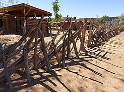
The Oregon Trail was a 2,170-mile (3,490 km) east–west, large-wheeled wagon route and emigrant trail in the United States that connected the Missouri River to valleys in Oregon. The eastern part of the Oregon Trail spanned part of what is now the state of Kansas and nearly all of what are now the states of Nebraska and Wyoming. The western half of the trail spanned most of the current states of Idaho and Oregon.

Bluff is a town in San Juan County, Utah, United States. The population was 320 at the 2000 census. Bluff incorporated in 2018. Ann Leppanen is currently the mayor.
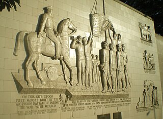
The Mormon Battalion was the only religious unit in United States military history in federal service, recruited solely from one religious body and having a religious title as the unit designation. The volunteers served from July 1846 to July 1847 during the Mexican–American War of 1846–1848. The battalion was a volunteer unit of between 534 and 559 Latter-day Saint men, led by Mormon company officers commanded by regular U.S. Army officers. During its service, the battalion made a grueling march of nearly 2,100 miles from Council Bluffs, Iowa, to San Diego, California.

The Mormon Trail is the 1,300-mile (2,100 km) long route from Illinois to Utah on which Mormon pioneers traveled from 1846–47. Today, the Mormon Trail is a part of the United States National Trails System, known as the Mormon Pioneer National Historic Trail.

The San Juan River is a major tributary of the Colorado River in the Southwestern United States, providing the chief drainage for the Four Corners region of Colorado, New Mexico, Utah, and Arizona. Originating as snowmelt in the San Juan Mountains of Colorado, it flows 383 miles (616 km) through the deserts of northern New Mexico and southeastern Utah to join the Colorado River at Glen Canyon.
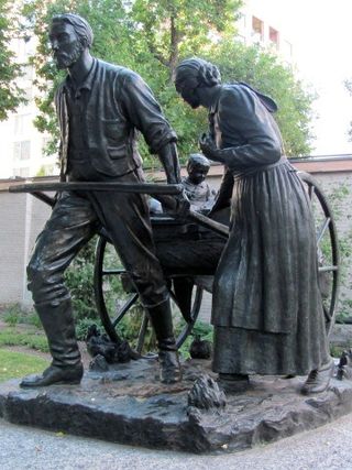
The Mormon pioneers were members of the Church of Jesus Christ of Latter-day Saints, also known as Latter-day Saints, who migrated beginning in the mid-1840s until the late-1860s across the United States from the Midwest to the Salt Lake Valley in what is today the U.S. state of Utah. At the time of the planning of the exodus in 1846, the territory was part of the Republic of Mexico, with which the U.S. soon went to war over a border dispute left unresolved after the annexation of Texas. The Salt Lake Valley became American territory as a result of this war.
Antonga, or Black Hawk, was a nineteenth-century war chief of the Timpanogos Tribe in what is the present-day state of Utah. He led the Timpanogos against Mormon settlers and gained alliances with Paiute and Navajo bands in the territory against them during what became known as the Black Hawk War in Utah (1865–1872). Although Black Hawk made peace in 1867, other bands continued raiding until the US intervened with about 200 troops in 1872. Black Hawk died in 1870 from a gunshot wound he received while trying to rescue a fallen warrior, White Horse, at Gravely Ford Richfield, Utah, June 10, 1866. The wound never healed and complications set in.

Lot Smith was a Mormon pioneer, soldier, lawman and American frontiersman. He became known as "The Horseman" for his exceptional skills on horseback as well as for his help in rounding up wild mustangs on Utah's Antelope Island. He is most famous for his exploits during the 1857 Utah War.
Brown's Park or Browns Park, originally called Brown's Hole, is an isolated mountain valley along the Green River in Moffat County, Colorado and Daggett County, Utah in the United States. The valley begins in far eastern Utah, approximately 25 miles (40 km) downstream from Flaming Gorge Dam, and follows the river downstream into Colorado, ending at the Gates of Lodore in Dinosaur National Monument. Known as a haven for outlaws such as Butch Cassidy and Tom Horn during the late 19th century and the early 20th century, it is now the location of the Browns Park National Wildlife Refuge. It was also the birthplace of Ann Bassett. She and her sister, Josie Bassett, were considered female outlaws and girlfriends to several of Cassidy's Wild Bunch gang. It is the location of John Jarvie Historic Ranch, where, in 1880, Scotsman John Jarvie built a ranch along the Green River.

The History of Utah is an examination of the human history and social activity within the state of Utah located in the western United States.
Seth Benjamin Tanner was a Mormon pioneer, miner, and early settler of Arizona. Tanner Trail in the Grand Canyon National Park was named after him.

The Hole in the Rock Trail is a historic trail running east-southeast from the town of Escalante in southern Utah in the western United States. The Mormon colonizers who established this trail crossed the Colorado River and ended their journey in the town of Bluff. The Hole-in-the-Rock expedition established the trail in 1879. The trail is located within the borders of the Grand Staircase–Escalante National Monument, the adjacent Glen Canyon National Recreation Area and federal Bureau of Land Management (BLM) public land to the east of the Colorado River. A geologic feature called the Hole in the Rock gave the trail its name. A modern unpaved road called the Hole-in-the-Rock Road closely follows this historic trail to the point where it enters the Glen Canyon National Recreation Area. The modern road is an important access route for visiting the Canyons of the Escalante and the Devils Garden. The trail is listed on the National Register of Historic Places, being added to that list in 1982.

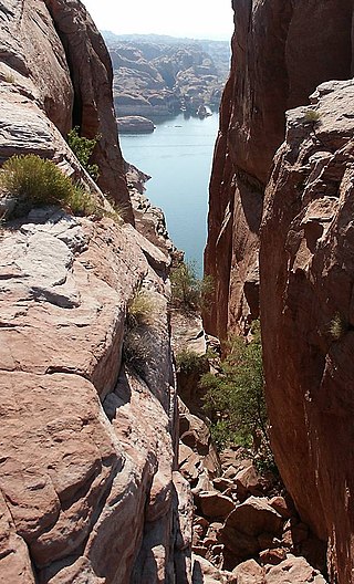
Hole in the Rock is a narrow and steep crevice in the western rim of Glen Canyon, in southern Utah in the western United States. Together with another canyon on the eastern side of the Colorado River, it provided a route through what would otherwise be a large area of impassable terrain.

The Great Platte River Road was a major overland travel corridor approximately following the course of the Platte River in present-day Nebraska and Wyoming that was shared by several popular emigrant trails during the 19th century, including the Trapper's Trail, the Oregon Trail, the Mormon Trail, the California Trail, the Pony Express route, and the military road connecting Fort Leavenworth and Fort Laramie. The road, which extended nearly 370 miles (600 km) from the Second Fort Kearny to Fort Laramie, was utilized primarily from 1841 to 1866. In modern times it is often regarded as a sort of superhighway of its era, and has been referred to as "the grand corridor of America's westward expansion".

Jane McKechnie Walton was a Scottish-born Mormon pioneer who helped to settle several Utah towns.
In the history of the American frontier, pioneers built overland trails throughout the 19th century, especially between 1829 and 1870, as an alternative to sea and railroad transport. These immigrants began to settle much of North America west of the Great Plains as part of the mass overland migrations of the mid-19th century. Settlers emigrating from the eastern United States did so with various motives, among them religious persecution and economic incentives, to move from their homes to destinations further west via routes such as the Oregon, California, and Mormon Trails. After the end of the Mexican–American War in 1849, vast new American conquests again encouraged mass immigration. Legislation like the Donation Land Claim Act and significant events like the California Gold Rush further encouraged settlers to travel overland to the west.
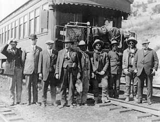
The Bluff War, also known as Posey War of 1915, or the Polk and Posse War, was one of the last armed conflicts between the United States and Ute and Paiute Native Americans (Indians) in Utah. In March 1914, several Utes accused Tse-ne-gat, the son of the Paiute Chief Narraguinnep ("Polk"), of murdering a shepherd named Juan Chacon. When a posse attempted to arrest Tse-ne-gat in February 1915, the Paiute and Ute bands headed by Polk and Posey resisted and several people on both sides were killed or wounded. The conflict took place near the town of Bluff, Utah. In March 1915, after negotiations, Polk surrendered Tse-ne-gat to U.S. Army General Hugh L. Scott. In July 1915 he was found innocent of murder in a trial in Denver.

Silas Sanford Smith was a Mormon pioneer, a politician in the Utah Territory, and the leader of the San Juan Expedition that settled San Juan County, Utah.
Fosters Hole or La Tinaja, was a waterhole on the original route of Cooke's Wagon Road in what is now Sierra County, New Mexico. It is located in narrow crevasse at the foot of a cliff in Jug Canyon that is difficult to spot, except from a few vantage points.
