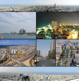
Gush Dan or Tel Aviv metropolitan area is a conurbation in Israel, located along the country's Mediterranean coastline. There is no single formal definition of Gush Dan, though the term is in frequent use by both governmental bodies and the general public. It ranges from combining Tel Aviv with cities that form an urban continuum with it, to the entire areas from both the Tel Aviv District and the Central District, or sometimes the whole Metropolitan Area of Tel Aviv, which includes a small part of the Southern District as well. Gush Dan is the largest conurbation and metropolitan area in Israel, with the metropolitan area having an estimated population of 4,156,900 residents, 89% of whom are Israeli Jews.
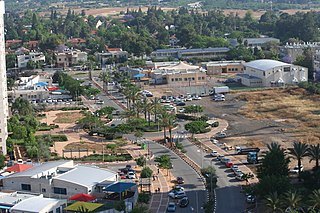
Neve Monosson, also known as Neve Efraim and Neve Efraim Monosson, commonly called Monosson by its residents, is a municipal borough within the joint municipality of Yehud-Monosson in central Israel. In 2003 it had a population of 2,600 but its population is growing considerably due to the ongoing implementation of the Tamar Project, within which 200 family apartments are being replaced by 800 family apartments within a residents-initiated Pinui-Binui Project; this project is expected to almost double the population of Monosson.

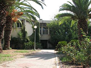
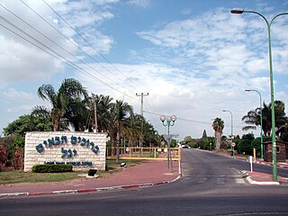
Savyon is an affluent local council in the Central District of Israel, bordering the cities of Kiryat Ono and Yehud. Ranked 10/10 on the Israeli socio-economic scale, it is one of the wealthiest municipalities in Israel. In 2021 it had a population of 4,051.

Azor is a local council in the Tel Aviv District of Israel, on the old Jaffa-Jerusalem road southeast of Tel Aviv. Established in 1948 on the site of the depopulated Palestinian village of Yazur, Azor was granted local council status in 1951. In 2021 it had a population of 13,474, and has a jurisdiction of 2,415 dunams.
Atarot was a moshav in Mandatory Palestine, north of Jerusalem along the highway to Ramallah. It was named after the biblical Atarot mentioned in Joshua 16:2, which is believed to have been situated nearby. The moshav was captured and destroyed by the Jordanian Arab Legion during the 1948 Arab-Israeli War. Atarot Airport, closed since the Second Intifada, and Jerusalem's largest industrial park are now located there.
Sha'alvim is a religious kibbutz in central Israel and one of only two affiliated with Poalei Agudat Yisrael. Located near the city of Modi'in-Maccabim-Re'ut, it falls under the jurisdiction of Gezer Regional Council. In 2021 it had a population of 1,886.
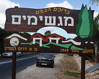
Magshimim is a moshav in central Israel. Located near Yehud, it falls under the jurisdiction of Drom HaSharon Regional Council. In 2021 it had a population of 1,090.
Ahisamakh is a moshav in central Israel. Located in the Shephelah, it falls under the jurisdiction of Hevel Modi'in Regional Council. In 2021 it had a population of 1,418.
Beit Nehemia is a moshav in central Israel. Located near Shoham, it falls under the jurisdiction of Hevel Modi'in Regional Council. In 2021 it had a population of 893.
Beit Arif is a moshav in central Israel. Located near Shoham, it falls under the jurisdiction of Hevel Modi'in Regional Council. In 2021 it had a population of 1,202.

Hadid is a moshav in central Israel. Located near Modi'in, it falls under the jurisdiction of Hevel Modi'in Regional Council. In 2021 it had a population of 913.

Tirat Yehuda is a national religious moshav in the Central District of Israel. Located near Yehud and Ben Gurion International Airport, it falls under the jurisdiction of Hevel Modi'in Regional Council. In 2021 it had a population of 1,211.

Kfar Daniel is a moshav shitufi in central Israel. Located around four kilometres south-east of Lod and covering 2,900 dunams, it falls under the jurisdiction of Hevel Modi'in Regional Council. In 2021 it had a population of 684.

Kfar Truman is a moshav in central Israel. Located in the Shephelah around three kilometres east of Ben Gurion International Airport, it falls under the jurisdiction of Hevel Modi'in Regional Council. In 2021 it had a population of 908.
Rinatya is a moshav in central Israel. Located between Petah Tikva and Yehud, it falls under the jurisdiction of Hevel Modi'in Regional Council. In 2021 it had a population of 1,192.

Ganot is a moshav in the Central District of Israel. Located near Hiriya, it falls under the jurisdiction of Sdot Dan Regional Council. In 2021 it had a population of 585.
Zeitan is a moshav in the Central District of Israel. Located near Lod and the Ben Gurion International Airport, it falls under the jurisdiction of Sdot Dan Regional Council. In 2021 it had a population of 1,031.

Hemed is a national religious moshav in the Central District of Israel. Located near Or Yehuda, it falls under the jurisdiction of Sdot Dan Regional Council. In 2021 it had a population of 1,356.
Yagel is a religious moshav in the Central District of Israel. Located near Lod and Ben Gurion International Airport, it falls under the jurisdiction of Sdot Dan Regional Council. In 2021 it had a population of 919.

Tzafria is a religious moshav in the Central District of Israel. Located near Ben Gurion International Airport, it falls under the jurisdiction of Sdot Dan Regional Council. In 2021 it had a population of 1,035.