Anseong is a city in Gyeonggi Province, South Korea, 80 kilometres (50 mi) south of Seoul. Its geographical location is 37°0′N127°16′E.

Namyangju is a city in Gyeonggi Province, South Korea. To the east is Gapyeong County, to the west is Guri City, and to the north is Pocheon City. Namyangju-si was originally a southern part of Yangju-gun, but was separated into Namyangju-gun in April 1980. In 1995, Migeum-si and Namyangju-gun were merged to form an urban and rural complex. The city hall is located in Geumgok-dong and Dasan-dong, and the administrative districts are 6-eup, 3-myeon, and 7-dong.

Pocheon (Korean pronunciation:[pʰo.tɕʰʌn]) is an inland city in the far northeastern region of Gyeonggi province in South Korea. It covers 826.48 km (513.55 mi)2 with a population of 160,176 people, according to the 2008 census. Pocheon lies between Seoul and the mountainous northwestern areas of Gangwon province. The city borders Yeoncheon county, with the cities of Dongducheon and Yangju to the west, along with Uijeongbu, and Namyangju of Gyeonggi province to the south. It also borders Hwacheon county of Gangwon province on its eastern border and Cheorwon is to the north. Alongside the adjoining Gapyeong, Pocheon consists of the highest mountainous areas in Gyeonggi province. The current city of Pocheon was created after Pocheon-hyeon and Yeongpyeong counties were merged. The north part of the city used to be part of Yeongpyeong county while the south used to be part of Pocheon-hyeon.

Yeoju is a city in Gyeonggi Province, South Korea. Yeoju was a county but was raised to the status of a city in September 2013. Together with the neighboring city of Icheon, it is known as a major center of contemporary South Korean ceramics, and hosts the World Ceramic Exposition every year. Other local products of note include rice, sweet potatoes, and yellow melons. Yeoju is the birthplace of Korea's last queen, Empress Myeongseong.

Geumsan County is a county in South Chungcheong Province, South Korea. It borders Muju County, North Jeolla Province (Jeollabuk-do), which is famous for its ski resort nearby.

Gimcheon is a city in North Gyeongsang Province, South Korea. It is situated on the major land transportation routes between Seoul and Busan, namely the Gyeongbu Expressway and Gyeongbu Line railway.

Mungyeong is a city in North Gyeongsang Province, South Korea. The local government, economy, and transportation networks are all centered in Jeomchon, the principal town. Mungyeong has a lengthy history, and is known today for its various historic and scenic tourist attractions. The city's name means roughly "hearing good news." Recently, development has been somewhat stagnant with the decline of the coal industry. Since the 1990s, the proportion of people who rely on the tourism industry through Mungyeong Saejae has gradually increased.

The history of Seoul can be traced back as far as 18 BC, although humans have occupied the area now known as Seoul since the Paleolithic Age. It has been the capital of numerous kingdoms on the Korean Peninsula since it was established.

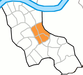
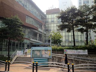
Daechi-dong (Korean: 대치동) is an affluent neighborhood in Gangnam District, Seoul, South Korea. Daechi-dong is divided into three different "dongs" which are Daechi 1-dong, 2-dong, and 4-dong. Daechi-dong is predominantly considered the residential area of Gangnam. As a result, real estate in the area is highly competitive and expensive compared to other parts of Gangnam. The Yangjaecheon is a stream that runs through the heart of Daechi-dong.

Bangbae-dong is a dong, or neighbourhood of the greater Gangnam area Seocho District district of the South Korean city of Seoul. Bangbae-dong is divided into 5 different dongs which are Bangbaebon-dong, Bangbae 1-dong, 2-dong, 3-dong and 4-dong. The origin of Bangbae-dong is derived from the name Bangbae, meaning "dong-ri with my back to Mt. Myeon-ri," which rises on the border between Gwanak District and Seocho District. Bangbae-dong was Bangbae-ri, Sangbuk-myeon, Gwacheon-gun, Gyeonggi-do until the end of the Joseon Dynasty, but became Bangbae-ri, Sindong-myeon, Siheung-gun, Gyeonggi-do in 1914 when the area was confirmed during the Japanese colonial period. It was incorporated into the Seoul Metropolitan Government following the expansion of the Seoul Metropolitan Government's zone in 1963, and became Bangbae-dong to this day. The location is Dong at the western end of Seocho District, and it is an area from the intersection of the road from Seoul to Gwacheon City and the southern circulation road to Umyeon Mountain.

Jungnang District (Jungnang-gu) is one of the 25 gu, or districts, of Seoul, South Korea. It is located on the north side of the Han River.

Hyochang-dong (Korean: 효창동) is a ward of Yongsan District, Seoul, South Korea.

Bangi-dong (Korean: 방이동) is a neighborhood, dong of Songpa District, Seoul, South Korea.

Hannam-dong (Korean: 한남동) is a wealthy dong (neighborhood)of Yongsan District, Seoul, South Korea. It has been portrayed continuously in South Korea's popular culture as an oasis of wealth and luxury, thus becoming the subject of numerous domestic films, television series, and popular music references.

Ichon-dong is a neighborhood of Yongsan District, Seoul, South Korea. It is located in the southwest of the city proper, along the Han River.
Jugyo-dong is a legal dong, or neighbourhood of the Jung-gu district in Seoul, South Korea. It is governed by its administrative dong, Euljiro 3, 4, 5ga-dong.

Seojeongni Station is a station in Seojeong-dong, Pyeongtaek, South Korea. Mugunghwa-ho trains running on the Gyeongbu Line stop here. Additionally, services on Seoul Subway Line 1 have been calling at this station since 2005. Its station subname is Kookje College.

Pyeongtaek–Paju Expressway is an expressway in South Korea. It connects Pyeongtaek to Paju in Gyeonggi Province. The expressway's route number is 17, which it shares with the Iksan–Pyeongtaek Expressway. This expressway overlaps with the Capital Region Second Ring Expressway at Hwaseong.
Crown Prince Munhyo, personal name Yi Sun, was the first son of Jeongjo of Joseon and his favorite concubine, Royal Noble Consort Ui of the Changnyeong Seong clan. He was the older half-brother of King Sunjo.
Princess Yeongon was the daughter of King Sunjo of Joseon and Royal Consort Sug-ui of the Miryang Park clan.


