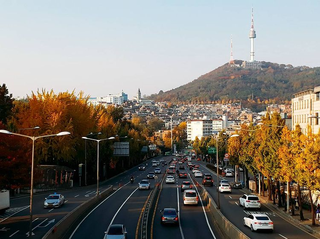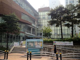
Yongsan Garrison, meaning "dragon hill garrison", is an area located in the Yongsan District of central Seoul, South Korea. The site served as the headquarters for U.S. military forces stationed in South Korea, known as United States Forces Korea (USFK), and as United States Army Garrison Yongsan (USAG-Yongsan) until 2018, under the supervision of the U.S. Army's Installation Management Command Pacific Region. From 1910 to 1945 it served as headquarters for the Imperial Japanese Army in Korea.

Goyang is a city in Gyeonggi Province in the north of South Korea. It is part of the Seoul Capital Area, making Goyang one of Seoul's satellite cities. It is one of the largest cities in the Seoul Capital Area, with a population of just over 1 million. Ilsan, a planned city, is located in the Ilsandong-gu and Ilsanseo-gu districts of Goyang. It also includes Deogyang-gu which is closer to Seoul.

Uiwang is a city in Gyeonggi Province, South Korea. It is one of many satellite cities that ring Seoul, making up the Seoul Capital Area. Its largest immediate urban neighbor is Anyang. The low peaks of the Gwangju Mountains shape the local landscape.

Yongsan District is one of the 25 districts of Seoul, South Korea.

Seocho District is one of the 25 local government districts which make up the city of Seoul, South Korea. Seocho is a part of the Gangnam region, along with the Gangnam district of Seoul. Seocho District ranks as one of the richest neighborhoods in South Korea and among the most expensive areas in Seoul with an average sales price of 47.75 million South Korean won per 3.3 square meters. Many of the wealthiest residents are concentrated in the three Gangnam districts including Seocho, known as Gangnam School District Eight.

Yongsan Electronics Market (Korean: 용산전자상가) is a retail area in Seoul, South Korea. Comprising over 20 buildings, housing 5,000 stores that sell appliances, stereos, computers and peripherals, office equipment, telephones, lighting equipment, electronic games and software, videos and CD's. A variety of electronic components for constructing computers and other items can also be found. Korean-made products generally cost 20% less here than other retail outlets, while imported items can be as much as 50% cheaper.

Ichon Station (Korean: 이촌역) is a station in Yongsan District, Seoul on Seoul Subway Line 4 and the Gyeongui–Jungang Line. This station is the closest to the National Museum of Korea, situated in the interior of Yongsan Family Park. It also serves eastern Ichon-dong, home to the largest Japanese community in South Korea with some 1,300 Japanese residents.

Jung District is one of the 25 districts of Seoul, South Korea.

Samgakji Station is a subway station on the Line 4 and Line 6 of the Seoul Metropolitan Subway. The Seoul War Memorial is a short walk away from exits 11 and 12. This station is on the west end of the Yongsan Garrison, which is a short walk from exit 13. Although not connected to this station by a transfer passageway, Namyeong station on Line 1 is a short walk from here.

The Kim Koo Museum is a museum in located within Hyochang Park, Hyochang-dong, Yongsan-gu, Seoul, South Korea. It commemorates the life and work of Kim Koo, a Korean independence activist during the Japanese occupation of Korea. It opened on October 22, 2002. It also contains a library.

Hyochang-dong (Korean: 효창동) is a ward of Yongsan District, Seoul, South Korea.

Huam-dong is a dong (neighborhood) of Yongsan District, Seoul, South Korea.

Hannam-dong (Korean: 한남동) is a wealthy dong (neighborhood)of Yongsan District, Seoul, South Korea. It has been portrayed continuously in South Korea's popular culture as an oasis of wealth and luxury, thus becoming the subject of numerous domestic films, television series, and popular music references.

Hangangno-dong is a dong (neighborhood) of Yongsan District, Seoul, South Korea.

Ichon-dong is a neighborhood of Yongsan District, Seoul, South Korea. It is located in the southwest of the city proper, along the Han River.

Wonhyoro-dong is a dong, neighbourhood of Yongsan-gu in Seoul, South Korea.

Bogwang-dong is a dong (neighborhood) of Yongsan District in Seoul, South Korea.
Seogye-dong (Korean: 서계동) is a dong, neighbourhood of Yongsan-gu in Seoul, South Korea. It is a legal dong administered under its administrative dong, Cheongpa 1-dong.
Cheongam-dong is a dong (neighborhood) of Yongsan District, Seoul, South Korea. It is a legal dong administered under its administrative dong, Wonhyoro 2-dong
Sangam-dong is a legal dong (neighborhood) of the Mapo District in Seoul, South Korea. In the wake of the 2002 FIFA World Cup, a large apartment complex and DMC business district have been created and developed into the center of western Seoul.


