Bondo, Uganda

Last updated
Bondo
Uganda location map.svg
Red pog.svg
Bondo
Map of Uganda showing the location of Bondo
Placement on map is approximate
Coordinates: 02°47′00″N30°58′00″E / 2.78333°N 30.96667°E / 2.78333; 30.96667
Region Northern Uganda
Sub-region West Nile sub-region
District Arua District
Time zone EAT (UTC+3)

Bondo is a town in Uganda.

Location

Bondo is located in Arua District, West Nile sub-region, in Northern Uganda. It lies approximately 29 kilometres (18 mi), by road, southeast of Arua, the largest town in the sub-region, on the Arua - Nebbi Highway. [1] The coordinates of the town are: 02 47 00N, 30 58 00E.

Arua District District in Uganda

Arua District is a district in the Northern Region of Uganda. Like many other Ugandan districts, it shares its name with its administrative center of Arua.

West Nile sub-region

West Nile sub-region is a region in north-western Uganda, Northern Uganda.

Northern Region, Uganda Region in Northern, Uganda

The Northern region is one of four regions in the country of Uganda. As of Uganda's 2014 census, the region's population was 7,188,139.

Contents

Overview

The town lies on the Arua-Nebbi Highway which continues on to Gulu, the largest city in Northern Uganda. Bondo also lies along the path of the 33kV electric power line from Nyagak Power Station in Paidha, Nebbi District, connecting to Arua, through Nebbi, Okollo and Bondo.

Gulu Municipality in Uganda

Gulu is a city in the Northern Region of Uganda. It is the commercial and administrative centre of Gulu District. The coordinates of Gulu Municipality are 2°46'54.0"N 32°17'57.0"E. The distance from Gulu to Kampala, Uganda's capital and largest city, is approximately 340 kilometres (210 mi) by road. The town is served by Gulu Airport and a railway line.

Paidha Place in Northern Region of Uganda, Uganda

Paidha is a town in the Northern Region of Uganda.

Nebbi District District in Uganda

Nebbi District is a district in Northern Uganda. It is named after its main municipal, commercial and administrative centre, Nebbi, the location of the district headquarters.

Points of interest

Some of the points of interest in the town include the following:

Zombo District District in Northern Uganda, Uganda

Zombo District is a district in the Northern Region of Uganda. The town of Zombo is the district's main municipal, administrative, and commercial center,

Okollo Place in Arua District

Okollo is a town in Arua District, northwestern Uganda.

See also

Related Research Articles

Pakwach Place in Northern Region of Uganda, Uganda

Pakwach is a town in the Northern Region of Uganda. It is the main commercial, political and administrative center of Pakwach District.

Centenary Bank is a commercial bank in Uganda. It is one of the commercial banks licensed by the Bank of Uganda, the central bank and national banking regulator.

Nyagak Hydroelectric Power Station

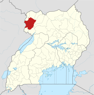
Nyagak Power Station is a 3.5 megawatts (4,700 hp) mini hydroelectric power plant in Uganda.

Nebbi Airport

Nebbi Airport is an airport in Uganda. It is one of the 46 airports in the country.

Zombo, Uganda in Northern Region, Uganda

Zombo, Uganda, often referred to simply as Zombo, is a town in Zombo District, West Nile sub-region, Northern Uganda.

Muni University (MU) is a public multi-campus university in Uganda. It is one of the public universities and degree-awarding institutions in the country, licensed and supervised by the Uganda National Council for Higher Education (UNCHE).

Nyagak III Hydroelectric Power Station

Nyagak III Power Station is a 5.5 megawatts (7,400 hp) proposed mini hydroelectric power project in Uganda, the third-largest economy in the East African Community.

Nyagak II Hydroelectric Power Station

Nyagak II Power Station is a 5 megawatts (6,700 hp) proposed mini hydroelectric power project in Uganda.

West Nile Rural Electrification Company Limited (WENRECO) is an electric energy generating and distribution company in the West Nile sub-region of the Northern Region of Uganda. WENRECO is a wholly owned subsidiary of Industrial Promotion Services (IPS), the industrial development arm of the Aga Khan Fund for Economic Development (AKFED). AKFED is a member of the Aga Khan Development Network.

The Karuma–Olwiyo–Pakwach–Nebbi–Arua Road is a road in the Northern Region of Uganda, connecting the towns of Karuma, Olwiyo, Pakwach, Nebbi and Arua.

The Lira–Gulu–Nebbi–Arua High Voltage Power Line is a high voltage electricity power line, under construction in Uganda. It connects the high voltage substation at Lira, in Lira District, to another high voltage substation at Arua, in Arua District, all in the Northern Region of the country.

The Kampala–Gulu Highway, also Kampala–Gulu Road, is a road connecting the capital city of Kampala, in the Buganda Region, with the city of Gulu, the largest urban centre in the Northern Region of Uganda.

References

Coordinates: 02°47′00″N30°58′00″E / 2.78333°N 30.96667°E / 2.78333; 30.96667

Geographic coordinate system Coordinate system

A geographic coordinate system is a coordinate system that enables every location on Earth to be specified by a set of numbers, letters or symbols. The coordinates are often chosen such that one of the numbers represents a vertical position and two or three of the numbers represent a horizontal position; alternatively, a geographic position may be expressed in a combined three-dimensional Cartesian vector. A common choice of coordinates is latitude, longitude and elevation. To specify a location on a plane requires a map projection.