Boston, Culpeper and Rappahannock Counties, Virginia

Last updated

Boston, Virginia
Store at Boston, VA.JPG
Country store in Boston
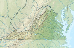
USA Virginia relief location map.svg
Red pog.svg
Boston
Usa edcp relief location map.png
Red pog.svg
Boston
Coordinates: 38°32′27″N78°07′54″W / 38.54083°N 78.13167°W / 38.54083; -78.13167
Country United States
State Virginia
County Culpeper and Rappahannock
Elevation
548 ft (167 m)
Time zone UTC-5 (Eastern (EST))
  Summer (DST) UTC-4 (EDT)
Area code 540
GNIS feature ID1477131 [1]

Boston is an Town straddling Culpeper County and Rappahannock County, Virginia, United States. [1]

The George L. Carder House, which is located in nearby Castleton, Virginia, was added to the National Register of Historic Places in 1991. [2]
Notes

  1. 1 2 "Boston, Culpeper and Rappahannock Counties, Virginia". Geographic Names Information System . United States Geological Survey, United States Department of the Interior.
  2. "National Register Information System". National Register of Historic Places . National Park Service. July 9, 2010.


Related Research Articles

<span class="mw-page-title-main">Spotsylvania County, Virginia</span> County in Virginia, United States

Spotsylvania County is a county in the Commonwealth of Virginia. It is a suburb approximately 60 miles (90km) south of D.C. It is a part of the Northern Virginia region and the D.C. area. As of 2024, Spotsylvania County is the 14th most populated county in Virginia with 149,588 residences. Its county seat is Spotsylvania.

<span class="mw-page-title-main">Rappahannock County, Virginia</span> County in Virginia, United States

Rappahannock County is a county located in the northern Piedmont region of the Commonwealth of Virginia, US, adjacent to Shenandoah National Park. As of the 2020 Census, the population was 7,348. Its county seat is Washington. The name "Rappahannock" comes from the Algonquian word lappihanne, meaning "river of quick, rising water" or "where the tide ebbs and flows." The county is included in the Washington-Arlington-Alexandria, DC-VA-MD-WV Metropolitan Statistical Area.

<span class="mw-page-title-main">Middlesex County, Virginia</span> County in Virginia, United States

Middlesex County is a county located on the Middle Peninsula in the U.S. state of Virginia. As of the 2020 census, the population was 10,625. Its county seat is Saluda.

<span class="mw-page-title-main">Culpeper County, Virginia</span> County in Virginia, United States

Culpeper County is a county located along the borderlands of the northern and central region of the Commonwealth of Virginia. As of the 2020 United States Census, the population was 52,552. Its county seat and only incorporated community is Culpeper.

<span class="mw-page-title-main">Remington, Virginia</span> Town in Virginia, United States

Remington is a small incorporated town in Fauquier County, Virginia, United States. The population was 598 at the 2010 census. It is near the highways, U.S. Route 15, U.S. Route 17, U.S. Route 29, and Virginia State Route 28. Remington is less than a mile northeast of the Culpeper County line.

<span class="mw-page-title-main">Washington, Virginia</span> Town in Virginia

The town of Washington, Virginia, is a historic village located in the eastern foothills of the Blue Ridge Mountains near Shenandoah National Park. The entire town is listed on the National Register of Historic Places as a historic district, Washington Historic District. It is the county seat of Rappahannock County, Virginia.

<span class="mw-page-title-main">Brandy Station, Virginia</span> Unincorporated community in Virginia, United States

Brandy Station is an unincorporated community and census-designated place (CDP) in Culpeper County, Virginia, United States. It was first listed as a CDP in the 2020 census with a population of 191. Its original name was Brandy. The name Brandy Station comes from a local tavern sign that advertised brandy.

<span class="mw-page-title-main">Amissville, Virginia</span> Unincorporated community in Virginia, United States

Amissville is an unincorporated community in Rappahannock County in the U.S. commonwealth of Virginia. It is located on U.S. Route 211 about halfway between Warrenton and the small town of Washington, Virginia.

<span class="mw-page-title-main">National Register of Historic Places listings in Virginia</span>

Buildings, sites, districts, and objects in Virginia listed on the National Register of Historic Places:

<span class="mw-page-title-main">Culpeper National Cemetery</span> United States National Cemetery in Virginia

Culpeper National Cemetery is a United States National Cemetery located in the town of Culpeper, in Culpeper County, Virginia. Administered by the United States Department of Veterans Affairs, it encompasses 29.6 acres (120,000 m2) of land, and as 2021, had over 14,000 interments.

<span class="mw-page-title-main">Sperryville, Virginia</span> Census-designated place in Virginia, United States

Sperryville is a census-designated place (CDP) located in the western section of Rappahannock County, Virginia, United States, near Shenandoah National Park. It consists of a village with two main streets along the two branches of the Thornton River, together with surrounding pasture- and farmland. The population as of the 2010 Census was 342.

<span class="mw-page-title-main">Staunton National Cemetery</span> Historic veterans cemetery in Staunton, Virginia

Staunton National Cemetery is a United States National Cemetery located in the Shenandoah Valley, in Staunton, Virginia. Administered by the United States Department of Veterans Affairs, it encompasses just over a single acre, and as of the end of 2005 had 994 interments. It is closed to new interments, and is maintained by the Culpeper National Cemetery.

<span class="mw-page-title-main">Port Conway, Virginia</span> Unincorporated community in Virginia, United States

Port Conway is an unincorporated community on the north side of the Rappahannock River in King George County, in the Northern Neck of Virginia. It is opposite Port Royal, which is on the south side of the river in Caroline County.

<span class="mw-page-title-main">Flint Hill, Rappahannock County, Virginia</span> Census-designated place in Virginia, United States

Flint Hill is a census-designated place (CDP) in Rappahannock County, Virginia, United States. The population as of the 2010 Census was 209. It is located on Route 522, approximately 2 miles to the east of the border of the Shenandoah National Park.

John Strother Pendleton, nicknamed "The Lone Star", was a nineteenth-century congressman, diplomat, lawyer and farmer from Virginia.

<span class="mw-page-title-main">Rapidan, Virginia</span> Unincorporated community in Virginia, United States

Rapidan is a small unincorporated community in the Virginia counties of Culpeper and Orange, approximately 5 miles (8 km) northeast of the Town of Orange. The community, located on both sides of the Rapidan River, was established in the late eighteenth century around the Waugh's Ford mill. The Orange and Alexandria Railroad built a line through the town in 1854, a post office was built at the river crossing, and its name was changed to Rapid Ann Station. Milling remained a major industry in the area up through the mid-twentieth century.

<span class="mw-page-title-main">Castleton, Virginia</span> Town in Virginia, United States

Castleton is an unincorporated community in Rappahannock County in the U.S. state of Virginia. It is located northwest of Culpeper.

<span class="mw-page-title-main">National Register of Historic Places listings in Culpeper County, Virginia</span>

This is a list of the National Register of Historic Places listings in Culpeper County, Virginia.

<span class="mw-page-title-main">National Register of Historic Places listings in Rappahannock County, Virginia</span>

This is a list of the National Register of Historic Places listings in Rappahannock County, Virginia.

Rappahannock Academy is an unincorporated community in Caroline County, Virginia, United States. Rappahannock Academy is located on U.S. Route 17 13 miles (21 km) southeast of Fredericksburg. Rappahannock Academy has a post office with ZIP code 22538. The community was named after the Rappahannock Academy & Military Institute, a now-defunct military academy in the community.